A steep but beautiful alpine hike with expansive high-country views, spectacular outlooks back toward Dead Horse Gap, and a summit perspective toward Mount Kosciuszko where the final patches of snow linger through summer. This is a great day walk for families who don’t mind an incline close to Thredbo.
Overview
This alpine route from Dead Horse Gap (1582m) up to South Rams Head trig (2052m) is a rewarding but steep and mostly unmarked day hike in Australia’s Snowy Mountains. With spectacular views toward the Main Range and Mount Kosciuszko, it feels remote despite starting just off the Alpine Way.
It’s not a manicured or signposted tourist track – so navigation tools (map and GPS app) are essential. In clear summer conditions this hike is suitable for families with children (if you don’t mind carrying them or using something like our Unirider). The elevation gain will test you if you don’t do this kind of walk regularly but we completed it by allowing extra time and pacing ourselves.
Access
Trailhead: Dead Horse Gap carpark
Suggested Meeting Point: If you’re coming from Melbourne, Khancoban is a great base, otherwise Thredbo Village is nearby.
Travel time: By car: 1.5 hours from Khancoban and 40 mins from Jindabyne. Also important to note that fees apply to access to Kosciuszko National Park year-round.
South Rams Head Trail Information
Hike time: 4.5 hours (2.5 up, 1.5 down) at a slow-steady pace
Season: Summer (February)
Fitness: Grade 2 – Moderate | Technical: Grade A – Easy
*See how I rate my walks
Safety Notes: The trail is unmarked in sections, and a map and navigation app are recommended. The trail would be significantly harder to follow in snow. Given the limited mobile reception until near the top, it is also advisable to carry a snake bite kit, a well-stocked first aid kit, and a PLB.
Download and the South Rams Head GPX file
NOTE: This GPX map was hand drawn and does not follow our exact path near the top. There is no clear marked path in this section just rock cairns that could be easily missed. Please carry a map/app that tracks your location and return path such as Wikiloc or Alltrails.
App or map? While many rely on navigation apps I always recommend printing a copy of your hike maps using OpenTopo or similar and keeping it in a waterproof case. You should also consider an emergency GPS beacon.
Post Hike Report
Ascent
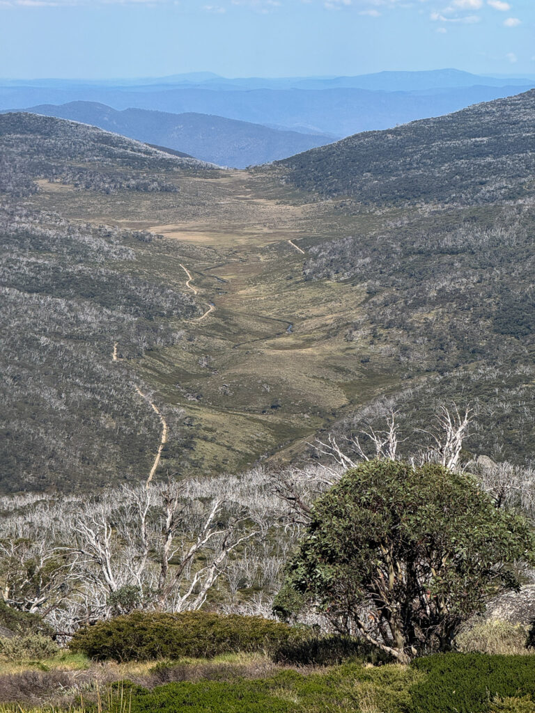
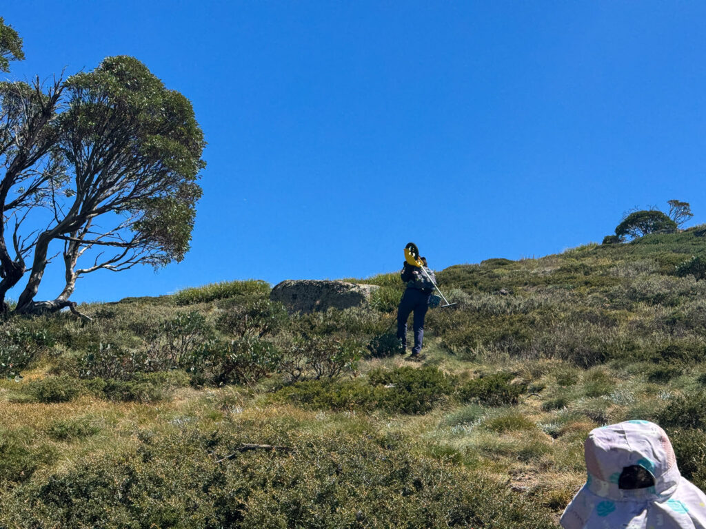
From roughly 1500 m elevation at Dead Horse Gap, the climb begins almost immediately. The trail gains steadily through burnt out snow gum forest and scattered rock. The trail is shrubby and a bit overgrown but generally easy to follow, with Rams Head visible most of the hike as well as the view back to the Dead Horse Gap to help you stay oriented.
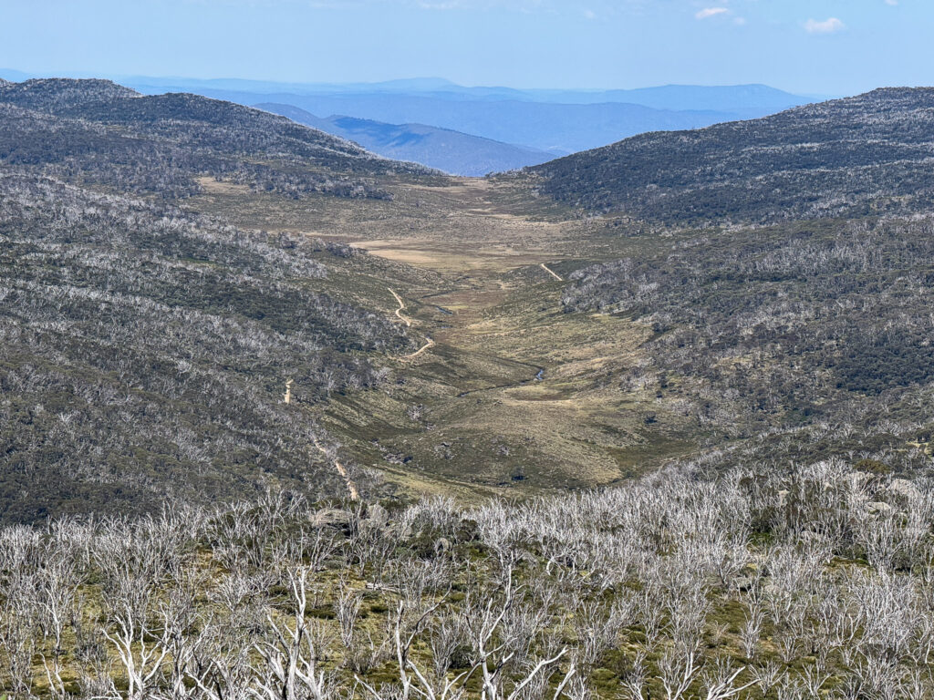
Once you clear the lower forests, the views begin to open up. One of the true highlights of the ascent is turning around and looking back across Dead Horse Gap to the upper reaches of the Thredbo River. The sweeping alpine meadow, the ribbon of path, and the layered valleys stretching into the distance make for a spectacular perspective. The higher you climb, the more dramatic it becomes.
With sunny skies the navigation remained straight forward, but it’s easy to imagine how different this ridge would feel under snow. Carrying my child a lot of the way meant more rest stops – but also more time to appreciate the silence. We also stopped to look at beautiful wildflowers, and thousands of grasshoppers which my daugter loved to chase.
There are a number of sections where the trail is overgrown with shrubs, much taller than my toddler as well as some slippery grass and rocks on some sections. We also noticed a lot of funnel web/spider holes so be careful where you sit.
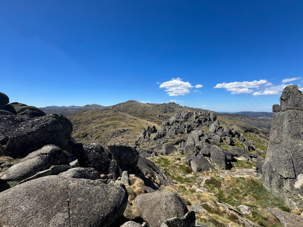
Summit (South Rams Head trig)
As the tree line disappears so does the trail, with cairns/rock piles on top of the rocks indicating the path to follow. We left a bright marker back where the trail ended, as we figured it could be easy to miss on the way down – and it avoids the need to bushbash to relocate the trail. After about 20 minutes of rockhopping and walking up the steep open grass, we reached the ridgeline.
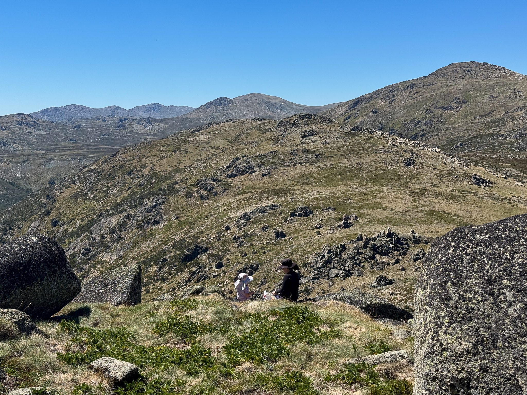
From South Rams Head you look north toward the Main Range and across to Mount Kosciuszko. Even in February there was one last stubborn patch of snow still clinging to the Kosciuszko. The view stretches south toward Victoria, east back down the ridge we climbed, and behind us once again toward Dead Horse Gap. We found a nice picnic spot between the rocks to enjoy the view.
Descent
The descent is fairly straightforward, follow the rock cairns back down to the trail, or use a navigation map then back into the scrub and burnt out snowgum forests you go. Given the steepness, and slippery grrass on the trail we took extra care to avoid falls or slips – ankle injuries have a tendency to slow people down.
With the trail above Dead Horse Gap visible most of the way back down, there is little difficulty heading the right way on a clear day – but take care if it is cloudy or foggy to stay on track. We used our UniRider to speed things up, and got back to the carpark tired shortly before 5.00pm before heading to Khancoban Alpine Hotel for dinner.
Other photos of Dead Horse Gap to South Rams Head