
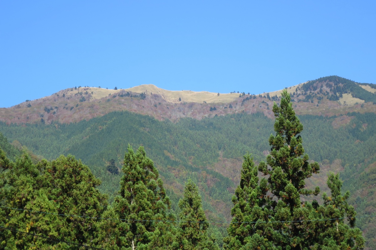
The Iya Valley in Tokushima is one of Japan’s “Three Hidden Regions,” famous for its tall limestone gorges, historic thatched-roof houses, and the iconic Kazurabashi (vine bridges) across the Iya River.
The valley’s popularity boomed with the advent of social media and some National Geographic coverage of Nagoro-mura. For travellers seeking the “Hidden Japan” vibe it remains a great place to visit because of how hard it is to reach and drive through.
While visitors head to the famous vine bridges or the Doll Village (one of them was named after me!), not many foreigners tend to get out and hike the mountains here! While Mt. Tsurugi sees a fair amount of foot traffic, there are plenty of hidden hikes to find if you are willing to explore a little.
My Top 5 Iya Valley Hikes
Here are the top 5 as hiked by myself personally…with a few extra suggestions at the end.
5. Mt Kobiso (小檜曽山)
Starting with an “off the grid” choice seems apt for me, because if you’re coming to see “hidden” Japan, why not visit the hidden parts of that place? Located on the border of Otoyo-town and the Iya Valley on the quietest (arguably) of the entry roads – this is the one for you if avoiding other foreigners is your vibe.
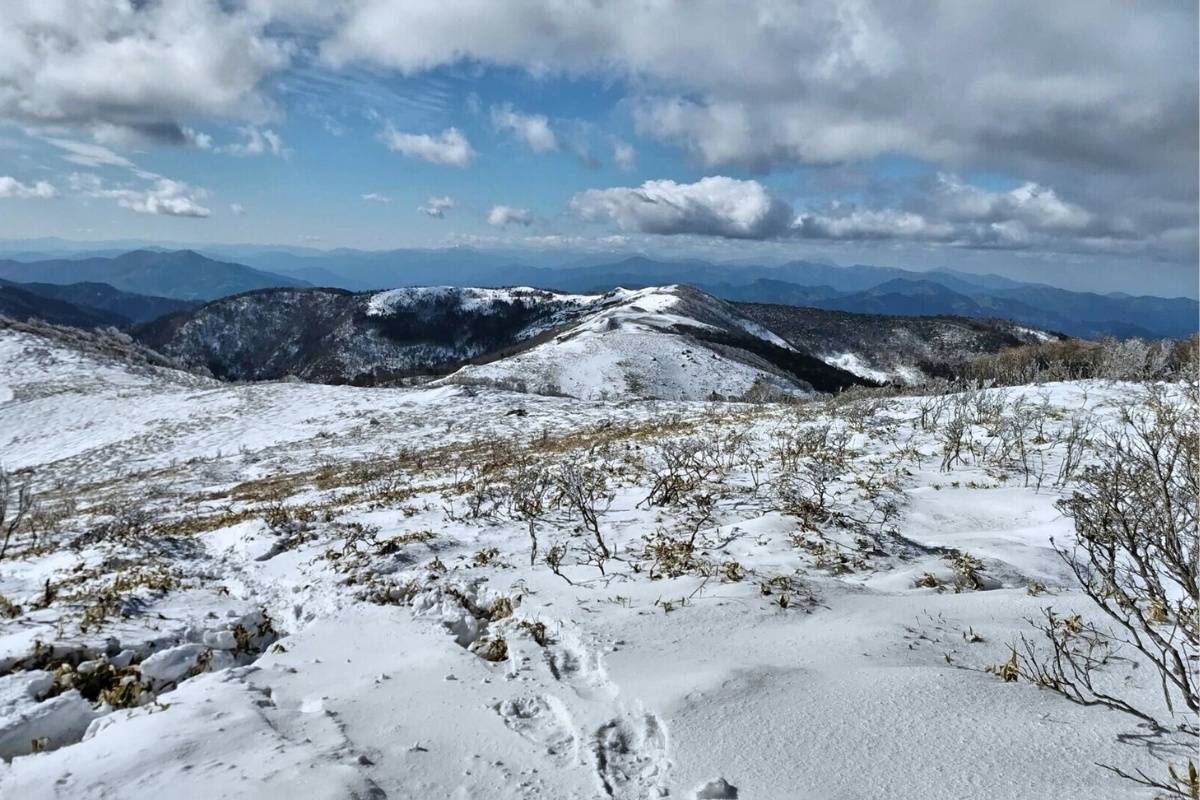
- Hike Stats: 5.2km return, 450m elevation gain, 1,481m altitude.
- Quick info: A quiet, deep-forest trek that leads to a peaceful sasa-fillet summit. It’s for those who prefer the sound of the wind over the sound of other hikers.
- Accessibility: Requires a confident driver to navigate the windy mountain roads to the start. Kei car territory.
- Learn more: Mt. Kobiso 小檜曽山 Winter Hike
4. Kurozou Marshlands (黒沢湿原)
If you aren’t looking for a high-altitude slog, or it’s the middle of winter, this is a perfect one for you! It’s a beautiful marshland perched in the mountains that looks different every season. The hike starts and finishes at an Onsen in the valley below!

- Hike Stats: 5km return, 300m elevation gain
- Quick info: This one starts with an easy walk along a concrete path however the terrain is quite steep. At the top a flat, easy boardwalk and trail loop through the marshlands awaits. It’s great for a rest day or if you have kids who aren’t up for a summit.
- Accessibility: Access by car with a nearby onsen to finish the day.
- Learn More: Kurozou Marshlands 黒沢湿原 & Tabinoshiri Waterfall たびの尻滝
3. Mt. Kanbo (寒峰)
Also known as “Kampou” by the locals, this is a moderately challenging hike that offers a great alternative if you want to escape well-trod peaks like Tsurugi and still get a great sasa-covered view.
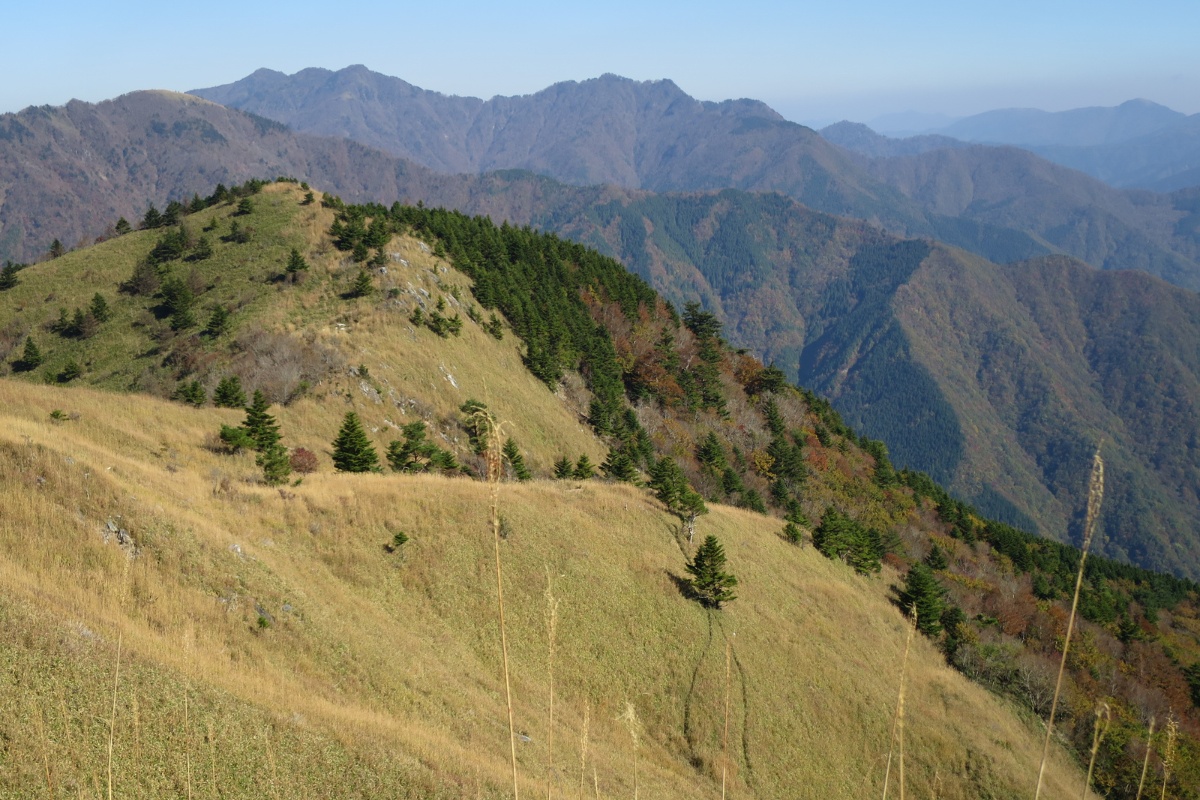
- Hike Stats: 8.2km loop, 800m elevation gain, 1,604m peak.
- Quick info: The first section is a gradual climb through pine and cedar forests before opening up into a ridge with perfect views of Tenguzuka and Miune. The descent can be steep and overgrown, so take your time.
- Accessibility: Starts from a small shrine carpark above Ochiai village. Car access only.
- Learn More: Mt. Kanbo 寒峰 Day Hike
2. Mt. Tsurugi (剣山)
The second-highest mountain in Shikoku and Western Japan and the one everyone knows. It’s popular for a reason – the ridge views are hard to beat. There’s a dinky little singl chairlift that takes you half the way up.
- Hike Stats: 4km return, 400m elevation gain, 1,955m altitude.
- Quick info: A very well-maintained trail. Most people take the chairlift halfway up, which makes the final summit push a short and easy one.
- Accessibility: Pretty easy to get to via Route 438. There is a big parking lot and a visitor center at Minokoshi. Buses run on weekends and holidays during war season.
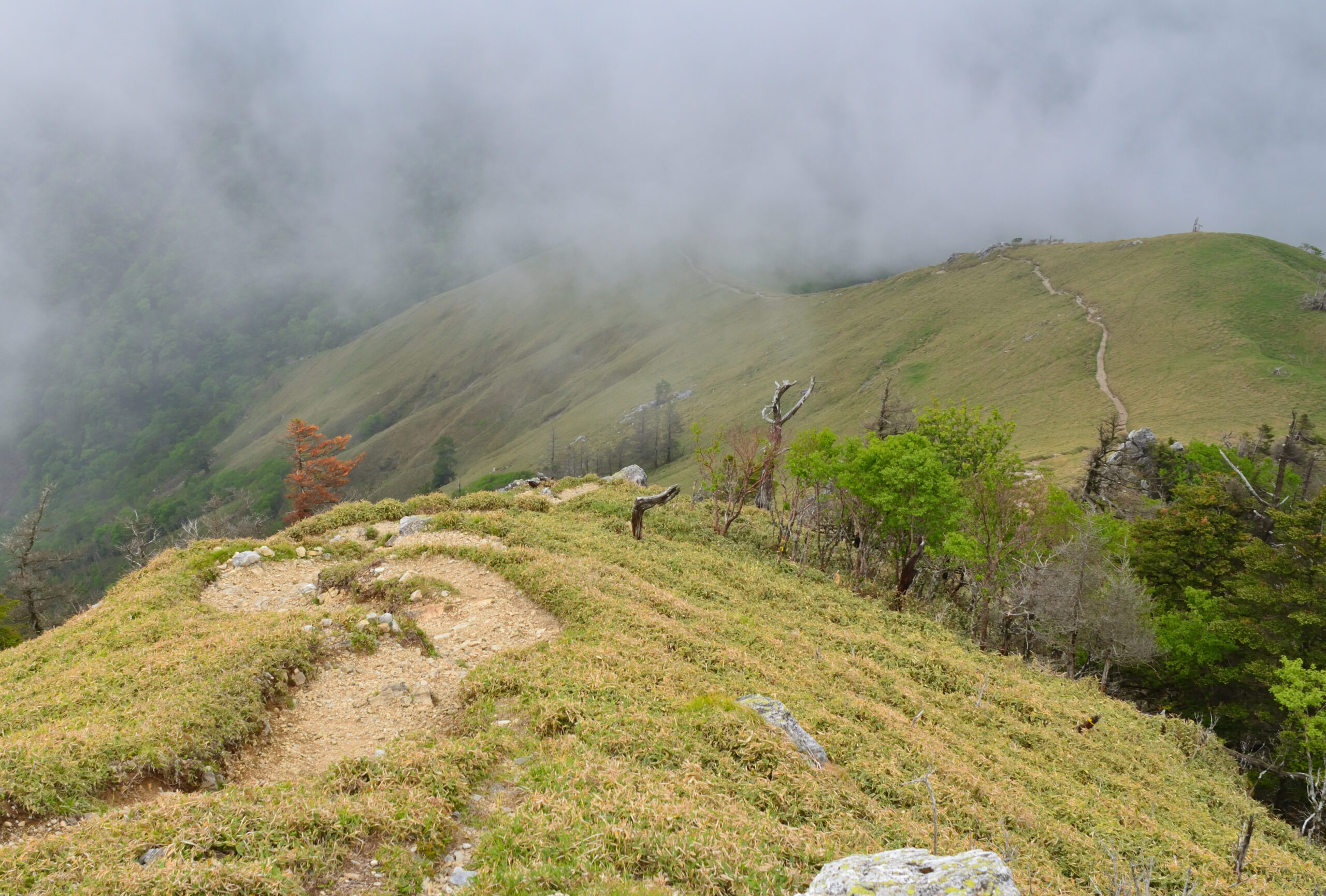
1. Mt. Miune (三嶺)
Referred to by some as the most beautiful mountain in Shikoku, Miune is my top pick not just for the Iya Valley but all of Shikoku (I know som may disagree!). With great views of the central Shikoku ranges it feels much less touristy than Tsurugi. It’s a real hike with big elevation gain and a view to match.
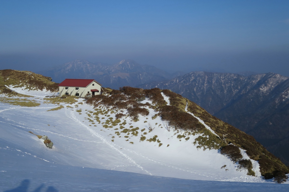
- Hike Stats: 10km return, 950m elevation gain, 1,893m altitude.
- Quick info: This is a long day out. The summit has a stunning alpine pond, mountain hut and the best views in the Valley in my opinion.
- Accessibility: There are two main trailheads including one near an old onsen and one at Nagoro-mura (the doll village). It’s a steep climb and you’ll need a decent level of fitness for this one.
- Learn more: Mt. Miune 三嶺 Winter Hike | Mt. Miune Summer 三嶺 Overnight
Other great hikes in the Iya Valley
If you have more time in the valley, these are also worth a look:
- Mt. Jirogyu 次郎笈 – 1,930m
- Mt. Tenguzuka 天狗塚 – 1,812m
- Mt. Marusasa 丸笹山 – 1,712m
- Mt. Eboshi 烏帽子山 – 1,670m
- Mt. Kunimi 国見山 – 1,409m
Pro tips for Iya Valley
These mountains are beautiful but they don’t mess around – the peaks can be snowcapped through Autumn, Winter, and Spring. You need to be prepared for it to get cold fast.
Pro Tip: To get to these trailheads, renting a “Kei car” is the only way to go. The roads are narrow and the mountain passes can be tight. Also, keep in mind that snow can fall on the roads in winter, especially on the higher passes, so check the weather before you drive.