
Shikoku is often overlooked by hikers and travellers in Japan, but the island’s four prefectures offers some of the best moderate (non-mountaineering) foot-on-ground hiking trails in the country. From the well known Ishizuchi to the endless bamboo grasses of the peaks like Miune and Sasagamine, there is a lot to explore… I know, because I still have 5 or 6 on my “to do” list (see them at the bottom).
My Top 10 Shikoku Hikes
So without further ado – here are the best hikes in Shikoku, as hiked by myself!
10. Mt. Kobiso (小石丸山)
Located on the edge of the Iya Valley, the journey to the trailhead is half the adventure.
- Hike Details: 6km return, 450m altitude gain, 1,481m peak height.
- Quick info: The drive is narrow and winding, but once you hit the trail, the forest is peaceful. The real highlight is the unexpected view from the top – it opens up to show a side of the valley most people never see.
- Accessibility: Narrow forest road access; a small car is highly recommended for the final stretch to the trailhead.
- Learn more: Mt. Kobiso (小石丸山) Day Hike
9. Mt. Kanbo (寒峰)
A spectacular but lesser-known hike in the Iya Valley also known as “Kampou” by the locals. This is a moderately challenging hike that offers a great alternative if you want to escape well-trod peaks like Tsurugi and still get a great sasa-covered view.
- Hike Stats: 8.2km loop, 800m elevation gain, 1,604m peak.
- Quick info: This is a fantastic alternative to the crowded Tsurugi trails. It’s a moderately challenging climb through cedar forests that opens onto a grassy ridge with clear views across to Mt. Miune and Mt. Tenguzuka.
- Accessibility: Starts from a small shrine carpark above Ochiai village. Car access only.
- Learn More: Mt. Kanbo 寒峰 Day Hike
8. Kurozou Marshlands (黒沢湿原)
It’s a short walk, but finding a high mountain marshland like this is incredible. Starts and finishes at a really cool onsen!

- Hike Details: 4km loop, 300m altitude gain, 550m altitude.
- Quick info: A very chill loop through the wetlands on well-maintained boardwalks. I’ve put this high on the list because it’s perfect for families or a rest day. Plus, having a high-quality onsen right at the start is a massive win.
- Accessibility: Paved but narrow roads lead to the marshland area; well-signed from the main valley.
- Learn more: Kurozou Marshlands (黒沢湿原) Day Hike
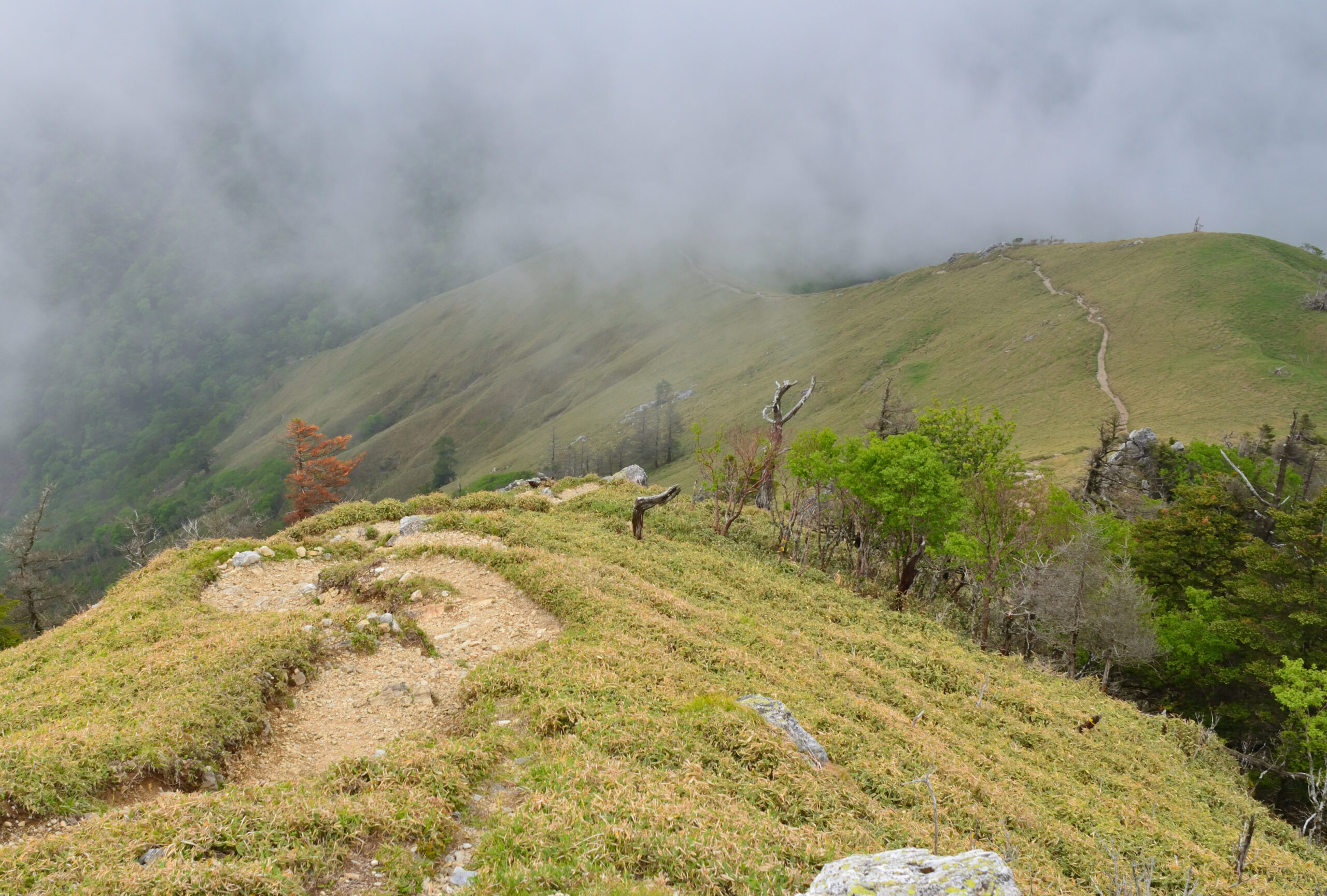
7. Mt. Sasagamine (笹ヶ峰)
A great climb that feels like a classic mountain adventure. With a high-mountain start, this one also features ladders and an old ski resort.
- Hike Details: 10.5km return, 850m altitude gain, 1,859m peak height.
- Quick info: The ladder section adds a bit of fun and technicality to the ascent. One of the coolest parts is the former ski resort lodge at the top where you can actually stay overnight – a rare find in the Shikoku backcountry.
- Accessibility: Accessed via the Minami-Iyo forest road; check for closures before heading out.
- Learn more: Mt. Sasagamine (笹ヶ峰) Day Hike
6. Heikeidaira (平家平)
Heikeidaira is a stunning peak that is all about its prime location in the central range. The name itself hints at the history of the area, tied to the legends of the fleeing Heike clan who sought refuge in these steep, inaccessible valleys.
- Hike Details: 8km return, 700m altitude gain, 1,692m peak height.
- Quick info: The views here are dominated by its proximity to nearby heavy hitters like Mt. Ishizuchi. It also overlooks the famous “UFO Line” ridgeline road, making for some very dramatic mountain photography. It’s a great spot to see the layers of Shikoku’s ridges fading into the distance.
- Accessibility: Best reached via the forest roads off the UFO Line or from the Niihama side.
- Learn more: Heikeidaira (平家平) Day Hike
5. Kajigamori (梶ヶ森)
What makes this great isn’t just the summit, but the logistics. It is one of the few places where you can feel properly deep in the mountains without needing a car to bridge the gap from the city.
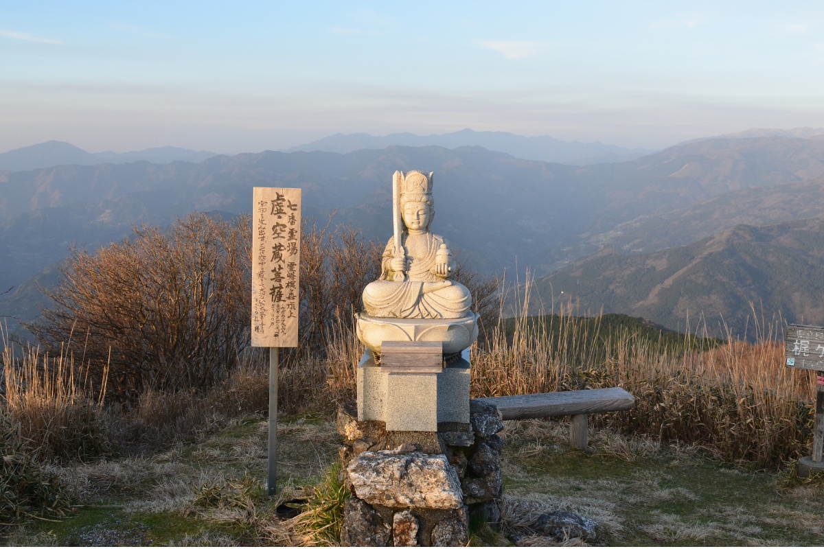
- Hike Details: 7.5km loop, 650m altitude gain, 1,400m peak height.
- Quick info: Both trailheads are accessible by train – which is incredibly rare for Shikoku hiking. There is also paid accommodation at the top, making it a great option for an easy overnight trip without having to carry full camping gear.
- Accessibility: Train access to Toyonaga Station, followed by a walk or short taxi to the trailhead.
- Learn more: Kajigamori (梶ヶ森) Day or Overnight Hike
4. Mt. Tsurugi (剣山)
Wait… you’re putting the second highest peak at number 4!? Tsurugi is a great hike, with facilities directly at the bottom and a chairlift half way – if you go – you’re going to have a great time. But to me, a well-trodden hike is never as fun as one I have to myself, hence why this is lower than usual. This hike is also pretty short.
- Hike Details: 6km return, 535m altitude gain, 1,955m peak height.
- Quick info: This is the most accessible high peak Iya Valley, if you’re coming from Tokushima city or the north. The ridge walk is beautiful and with a chairlift to skip the first 300m of climbing.
- Accessibility: Easily reached via Route 438 with a large parking lot at Minokoshi.
- Learn more: Mt Tsurugi Shikoku Tourism
3. Mt. Higashi-Akaishi (東赤石山) and Besshiyama
For sheer uniqueness, this is hard to beat. The geology here is completely different from the soft, bamboo-grass slopes found in the Iya Valley, offering a much more aggressive and textured landscape.
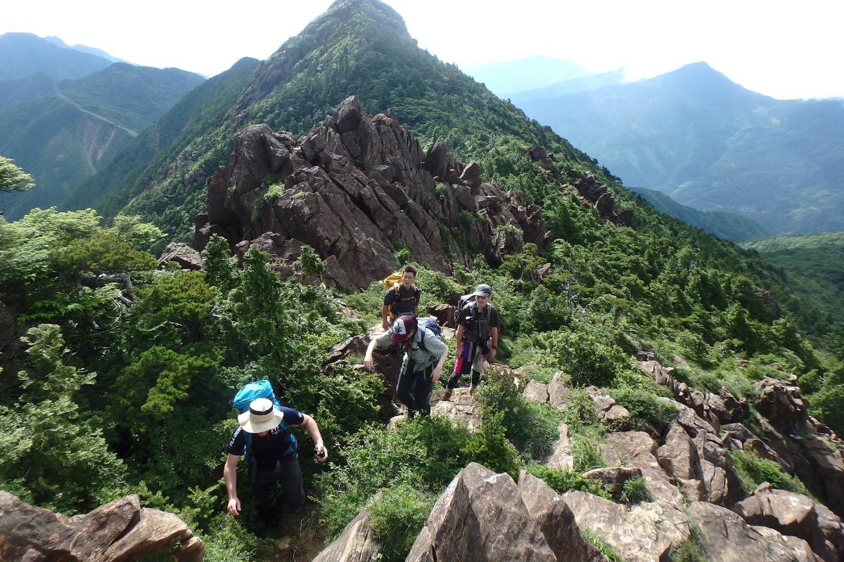
- Hike Details: 9km loop, 950m altitude gain, 1,706m peak height.
- Quick info: The terrain here is unexpected – rugged, rocky, and unlike the grassy ridges found elsewhere. On a clear day, the views over the Seto Inland Sea are world-class.
- Accessibility: Trailhead is located near the Besshi Suiyo copper mine area; paved but steep roads.
- Learn more: Mt. Higashi-Akaishi (東赤石山) Day or Overnight Hike
2. Mt. Ishizuchi (石鎚山)
The tallest mountain in Western Japan and certainly the most spectacular. It is a sacred peak, and you can feel the history as you climb. The hike also features some significant chain sections (which can be walked around if you like).
- Hike Details: 8.5km return (via Ropeway), 800m+ altitude gain, 1,982m peak height.
- Quick info: It’s famous for the heavy iron chains you can use to scale the vertical rock faces. It’s second on my list only because I usually prefer exploring the lesser-known, quieter corners of the island, this one gets busy, but you can’t deny the power of this summit.
- Accessibility: High accessibility via the Ishizuchi Ropeway or the Tsuchigoya road.
- Learn more: About Mt. Ishizuchi (石鎚山)
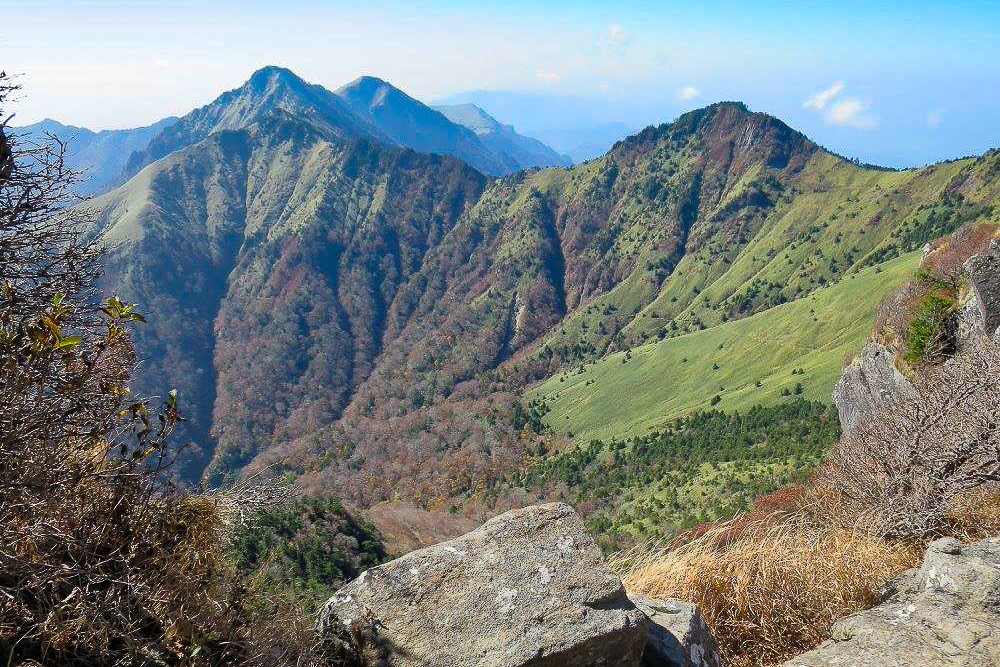
1. Mt. Miune (三嶺)
Often called the most beautiful mountain in Shikoku, Miune is my top pick for anyone wanting to see the true heart of the island’s wilderness.
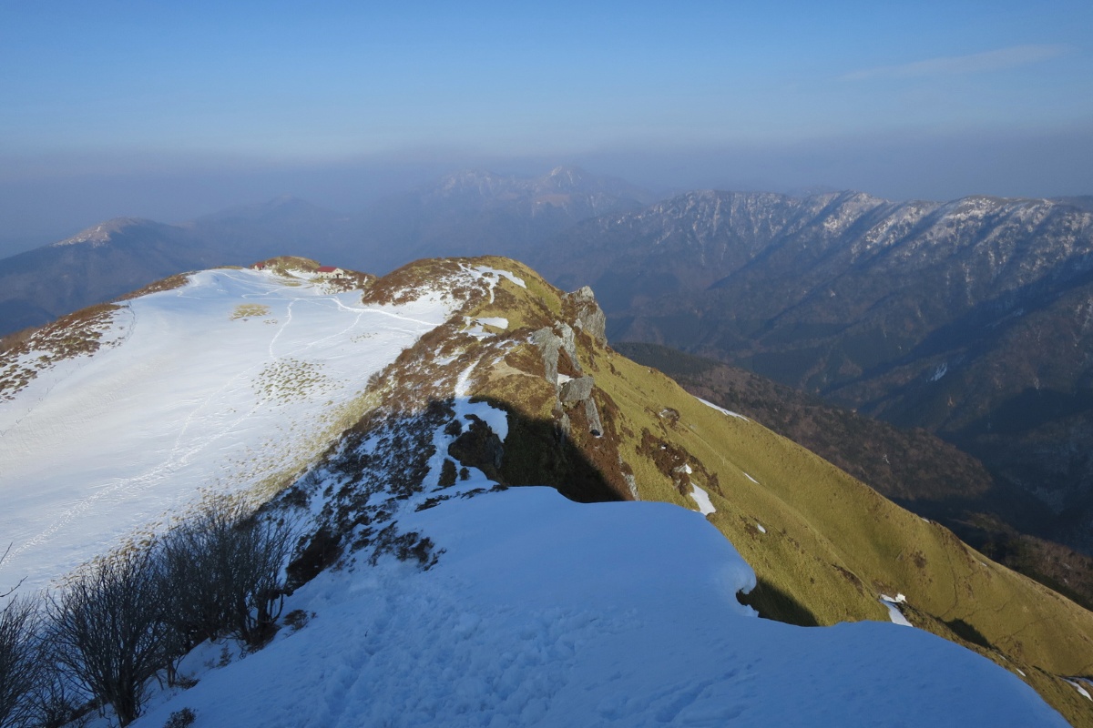
- Hike Details: 10km return, 950m altitude gain, 1,893m altitude.
- Quick info: It has a rugged, “real” wilderness feel that is unmatched. The summit provides the absolute best view over the central Shikoku mountainous area, looking out over a sea of bamboo-grass peaks that seem to go on forever. It’s a bit of a slog, but once you hit the ridge, you’ll see why it’s at the top of my list.
- Accessibility: Trailheads are both near Nagoro (the doll village); a long but manageable drive from the central Iya Valley.
- Learn more: Mt. Miune (三嶺) Overnight Hike
Other great hikes in Shikoku
If you have more time on the island, these are also worth a look:
- Map of Hikes in Shikoku
- Mt Yahazu (矢筈山) – 1,849m (On my bucket list)
- Mt. Maruzasa (丸笹山) – 1,712m (On my bucket list)
- Mt. Tsutsujo (筒上山) – 1,860m (On my bucket list)
- Mt. Oku-Kuishiyama (奥工石山)
- Mt Kamegamori / UFO Line – 1,897m
- Mt. Heiwamaru 平和丸 – 1705m (On my bucket list)
- Mt. Jirogyu (次郎笈) – 1,930m
- Mt. Kasatori (笠取山) – 1,562m (On my bucket list)
- Tsunatsukenomori (綱附森) – 1,643m (On my bucket list)
- Mt. Tenguzuka (天狗塚) – 1,812m
- Mt. Eboshi (烏帽子山) – 1,670m
Pro tips for Shikoku
For Shikoku, a “Kei car” is your best friend. If you don’t have a kei car, find a friend who does. The roads on the island including Iya Valley are famously narrow. Also, keep an eye on the mountain passes in winter as snow can make them impassable without the right gear.
Shikoku’s mountains aren’t to be taken lightly – even the smallest peaks here can be snowcapped from late Autumn through to Spring, and the weather can shift fast. If you want to break up the hikes – consider staying at one of the very awesome mountain huts in Shikoku.