

A hidden shrine, tunnel, bridges and waterfalls await you on this short and easy half-day walk in Ochi-town (越知町), Kochi Prefecture, Japan. If you find yourself nearby and have half a day to spare be sure to check this place out.
Your navigation app will get you so far but according to Google Maps the last section of the road doesn’t exist yet. Suffice to say; you’ll need a car to get to this one. Best time to go is during the peak of Spring (April) and Autumn (October-November) but don’t let that stop you out of season.
Course Information
Hike time: 1 1/2 hours (25mins to viewing area, 25mins to shrine, 1 1/2 hours full loop)
Season: Mid Spring (April)
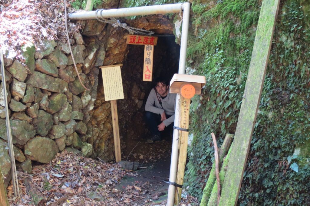
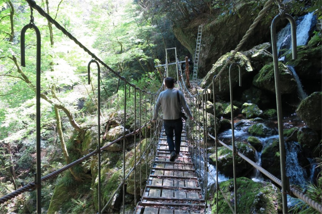
Difficulty: Fitness (Grade 1: Easy) Technical (Grade 1: Easy) – While this hike is short there are sections of the track where the trail is a little dangerous. For example, just before the shrine there is a section of wooden bridge that is almost rotted out and has some exposure to potentially dangerous cliffs.
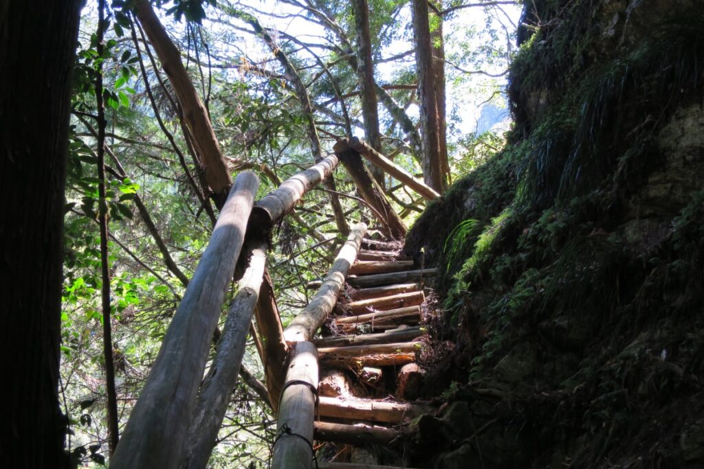
Between the shrine and the viewing point (if you do the full loop) there is a 5 metre (unsecured) ladder that goes to the top of a rock and continues to a waterfall. If you want to do the loop you can avoid climbing up the ladder by crossing the river to your left to find the trail (not advised if there is a lot of rain as the river could be slippery and dangerous). Take care and don’t do anything you don’t feel comfortable doing.
Access
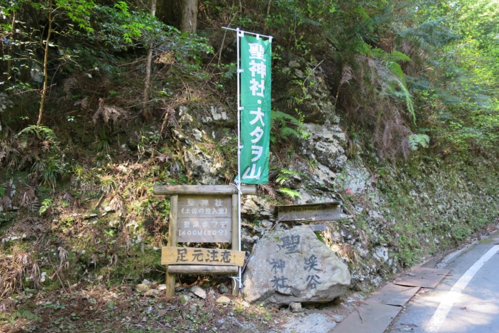
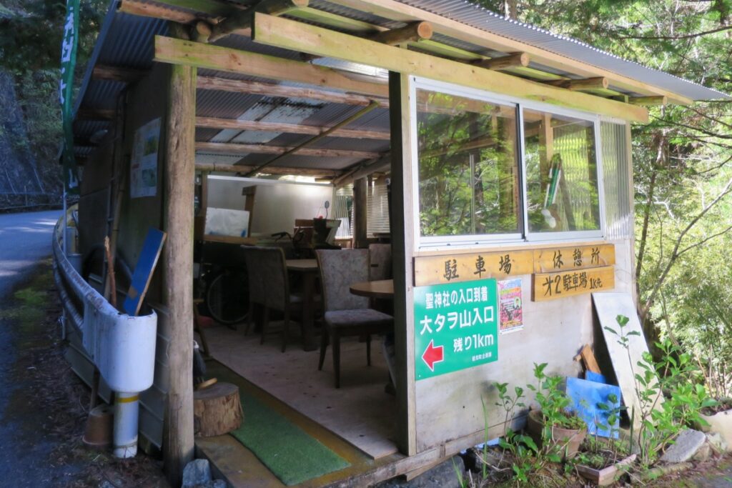
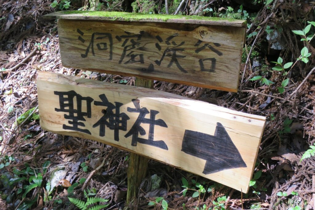
Trailhead: The road to access the hike does not currently appear on Google Maps. As such, drive to this point in Minaminokawa. From here you’ll need to follow the signs that appear on the road-side (see pictures). Hijiri Shrine Trail Head 聖神社入り口.
Suggested Meeting Point: There are a number of convenience stores on the way from Kochi with the last being around Ochi Town like this Lawson.
Post-Walk Report
When you start the hike you’ll have two options. Both are part of the same loop
Option 1: Trail on the left (from the car park). This trailhead will take you around to the viewing area first where you can get a good photo of the shrine from the distance. It will take you about 25 minutes to the viewing point. From here you can turn back OR you can continue to do the full loop around to the shrine. Be aware that if you do the full loop there are sections where the trail is steep and eroded and exposed to edges. Also, if there has been a lot of rain you might find it difficult to get all the way around. Consider going back to the start and taking the trail from the other way around.
Option 2: Trail on the right (from the car park) will take you to the shrine first. After about 10 minutes you will reach a fork; the left trail takes you through a tunnel, across a bridge and joins back up to the loop which can take you around to the viewing area. The right trail will take you up-hill to the shrine. Watch out for the rotting wooden bridge when you cross and take it easy. It will take you about 20 minutes in total to get to the shrine.
Photos of Hijiri Shrine
Packing and Preparation
Useful Links
- Ochi-town tourism site
- Yamareco hike information (Japanese)
- Hike blog with good pictures (Japanese)