

A moderate but well located (accessible by train) hike in the heart of Shikoku. Kajigamori is not the biggest and most beautiful mountain around but it is accessible by train with views both sides of Shikoku.
Overview
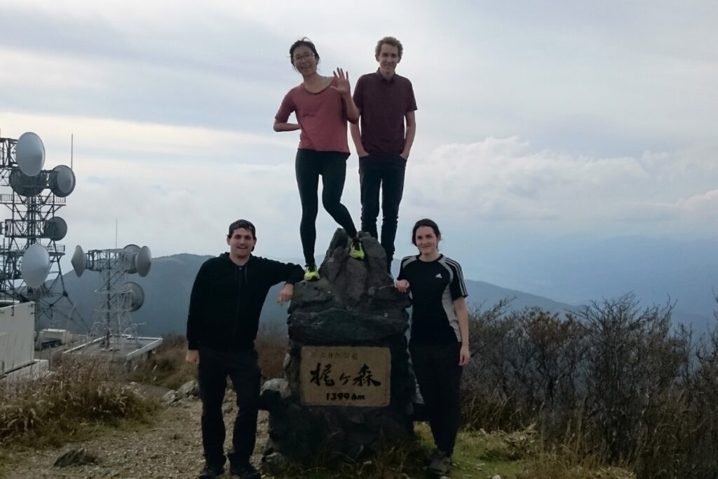
This is a 14.9km day hike to Mt. Kajigamori (梶ヶ森, 1399m) starting near Toyonaga Station (豊永駅) and finishing near Ōtaguchi Station (大田口駅) in Ōtoyo-cho, Kochi, Shikoku. We took a small detour on the way up to go to the beautiful Leben Cafe for lunch (to make pizzas! details below). We also passed Ryuo-n-taki, one of Japan’s “Top 100” waterfalls, as well as a beautiful old shrine located on a cliff face near the top of the mountain.
This hike is one of the more easily accessible hikes in the middle of Shikoku as you can start and finish at a train station (or stay overnight and meet the locals). If you’d like a shower afterwards Otoyo Strength offer access to the locker room and shower facilities (as well as slightly more convenient parking) for ¥2500.
Trail Information
Hike time: 7hour 15min (about 4hrs up, 2hrs down with a total walking time of 5 hours 15 min).
Overnight option: It would take an addition 2 hours-ish to walk to the Kajigamori Summit and back – and there is accommodation at the Sansou there if you wanted to break this into a two day hike.
Season: Mid Fall (Mid November)
Difficulty: Fitness (Grade 2: Moderate) Technical (Grade 1: Easy)
Most of this hike on the way up is through farmland and forest. It will get your heart-rate going but is not too steep or difficult. The main challenge with this hike is fitness as the length is quite long. Once the trail passes Ryuo-no-Taki the steepness will increase significantly. The terrain here becomes very rocky (and slippery) as you get closer to the top of the mountain. Be very careful of rock falls in this section. If you’re hiking in a group hike close together to avoid dislodging rocks that may bounce down the mountain and hit your friends. The down-hill trail just after the peak is quite steep and slippery but if you take your time you will be fine. There is one section where the trail has collapsed a little and a few places where the trail crosses a river.
Access and Parking
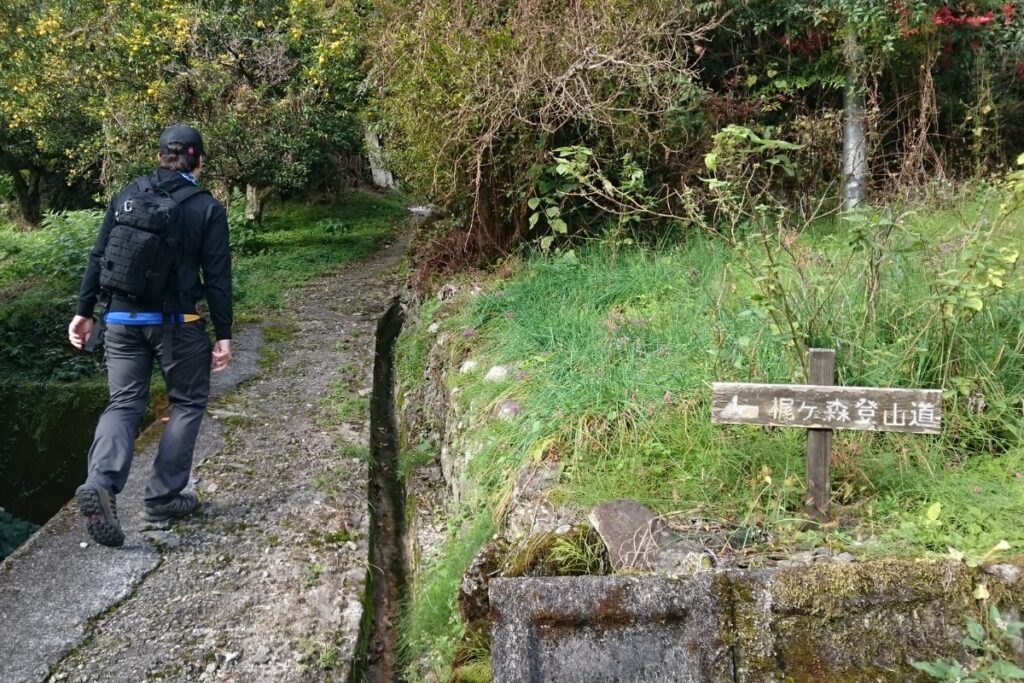
Trailhead: The hike starts here in Toyonaga, Otoyo-cho up a small road to your right once you cross the train line. You have the option of finishing near Otaguchi Station (大田口駅) or returning to Toyonaga.
Parking: There is side of road parking outside of the white lines 100m past the “Kondou Store Supermarket” こんどうストアー and Otoyo Strength parking lot here. Please DON’T park in the Kondou Store carpark while you’re off hiking.
Suggested Meeting Points: Toyonaga Station (豊永駅) or the こんどうストアー Supermarket (good for last minute hiking food).
Download and print the trail map
App or map? While many rely on navigation apps these days I strongly recommend printing a copy of your hike maps using one of the free topographic map services.
Post Hike Report
Ascent:
We arrived at the starting point just after 9.00am and parked our car at the Kondou Store super before walking down hill and across the bridge to the start of the trail (see the map pin for the exact trail-head marker). The start of the trail is marked with signs (look for the 梶ヶ森 kanji) and there are signs marking the trail at key points all the way up. We started hiking at 9.23am, passing through a cool forested area spotted with abandoned houses and old rice terraces. After about 30 minutes or so we left the forest and came to a small village area. A lady there was working in her garden and she offered us some Yuzu lemons that she had recently harvested!
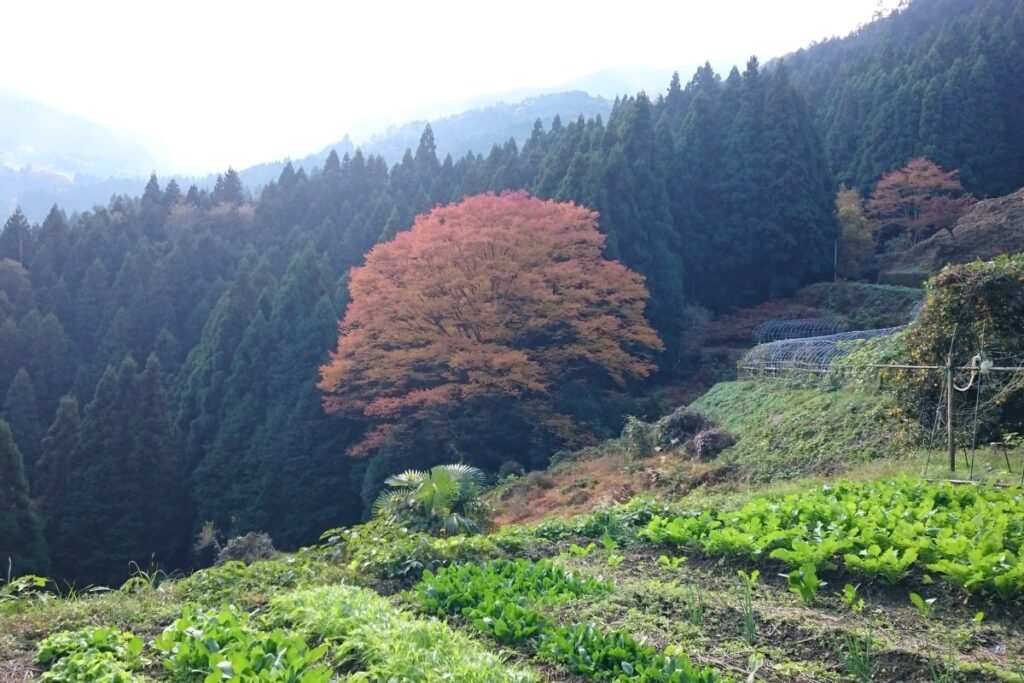
We continued walking along the road until we saw another sign indicating where the trail heads back into the forest. From here we followed the (partially overgrown trail) again trough the forest until we reached another road about 10.30am. From here the trail continues up into the forest however as we planned to make a detour to Leben Cafe for lunch we turned left and followed the road. If you want to skip the Cafe then just continue following the signs through the woods. Eventually we reached a point where we could see farmland (a cow paddock and rice fields) on our right. There is a trail marked on the map but the trail no longer exists. We made the decision to cut through the paddock (which required a little “bush bashing”) to get to the road near Leben Cafe.
Special Note:
These paddocks we walked through are actually part of the Leben farm and this is private property. Unless you ask permission from family that own the land to cut through you should walk around the farm via the road (which will take and extra 15 or 20 minutes). You will know when you get to the farm as they have a fence for their cattle.
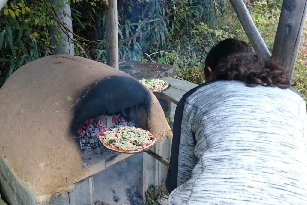
After walking through the cow fields we walked up a very steep driveway before finally reaching the Leben Cafe just after 11am. We were greeted warmly by the smell of wood fire in the air and by Tomoko who runs the cafe (Leben means “life” in German). It’s not often that you get to enjoy freshly baked pizza with locally sourced ingredients while hiking so this was a really cool experience! For 5,000 yen, Tomoko had prepared all of the ingredients for us to make 3 pizzas. We split the pizzas between four of us and were quite full afterwards. We spent about an hour and a half at the Leben Cafe making our pizzas, cooking them and eating. The views at Leben Cafe are really beautiful and the cabin itself is lovely.
Lunch at Kajigamori, Otoyo
For more information about the Leben Cafe or if you are interested in doing pizza making please visit their website and give them a call. Tomoko speaks really good English. The Leben Cafe is closed from December to March.
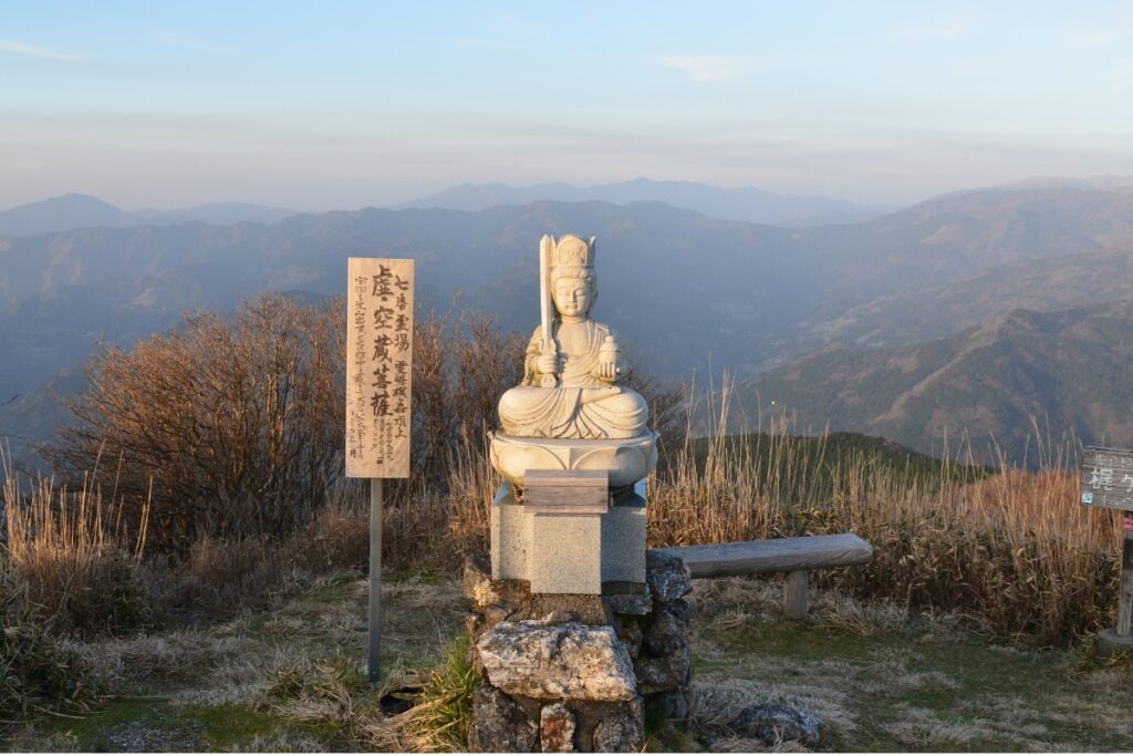
After leaving the Cafe about 12.30pm with a full belly we continued up the road towards Ryo-no-Taki. After passing the carpark the path continues through the woods until you reach the waterfall. Once you’ve finished enjoying the serenity, continue up and around the waterfall. This section of the path is not clear in some places but if you follow the GPS tracks or the red/pink markers on the tree up-hill you will eventually come to an old shrine. There is a ceremony held here once a year by priests at the nearby Jofukuji temple in Toyonaga. From here continue uphill (there are two paths you can take, we took the one that continued straight past the temple) and the terrain will become gradually steeper. Eventually you will reach a really steep Gorge. The terrain here is really rocky so if you are in a group keep close together to avoid dislodging rocks and hurting someone. If you look up and to your right you’ll see a shrine in the rocks. I wouldn’t advise climbing up to it as the wood used to build the shrine is quite old and a fall from there would probably kill you.
After passing through the gorge follow the path towards the Kajigamori Hut (next to the Kajigamori Observatory). We arrived at the observatory at 2.00pm. From here it’s a 25 minute walk along the road to reach the peak of Kajigamori. You can also take a path that cuts through the grass and campground about half-way along. We arrived at the peak at 2.35pm.
Descent
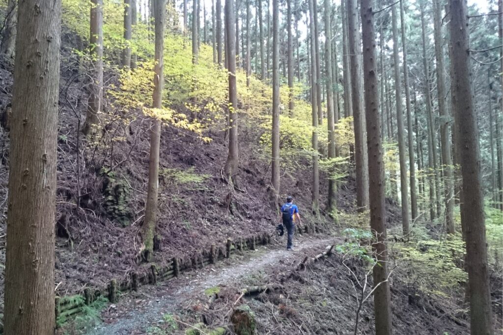
Going down from the peak was fairly straight forward however it is quite a long distance so depending on how fast you walk it could take a long time. The first half of the descent is through a pine forest which passes some beautiful rivers and waterfalls. You’ll also see some pulleys used to carry food/equipment up the mountain. The section straight after you leave the peak is very steep so be careful.
Once you leave the forest you’ll reach a road. Turn right and you’ll see the sign for the trail about 15 metres away. The trail here is a little overgrown but the path will get you home. The trail winds through scenic rice fields, forests, houses and between some inaka roads. In some sections when the trail crosses the roads the path is a little hard to find but ask some of the locals or keep an eye on your GPS and you’ll be fine. As long as you keep heading downhill towards Ōtaguchi Station you will eventually get there. Just before the end of the hike we passed some more locals who were harvesting their Yuzu. They kindly offered us another bag to add to our collection. We arrived at the bottom of the mountain right near the JA Yuzu lemon factory at 4.35pm. From here it’s a short 3 minute walk to Ōtaguchi Station.
Images of Mt Kajigamori
Packing and Preparation
Useful Links
- A shorter Kajigamori hike option (requires driving)
- Kajigamori Camping and Observatory Information
- Leben Cafe Accommodation, Menu and Contact Info
- Otoyo Tourist Information