
If you’re searching for hikes in Shikoku, you’ve probably heard of Mount Ishizuchi in Ehime. Standing at 1,982m, it may not be the tallest in the world, but its legendary chain climbs (which you can go around!), precipitous summit, and spiritual connections make this well worth the “Shikoku” bucket list.
Overview
This 8.5km return day hike to Mt Misen and Mt Ishizuchi via the ropeway is a 5 to 6 hour trek with around 800m of elevation gain. As the highest peak in Western Japan and one of the seven sacred mountains (七霊山), it offers a solid hike experience with a truly exposed final peak that just isn’t very common in Shikoku.
We took the Omotesando route from the ropeway to the summit. Due to foot injury I skipped the vertical chain sections (I didn’t trust myself climbing 65m of chains with an injury, but honestly, I was happy to have an excuse to walk around).
Access
Trailhead: Ishizuchi Ropeway Parking Lot
Suggested Meeting Point: Ishizuchi Fureai Camping Area (if you need a place to stay before/after)
Travel time: By car: 45 minutes from Saijo, 3 hours from Hiroshima. By Bus: JR Iyo-Saijo Station to Ishizuchi Ropeway-mae takes around an hour.
Mt Ishizuchi 石鎚山 Trail Information
Hike time: 5-6 hours return
Season: Autumn
Fitness: Grade 2 – Moderate | Technical: Grade A – Easy*
See how I rate my walks
Safety Notes: Start early for this hike and also be aware of the weather. The extended sections of vertical chain should not be taken lightly. If you’re not sure or confident just go around. There are no prizes for being a dumb hiker. In cold or wet conditions the chains may be freezing and slippery, so consider gloves (or going around). There are genuine sections of this hike where falls have resulted in serious injuries or death. The final ridge to the summit, for example, is exposed. *My rating above is based on not taking the chains. If you take the chains I would classify this as Grade C – Hard or higher.
Download and print the trail map
App or map? While many rely on navigation apps these days I strongly recommend printing a copy of your hike maps using one of the free topographic map services.
Post Hike Report
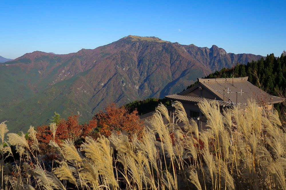
We stayed the night before at Ishizuchi Fureai-no-Sato (石鎚ふれあいの里), which has some really great rustic cabin options and sits conveniently close to the ropeway base. With the autumn air turning crisp and a two-hour drive behind us, having a head start in the morning was the right call. We caught an early ride up the ropeway, the beautiful autumn leaves below is worth the price on their own. While the colors at the base were at their peak, it usually means the very top has already started to turn to the deeper browns of late autumn.
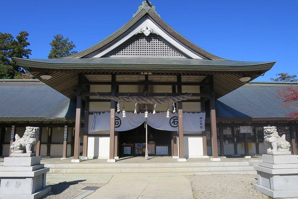
As soon as you step off the ropeway at Sancho-Joju Station (1,300m), it’s a short walk to the Ishizuchi Shrine Jojusha complex. The temple is one of the four main shrines of Ishizuchi-san and is a home of Shugendo – a tradition of mountain asceticism that blends Shinto and Buddhist beliefs. Practitioners, known as Yamabushi, have been climbing these slopes for over 1,300 years. If you need water, there is a refilling station here.
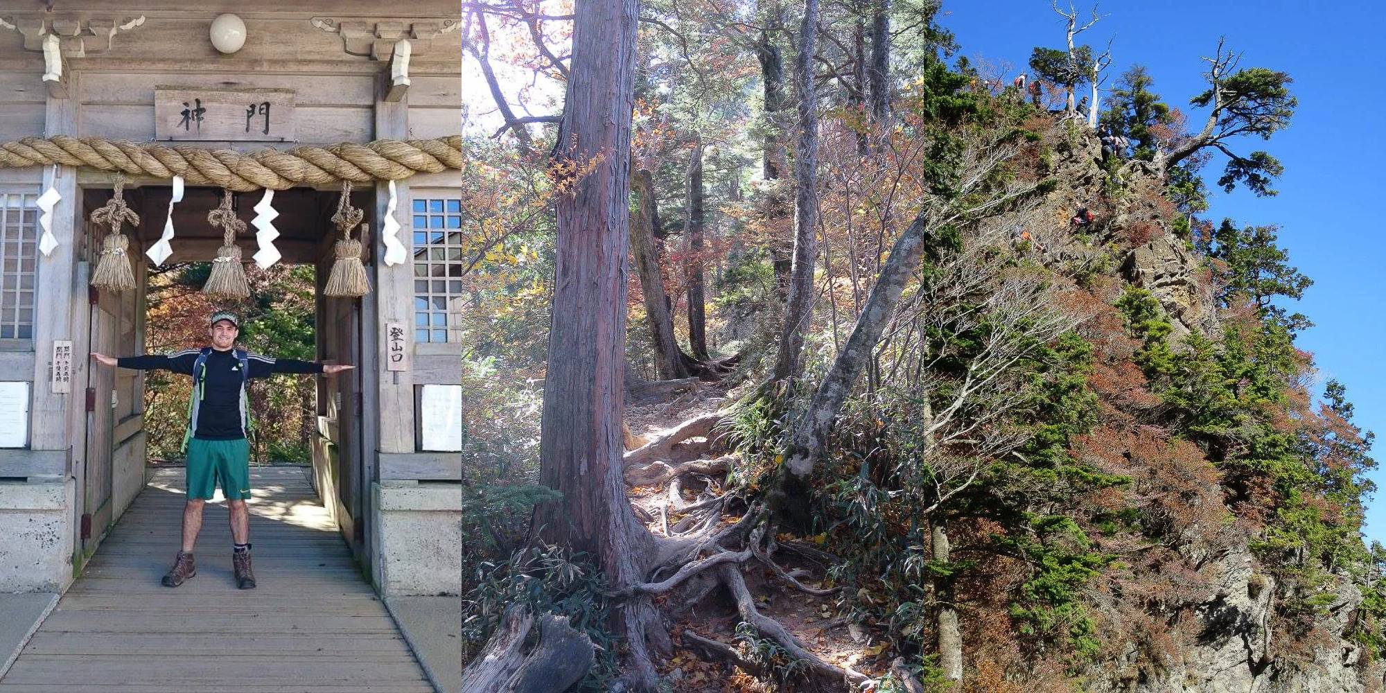
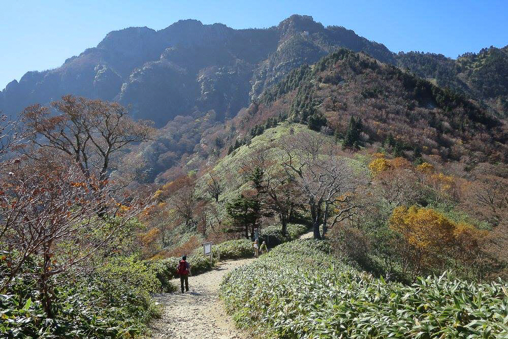
From Jōju-sha shrine, the trail starts easy. It’s wide and easy walking, mostly downhill until you reach the Hatchozaka saddle. From here, the path transitions into a classic hiking trail and the uphill slog starts. There are plenty of steps (which I think I find much more annoying than flat trails that switchbacks).
We eventually reached the first “Trial” Chains. In total, there are actually four sets of chains: the Trial Chain (Tameshi-no-Kusari), followed by the First, Second, and Third chains. The Trial Chain is essentially a “practice” run where you can gauge the grip of your boots, the temperature, and your nerves. Like all the chains on the hike, there is a path around if you aren’t sure. With a twisted and strapped ankle, I took the walk around.
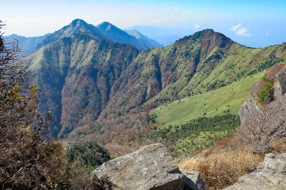
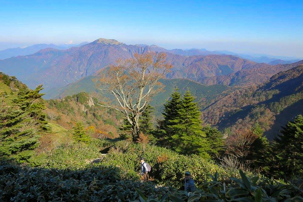
We continued up to a little saddle known as Yoake Pass (Yoake-toge) at around 1,650m. This is where you get your first real spectacular view towards the peak, with fewer trees and more of that iconic Shikoku sasa grass and steep stairs.
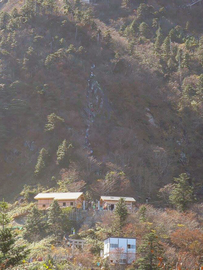
The next hurdle is the First Chain (Ichi-no-Kusari), a 33m vertical climb. Again, it’s possible to pass around this if you like or the conditions require. Looking up at the group, I was pretty happy to have an excuse not to do it.
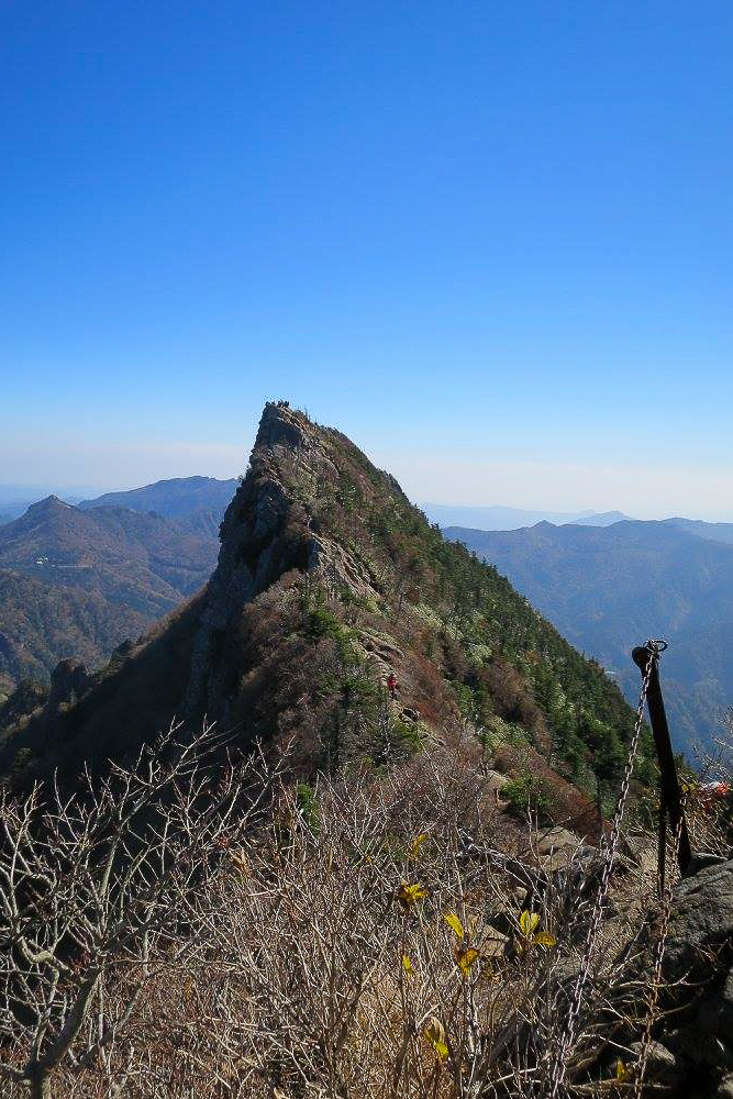
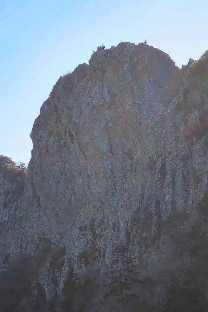
After a short walk, you reach the most significant test: the Second Chain (Ni-no-Kusari). At 65m long, it’s a massive hurdle before the final Third Chain which leads to the Mt Misen “pre” summit. Here you will find a few buildings and be able to look across at the actual Ishizuchi peak, Tengudake.
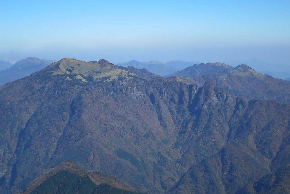
The walk across to the actual peak involves a chain and a pretty precarious cliff (see gallery below). If you are not a fan of heights, you will probably be pretty happy at the Mt Misen area without the final scramble. With my ankle now quite sore, I decided the amazing view there was enough for me – it was also quite busy on the scramble across. I found a quiet spot to stop and have my lunch and admire the view of nearby peaks. Many of which I hope to hike soon!
It was time to head back. As many people know, coming down from a mountain is often harder than getting up. In this case, I imagine most who climbed the chains will be walking back down; I don’t envy anyone climbing down that 65-meter section. It reminded me a lot of Wollumbin (Mt Warning) in Australia, which has a similar peak with chains.
We took extra time with my bad ankle to avoid twisting it or slipping, and managed to make it back to the ropeway about 3 o’clock. Perfect timing to drive back to the nearest onsen for a soak before dinner and the long drive home.
More photos of Mt Ishizuchi 石鎚山
Packing and Preparation
Useful Resources
- Ishizuchi Ropeway Information
- Ishizuchi Fureai Campground
- Hike Report with pictures on Yamap (In Japanese)