
If you’re the kind of person that to escape the tourist traps and have a bit of adventure this day hike in the (increasingly) famous Iya Valley is for you!
This moderately challenging hike is an 8.2km day loop hike starting near Ochiai village in Shikoku’s Iya Valley and finishing at the same location. The hike goal was to reach Mt. Kanbo (寒峰, 1604m) or ‘Kampou’ as the locals call it and return to our starting location.
Trail Information
Hike time: 5 hrs 46min return (roughly 3hrs up, 2hrs down)
Season: Mid Fall (Early November)
Difficulty: Fitness (Grade 2: Moderate) Technical (Grade 1: Easy)
The first section of the hike all the way to the peak is quite gradual with only a few steep sections. There are no extremely exposed edges or dangerous areas. The way down, however, is quite overgrown and steep. The trail, especially towards the end of the hike, is steep enough that you should take care and go slowly (slippery leaves etc). Just before you reach the road on the descent there is a landslide where it appears the old track has collapsed. Be careful not to walk over the edge (there are pink markers where the edges are which can be confusing as they are used in other places to mark the trail).
Access
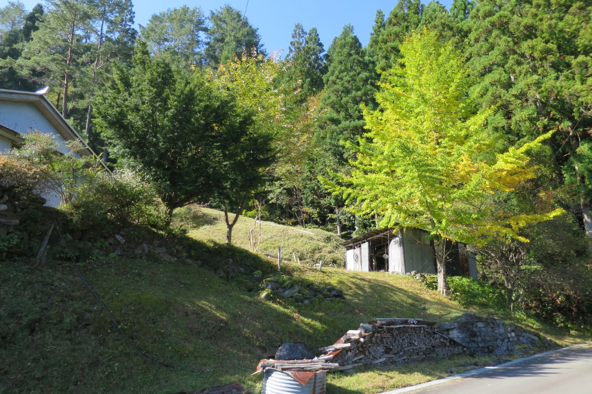
Trailhead: The hike starts in Higashiiyakurishido here at the small shrine carpark in the mountains above Ochiai-mura (access is by car only). There is a car park just past the temple. Please park there rather than at the house where the toilet is.
Suggested Meeting Point: As above
Download and print the trail map
App or map? While many rely on navigation apps these days I strongly recommend printing a copy of your hike maps using one of the free topographic map services.
Post Hike Report
Ascent: We arrived at the starting point at 10.40am after a long drive through the Iya Valley. The roads are quite windy and take longer than you think. The road from Ochiai village up to the starting point is also really steep and narrow. It might be more difficult without a Kei car. We bought all our food before entering the Iya Valley at the 7/11 in Oboke.
We started up the trail at 11.00am. The trail rises gradually up the mountain through a cool, calm pine forest (of the non-native logging variety). The start of the trail itself is kind of difficult to find as there are few signs and the trail was covered by leaves. If you keep a map handy (we used the GPX Viewer android app) you can tell if you’ve gone the wrong way. There are also a lot of red and pink markers along the entire track that you can follow but be careful to pay attention to where you are rather than walking blindly from marker to marker.
After about 30 minutes the trail passes a road (you could drive to this point and start here if you wanted to save time). From there you’ll walk through patches of native forest with colourful, deciduous trees. The trail is rocky, leafy and exposed to the sun so be careful of sunbaking snakes. We saw a Mamushi only a few seconds after saying “this is a risky spot for snakes”. Gaiters would be useful in this area. We also carried sticks to ‘brush’ the path ahead to avoid stepping on anything and a hiking bell to scare off any wild pigs before we saw them.
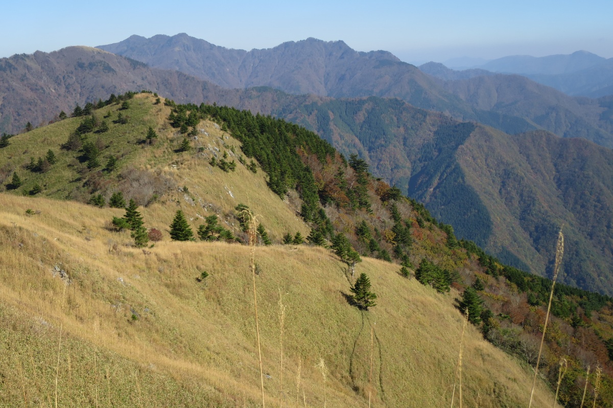
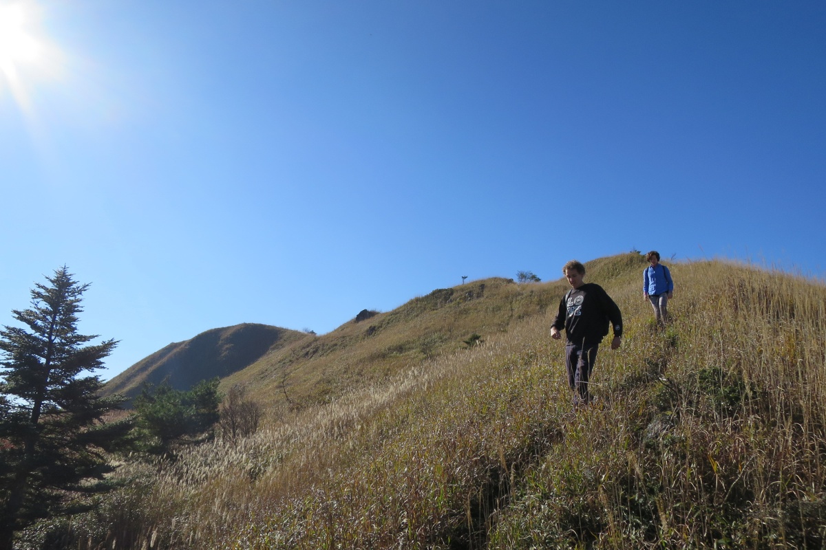
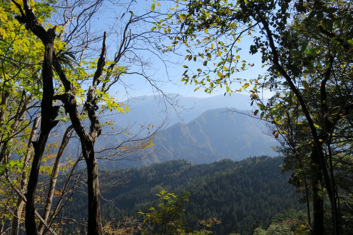
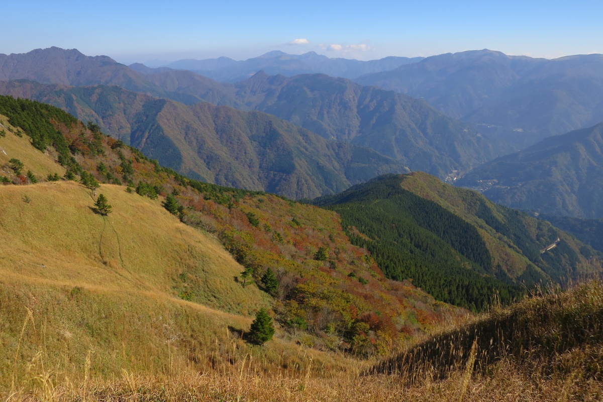
We reached start of the main ridgeline at 1500m at about 12.20pm. From here the mostly pine forests gives way to Japanese deciduals, cedar trees and mountain grasses. The trail continues all the way along this ridgeline to the peak. You’ll pass some beautiful old cedar trees, some flat basin areas that would be perfect for pitching a tent, and, on a clear day, have perfect views of all the main mountains in the Iya Valley including Tenguzuka, Miune, Yahazu and Tsurugi.
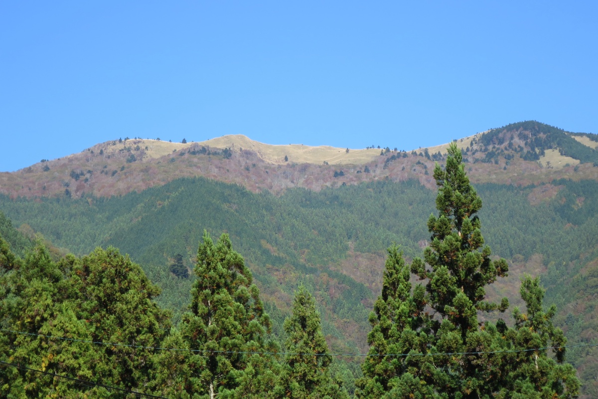
Descent: We arrived at the peak around 1.30pm before having a long lunch and taking some photos. The views from the top are spectacular with panoramic views and and the weather was perfect. I was surprised to see a lot of tall, dry grass at the top. Most mountains on Shikoku above a certain height on Shikoku are covered in small, shrubby wind-resistant sasa grass but this peak looked more like something from the Africa. Perhaps this mountain is not as exposed to the wind as others and therefore the long grass has more chance to grow. I don’t know.
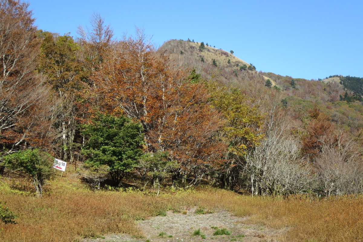
We left the peak about 2.10pm heading east. If you look at your map while you’re on the top of the mountain you’ll clearly see the spur that you came up and the spur that you will be going down. You can also see the house near the temple where you parked your car. We continued east from the peak. The track here is a lot more overgrown and hard to see at times. Follow your map/gps or the pink markers until you reach an old wooden sign with three arrows. Once path continues to Ochiai Pass, one points back the way you came and the other is the one that will lead you down the spur to your goal. Once again, the path from hear is really overgrown so be careful of your step.
After about 1hr 45 minutes of walking down hill on this steep spur line we eventually reached a logging road. Take care here as it’s steep and slippery. You’ll see the remnants of Japanese logging along with a cool monorail track. Just before you reach the logging road there are some steep exposed edges marked with pink tape. If you come to a a landslide as you can see the road in front of you right you should back-track about 20metres and look downhill to your right to find the track. There are some red markers indicating the final path down to the road but the path itself is really hard to see.
From here, we followed the logging road back down and around to the temple where we parked your car. There is one fork in the road just before your car. Go left if you want to take a shortcut. Go right if you want to walk the final section back down through the forest which you walked right at the start of the hike (we took the shortcut).
Photos of Mt Kanbo / Kanpou

Packing and Preparation
Outdoor Club Japan Insurance and Safety Information
Overnight Hike Gear Pack List
Clothing Information
Food Packing Guide
Useful Links