
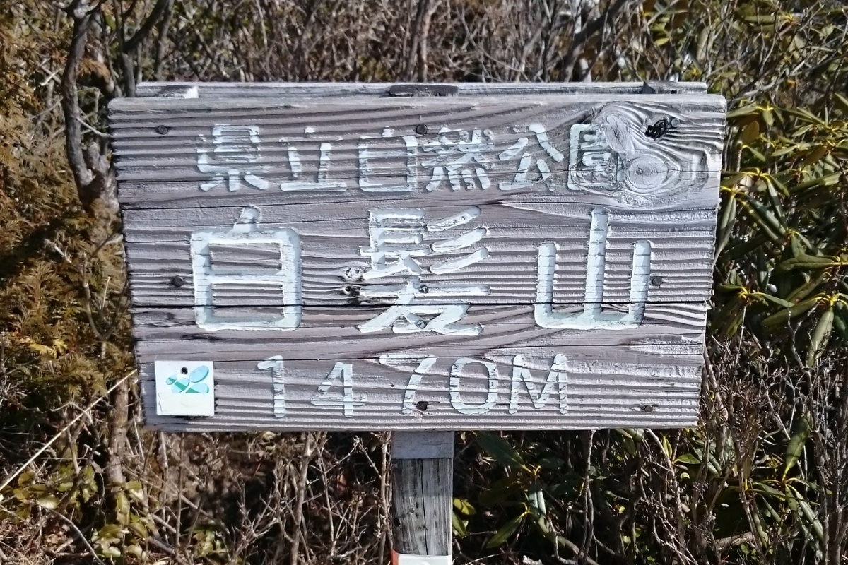
Mt Shiraga is a relatively short and easy hike (白髪山, 1469m) starting in Motoyama-cho (本山町) in Kochi, Japan. There are quite a number of mountains in Japan with this name which means “white hair mountain”. Honestly speaking this isn’t a hike that will knock your socks off – but it is a great one if you’re just getting into hiking or nearby and want to experience some snow in winter (yes, Shikoku has snow!).
There are two or three main paths you can take to reach the top of this hike. We took the “冬の瀬コース” course described on this page.
Trail Information
Hike time: 3.5 hours (about 2hrs up, 1.5hrs down, allow about 50 minutes from Motoyama to the trailhead)
Season: Early Spring (March)
Difficulty: Fitness (Grade 1: Easy) Technical (Grade 1: Easy)
This hike is neither steep nor long and follows (mostly) a well maintained path beside a river. There are however a lot of places where the path crosses the river, or where you are must walk up the river itself so be careful of the slippery rocks. If there has been a lot of rain (typhoon) you might find that there are sections of the river that you cannot to cross.
Access
Trailhead: The hike starts in Motoyama town here. This pin is not the trailhead and marks the start of the road from where but you’ll see signs directing you start of the hike (it’s good to know some basic hiking kanji). The road is mostly paved except for about 5km of dirt road near the end. We managed this easily in our regular Kei cars but if you have a large (non-4WD) or lowered car you might not be able to make it.
Suggested Meeting Point: Motoyama-cho Family Mart
Download and print the trail map
App or map? While many rely on navigation apps these days I strongly recommend printing a copy of your hike maps using one of the free topographic map services.
Post Hike Report
Ascent: We arrived at the trail head at 8.30am. From Motoyama town to this point it took us about 50minutes (30 minutes of which was slow driving on a gravel road near the end). You’ll notice this area is popular with dirt-bike riders and wild-game hunters.
The hike starts with a well marked sign and follows a very clear and well built path beside the river. After 5 or 10 minutes you’ll reach the point where the path first crosses the river. From here the next hour or so of the hike winds through the forest and across the river. Unlike many other places around Shikoku there are no tree plantations here so you’ll get to see a lot more natural vegetation. As mentioned earlier, be careful if there has been a lot of rain as the path might become very slippery or dangerous.
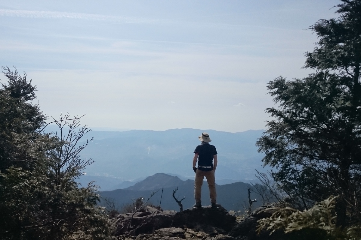
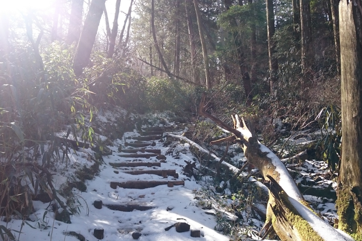
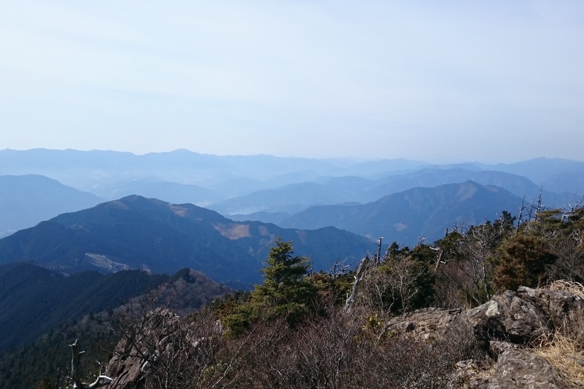
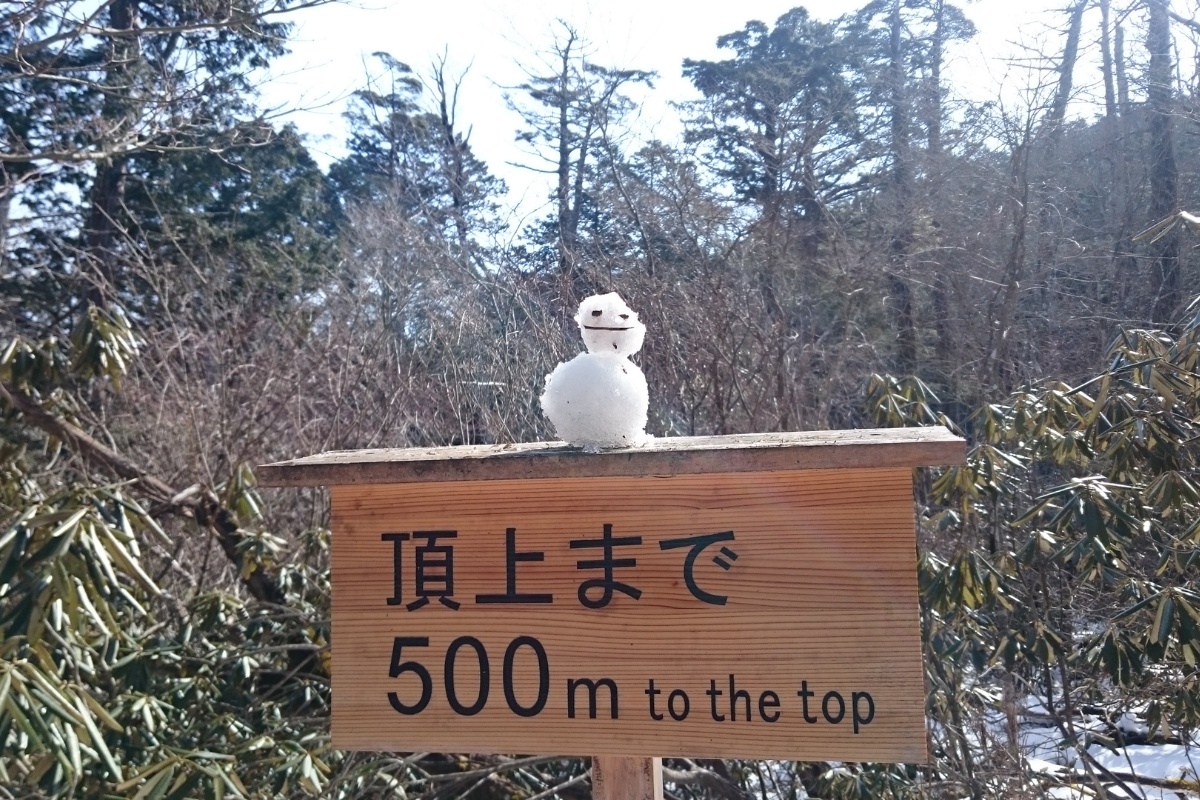
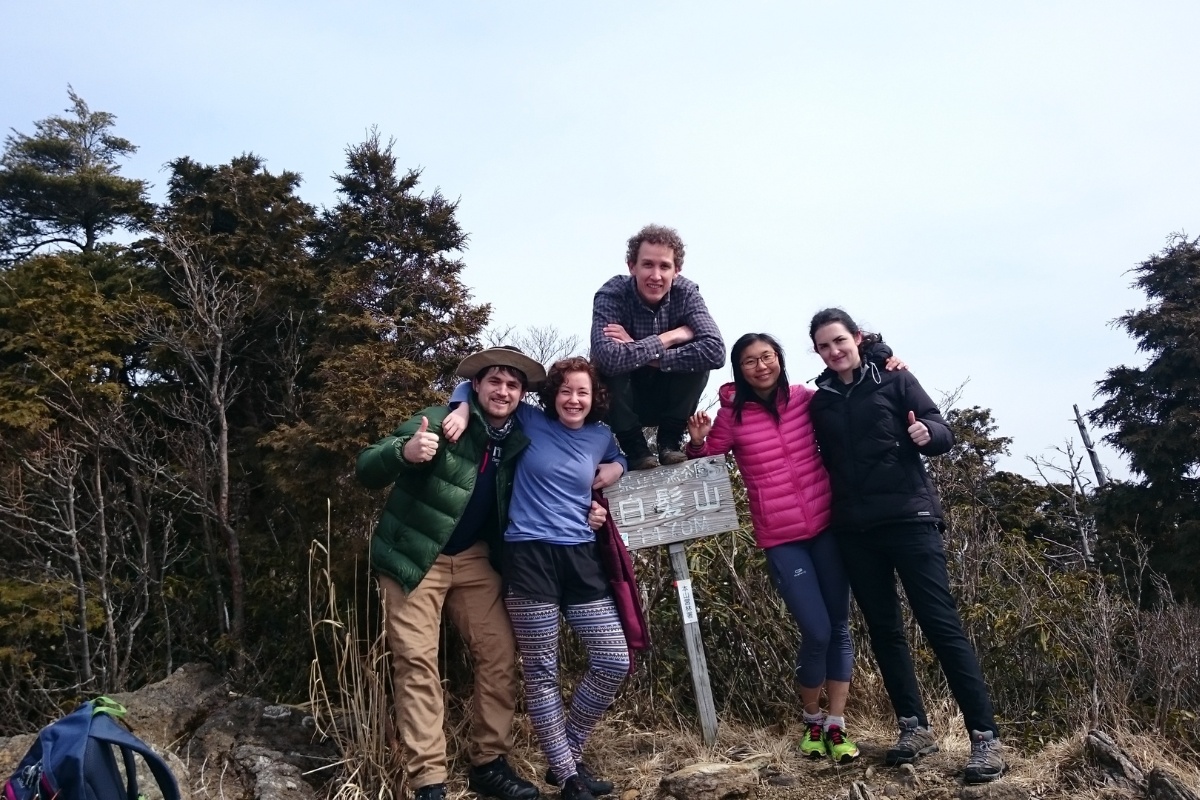
As we approached the top of the peak the vegetation began to thin. There were a a heap of large, dead old trees that looked like they were ready to fall over. Also, despite not having snowed for at least two weeks, there was still a lot of snow laying around. We didn’t need crampons as it was pretty shallow but if you’re doing this hike any earlier (January or February) I suggest bringing them along (especially on the way down). You’ll pass the foundations of some old buildings just near the peak and see some signs showing paths to other nearby mountains (Oku-Kuishiyama for example). We arrived at the peak about 10.30am. The peak is a small rocky out crop with great views over Motoyama and Kajigamori. On a clear day you’ll also be able to see as far as Mt. Tsurugi and Miune.
Descent: The descent of this hike is fairly straightforward. We returned back along the same path we came. We left the peak about 11:00am and were back at our cars before 12:30pm. We did have a little more trouble with the snowy/steep sections right at the top of the mountain (as well as the ice on some rocks) and you’ll also find the rock hopping sections along the river are a little more challenging on the way down but if you take it easy you won’t have any trouble.
Packing and Preparation
Useful Resources
- Tourist information page about the Tosa Reihoku area
- Wikipedia page about the mountain (Japanese)
- Shiraga Hike Report in Japanese