Ironically, hiking this active volcano was the safe choice for us. One of our biggest worries while living in Hokkaido and going into the outdoors was actually bears, so this short and popular trail was a safer choice for us as there were people around.
Located with fantastic views over Lake Shikotsu – well known for camping and fishing and ice festivals – this 3.5km hike with 316m elevation gain is not too far from Chitose and makes for a great day hike with scenic drive to boot.
Trail Information
Hike time: Approx 2.5 hours
Season: Autumn (October)
Fitness: Grade 1 – Easy | Technical: Grade A – Easy
See how I rate my walks
Safety notes: Check for active volcanic warnings, make yourself aware of the risk from bears (links below), and be aware that in winter this hike becomes significantly more isolated.
Access
Trailhead: Mount Tarumae 7th Station parking lot (summer)
The access road to the 7th Station (the Tarumae Tourist Line) closes from early November to late May, which adds roughly 12km of road walking to the hike.
Suggested Meeting Point: Lake Shikotsu Visitor Centre (or the town from which you’re coming from)
Download or view trail map
App or map? While many rely on navigation apps these days I strongly recommend printing a copy of your hike maps using one of the free topographic map services.
Post-Hike Notes
We started the hike around 11:30 am at the Mount Tarumae 7th Station parking lot. There is a toilet block and a shelter hut (Tarumae-san Goya) here. The hike is only located 30km from civilisation, but don’t let the short distances in terms of kilometres fool you. In Japan the roads are generally slow and windy; it often takes twice as long to get anywhere as you would expect, so leave early.
The trail begins below the tree line, with rocky volcanic soil (or just rocks) the vegetation doesn’t grow as high and seems to be hanging on. There is a toilet at the parking lot as well as a logbook.
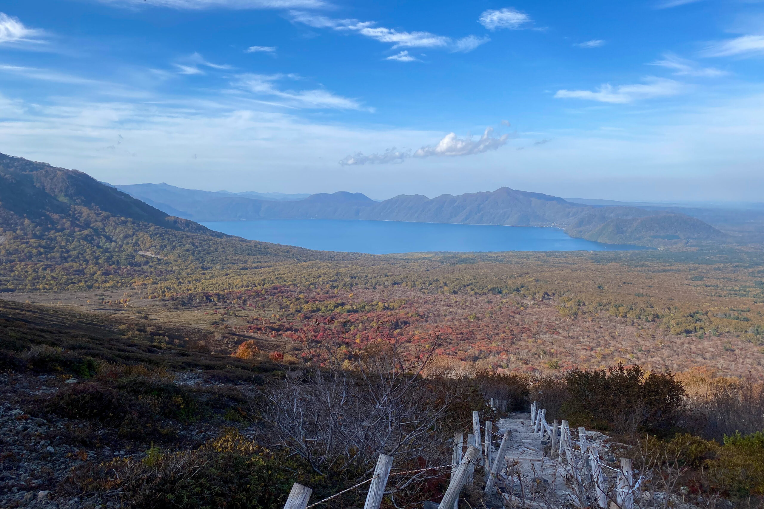
The path quickly starts uphill with loose volcanic rocks and large steps, making it a little tricky underfoot in both directions. The pace and altitude gain is fairly steady on the way up and within 30 minutes you’ll be able to turn back and start to get some great views of the nearby lake. The hike is exposed most of the way but well marked with ropes. I think it would be a different story in winter. We stopped midway for a snack as it was still a little warm despite being autumn. Japan’s heat and humidity can be hard work.
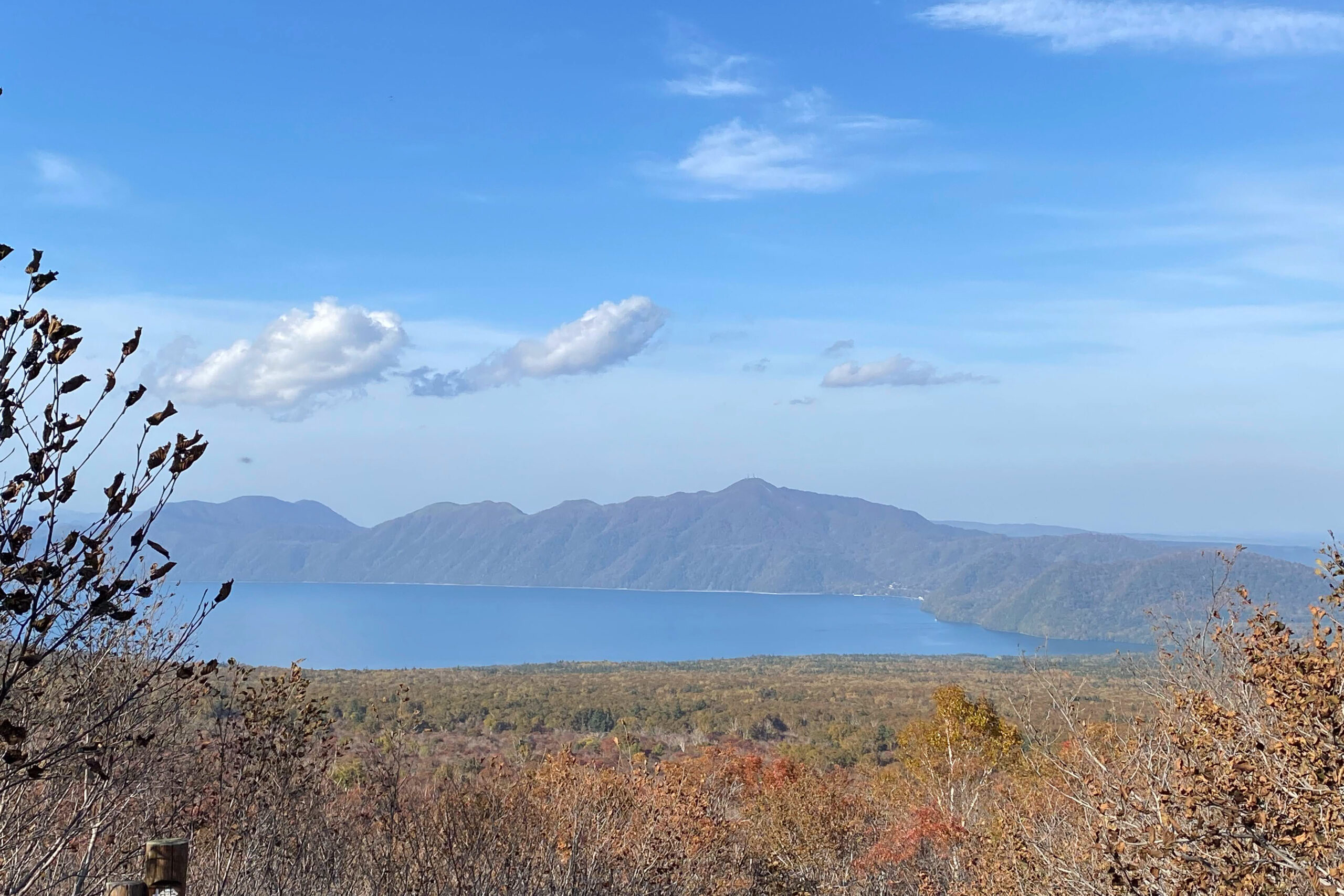
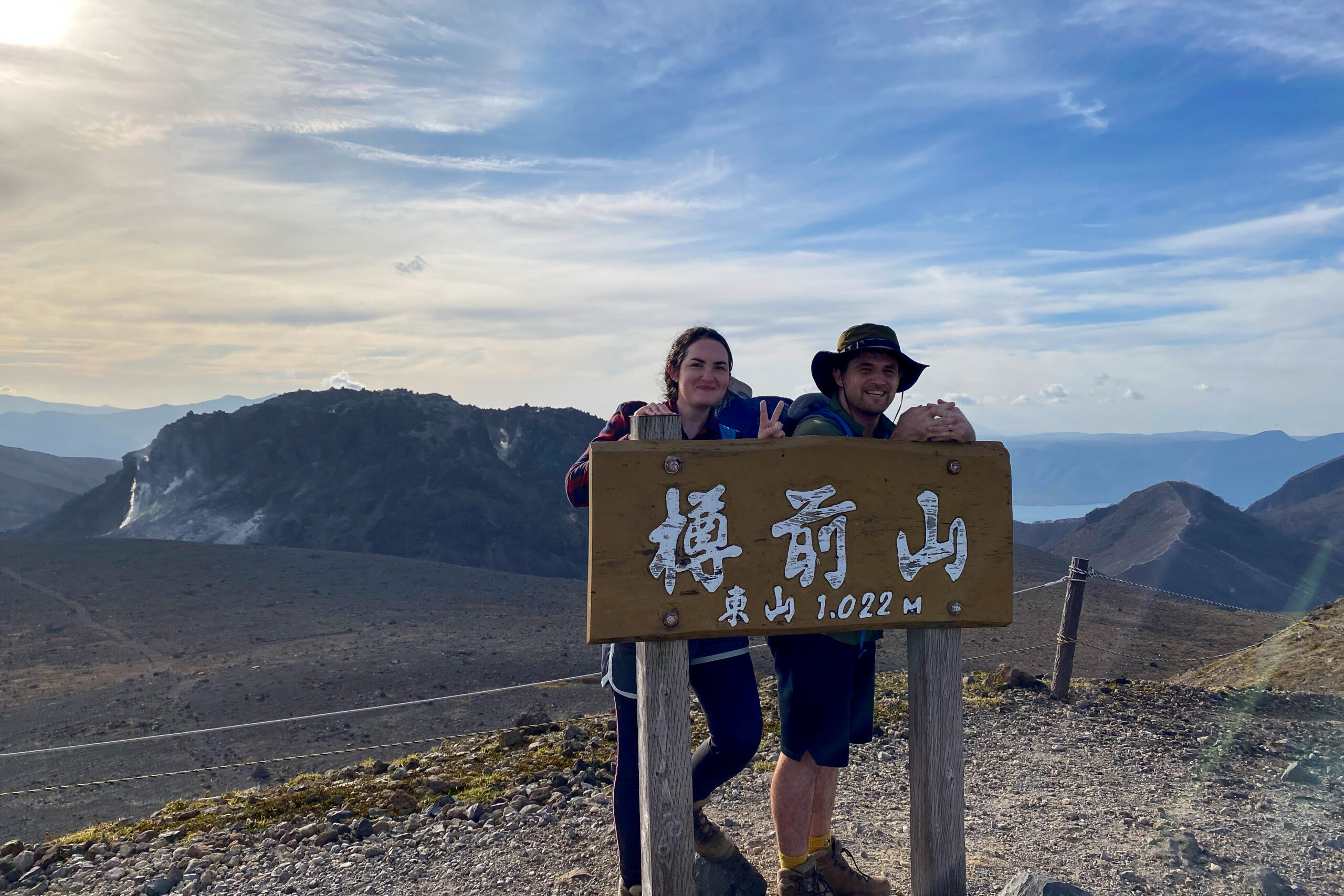
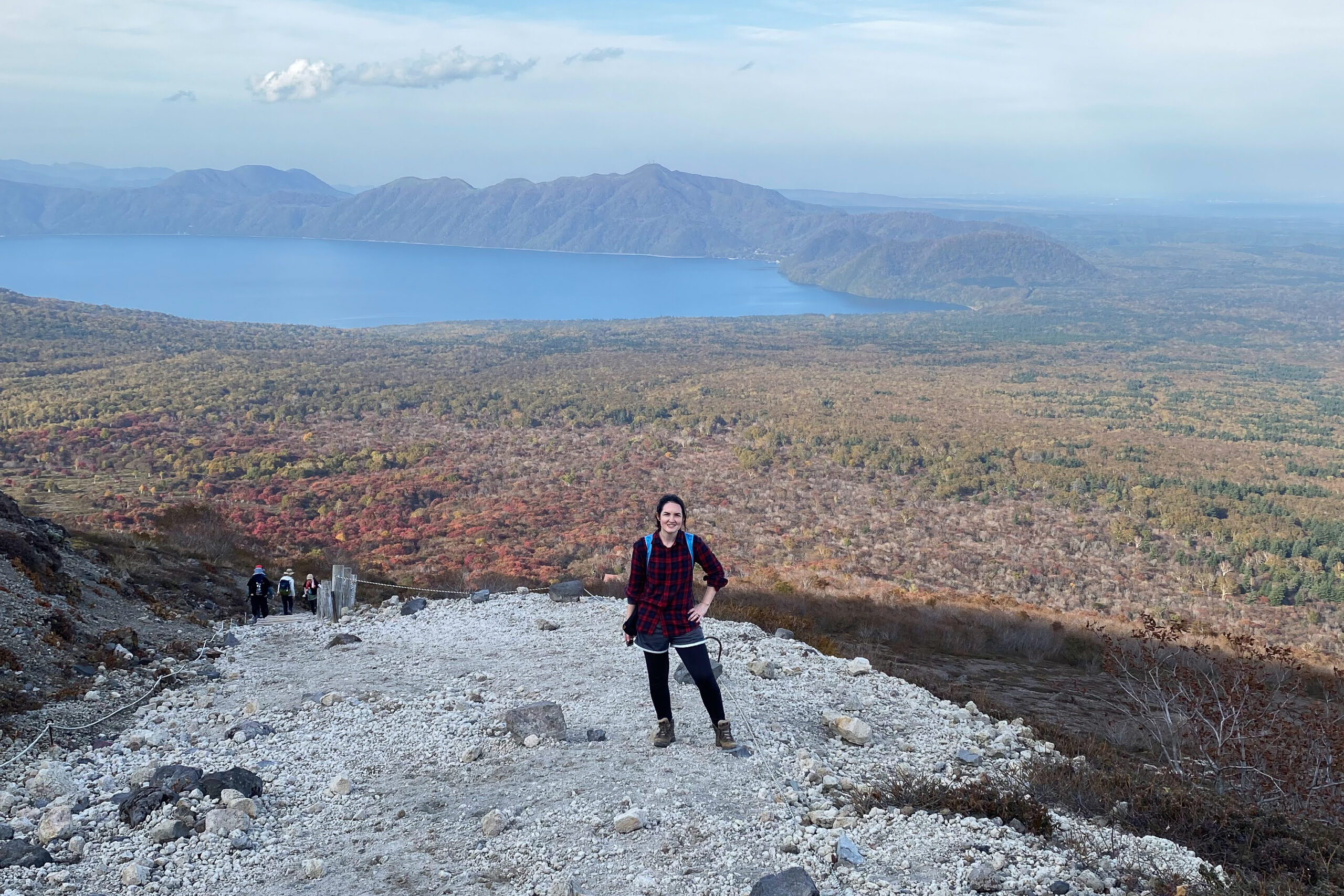
After around an hour we made it to the ridge line/crater rim of the Tarumae volcano, with the gas fuming Tarumae in sight and smell of sulfur in the air. We took a right turn to head up to the Mt Higashi (East) peak where we stopped for lunch and photos. Along with views of the lake you can also see the nearby cities of Tomakomai. We jumped in the car and hit the onsen! It’s possible to walk further around the rim, but we figured it’s best not to dwell on a volcano longer than you need.
On the way down we took it easy to avoid slipping and were back at our car before 3pm. We had a few hours drive to get home but lucky we’re in the land of onsen, kaitenzushi and ramen!
Onsen time
Finish the day with a visit to the nearby Marukoma Onsen Ryokan. Rates: 1,200 JPY for adults. Hours: Typically 10.00am-3.00pm for day visitors. The natural open-air bath is connected to the lake, so the water level fluctuates with the lake itself. We missed it this time, but found another onsen on the way.
Images of Heikeidaira