

Sasagamine is spectactular but challending hike in Shikoku with an old mountain hut at the top that was once a ski resort! This is one of the few areas in Shikoku where black bears are still sighted.
Overview
This is a 12.5km overnight return hike starting at the Kanpuzan entrance carpark (寒風山登山口) in Ino-cho and finishing at the same location. Loop hiking options can be seen on the Yamareco/Yamakei websites. The hike passes Kampuzan (寒風山, 1763m) on the way to Sasagamine (笹ヶ峰, 1860m). You can camp or stay at the Maruyamasou (丸山荘) mountain cabin. The cabin is private so you’ll need to call 0897-57-7855 and make a reservation (the owner will speak Japanese so get a friend to help). Afterwards you can check out the Kinoka Onsen (木の香温泉). See below for a full post-hike report and links with information about the hike and cabin.
Trail Information
Hike time: 7 1/2hrs. Day 1: 4 1/2 hours, Day 2 Return: 3 hours
Season: Early Fall (October)
Estimated Difficulty: Fitness (Grade 2: Moderate) Technical (Grade 2: Moderate)
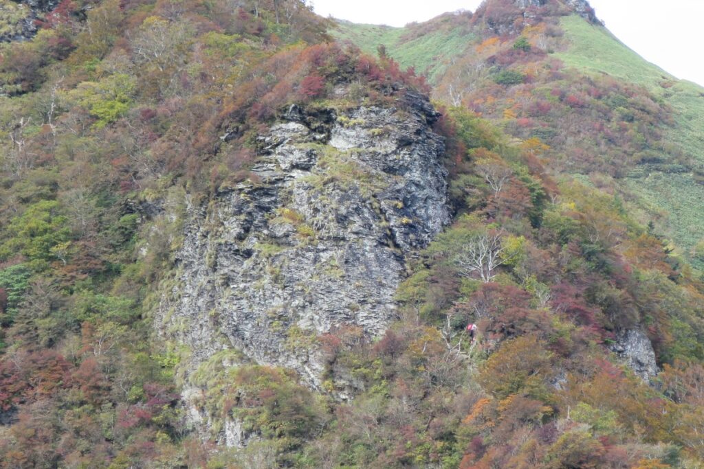
The first section of the hike from the carpark to the ridgeline is steep but not difficult. After you reach the ridge and head towards Kampuzan the trail passes up a steep section of ridge where there are steep cliffs on either side. It’s looks quite intimidating from a distance (look for the little ladders) but once you get up there you will see that the trail is quite protected and there are no directly exposed edges. Just be careful and take your time and you will be fine. After that the terrain is fairly straight forward but with a lot of ups and downs which can be quite tiring. Wind in certain sections can also be very strong.
Access and Parking
Trailhead: The hike starts at the 寒風山登山口 carpark in northern Ino-cho, Kochi (Access is by car only).
Suggested Meeting Point: Car Park at 寒風山登山口.
Download and print the trail map
App or map? While many rely on navigation apps these days I strongly recommend printing a copy of your hike maps using one of the free topographic map services.
Post Hike Report
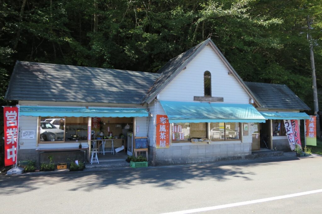
Ascent: We arrived at the Kanpuzan carpark about 11.45am in the morning ready to start by 12.30pm. Beforehand we took a short drive along the UFO Line to check out the early fall colours and nearby views over Mt. Ishizuchi and Kamagamori. The ladies at the store at the carpark were cooking some delicious food. Lots of local products and lunch meals including ramen. You could stock up here on food but there is no guarantee the store will be open weekdays and during the off season (Nov-April).
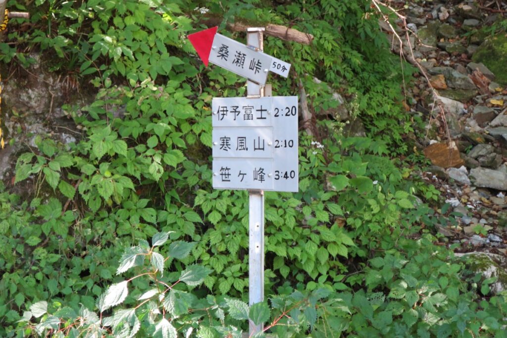
We started up the trail at 12.30. The first thing we noticed was a sign warning of a bear sighting from a few months ago. There were quite a large number of Japanese day-hikers already on the trail so we didn’t bother using our bells. The track is immediately very steep and continues like this for the first 20 minutes however after that the trail is a little more gradual. We reached the top of the first ridgeline (where the trail spits towards Iyo-Fuji) after about 50 minutes.
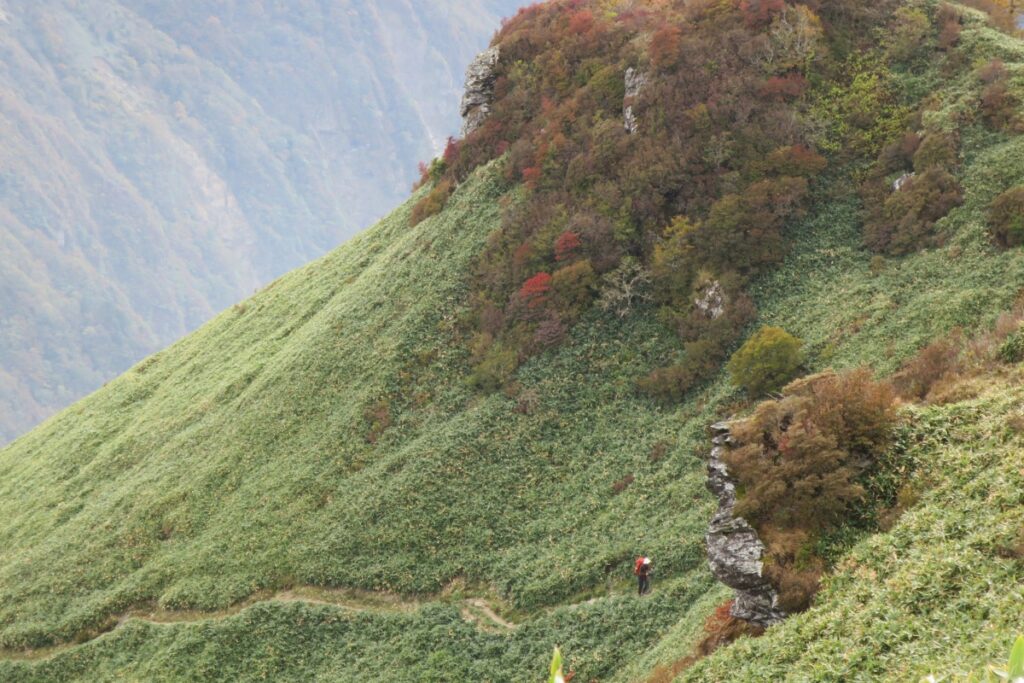
From there we continued along the trail towards Kampuzan. As mentioned above, the trail passes up a steep section of ridge where there are steep cliffs on either side. While it looks quite intimidating from a distance (with several ladders you’ll have to climb) there are no directly exposed areas. If you’re afraid of heights, you might feel a little nervous but if you take it easy you will be okay. From here the trail continues along the ridge. The up and down terrain from here can be quite tiring and this section took a little longer than we expected. It took us about one and a half hours from the time we first reached the ridgeline to reach the summit of Mt. Kampuzan.
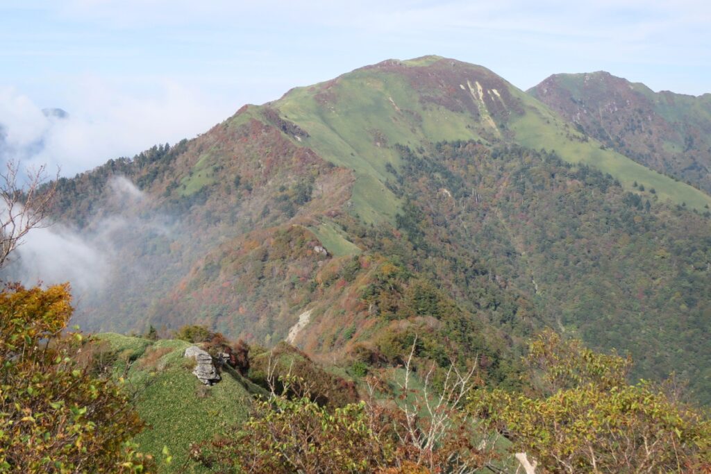
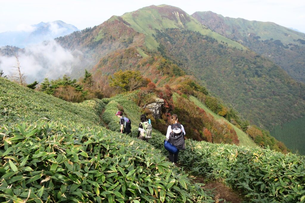
From Kampuzan to Sasagamine the trail is fairly straightforward although the path is overgrown in some places because of the bushes that grow here. I am not sure what these bushes are called but they are typical to most of the rolling, wind-exposed peaks above 1500m on Shikoku (Tsurugi, Miune, Tenguzuka etc). Just be careful you know where you are putting your feet as there are some sections of the trail that have collapsed or are uneven. It took us about 1 and a half hours from the peak of Kampuzan to the peak of Sasagamine and we arrived there about 4.30pm.
From Sasagamine it’s a steep-ish 500m descent to the Marusansou cabin (30-40minute walk down hill). The cabin is quite expensive to stay inside however you can camp outside for 400y. Later in the evening the wind started to pick up and temperatures dropped to about 5 degrees celcius. By morning it was cold and super windy so we ended up waking up around 4am and packing up our tents because the conditions were so bad and out tents had started leaking. In colder times or during bad weather the comfort of the cabin is very alluring and recommended. You can also buy food from the lovely Japanese couple who run the hut (beer is about 500y). The hut itself used to be a part of a ski-field for the locals and there are sets of old 70s and 80s style skis in the entrance area. The former ski-field has long since overgrown with trees but it would have been amazing to see it back in its heyday.
Descent: We waited until about 9am the next morning for the weather to improve but the strong winds continued. Thankfully the rain had stopped, however. It was quite amazing how strong the winds were along the ridgeline and it was an interesting experience walking through the clouds and wind (no pictures, we were busy walking)! Had it been rainy as well as windy our walk back would have been quite difficult. Be prepared for sudden changes in weather from one day to the next and make sure you pack the appropriate rain gear even if the weather forecast is looking nice!
The return trip took us about 3 hours (we arrived in the carpark about 12.45pm). By the time we had changed our clothes, ate some hot ramen, and headed to the nearby Onsen it was already 2.30pm.
Photos of Sasagamine and Kampuzan

Packing and Preparation
Useful Resources
- Yamareco trail information
- Section 1: Carpark to Kampuzan
- Marusansou Mountain Cabin info
- Topographic map (starting point)
- Nearby Konoka Onsen