
If you’re looking for a day hike or trail run with great views while you’re in Kochi City Mt Washio (or Washioyama) at 303m is a solid option. The hike itself is pretty easy, but finding the start of the trail can be tricky. It passes through farm orchards and some cool jungle-esque forest.
Overview
This 3km return day hike to Mt Washio (303m) in Kochi City is a 2 hour return trek with 200m of elevation gain. This hike can be done year out but in the summer humidity it can be a real workout. I suggest visiting in Autumn or Spring when it is a bit cooler. We took the less common route from a school ground baseball field which adds a bit of adventure and solves the lack of parking issue.
Trail Information
Hike time: 2 hours
Season: Early Spring (March)
Fitness: Grade 1 – Easy | Technical: Grade A – Easy
See how I rate my walks
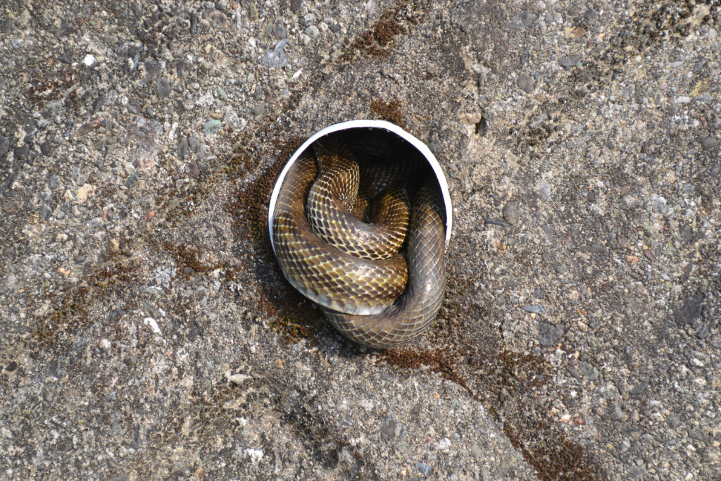
Safety notes: The trailhead can be a bit tricky to find, but lucky you’re in the middle of town. We did see snakes on this hike, so even though this is pretty civilised make sure you carry first aid.
Access
Trailhead: Tosa Highschool Toya Ground (Baseball field)
This is where we parked, you have to find the little tricky path on the side of the road pictured in the Japanese blog I’ve attached below (with pictures).
Suggested Meeting / Supply Point: 7-Eleven セブン-イレブン 高知横浜南店
Download or view trail map
Note: This trail was hand drawn (not recorded) from my notes. You’ll need to navigate using the pictures in the Japanese language blog I’ve shared, as the GPX file is an approximation only.
App or map? While many rely on navigation apps these days I strongly recommend printing a copy of your hike maps using one of the free topographic maps and apps.
Post-Hike Report
We decided to start this hike at the Tosa High School Koyo Ground. It’s a less known, more direct “back route” route that’s a bit harder to find at the start. It’s mostly popular with local school groups and I assume the locals with houses and gardens nearby. The biggest advantage of this starting spot is that it actually has a little bit of parking, just don’t block and access roads.
The first part of this hike is probably the trickiest – find a place to park and then locate the trailhead behind the first base dugout of the baseball field. Use these pictures for reference. This first section is basically “bush bashing” e.g. cutting across the first overgrown sectionto around the end of this road where the trail actually begins. If you eventually pass under a fruit orchard (with beautiful pink flowers on show) …you’re now on the right track.
Even though this is a small walk, be prepared to use some common sense navigation or carry a map on this trail just in case. The are a lot of different ways to go wrong so I suggest recording your track on the way up with a GPS app like Wikiloc or AllTrails – as then simply follow the same path back down. Once again, I suggest you use these pictures for reference.
Despite being in the middle of the city the trail felt quite wild with a lot of rainforest type trees growing on the way up. The Japanese blogger whose report I read for this hike suggests it feels “Miyazaki like” as you climb. I didn’t get pictures of the trees, though, sorry! Eventually the trail opened up as you approach the ridge and we had great views back where we came from.
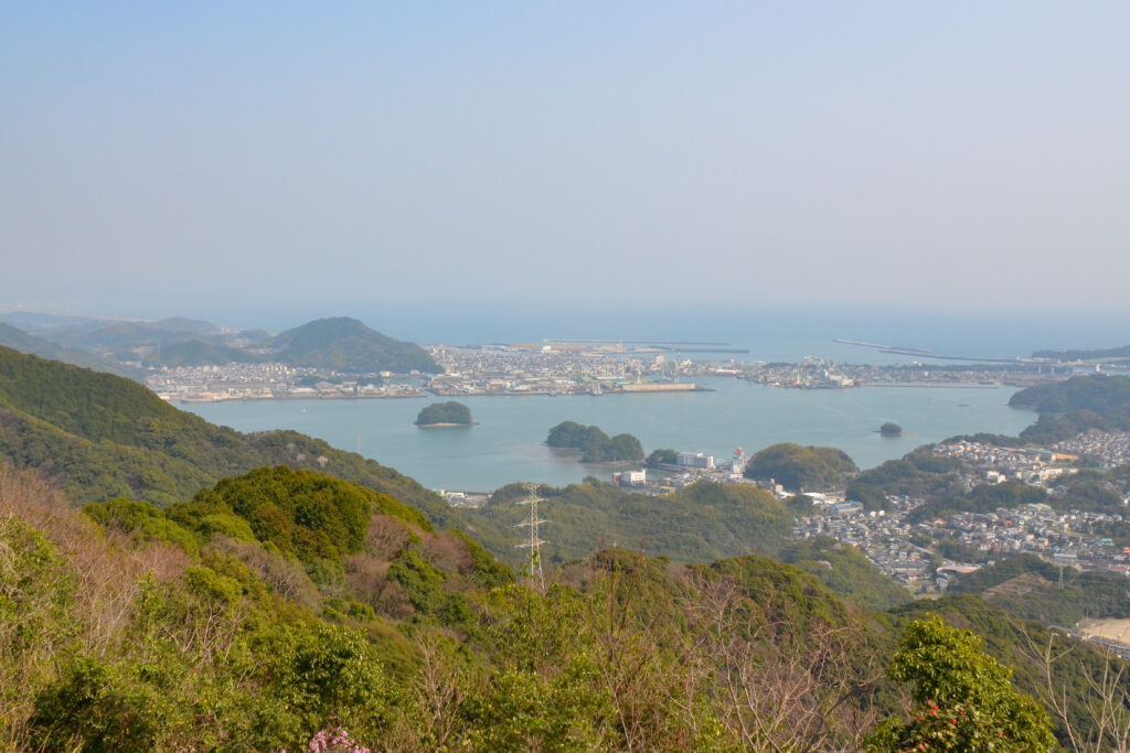
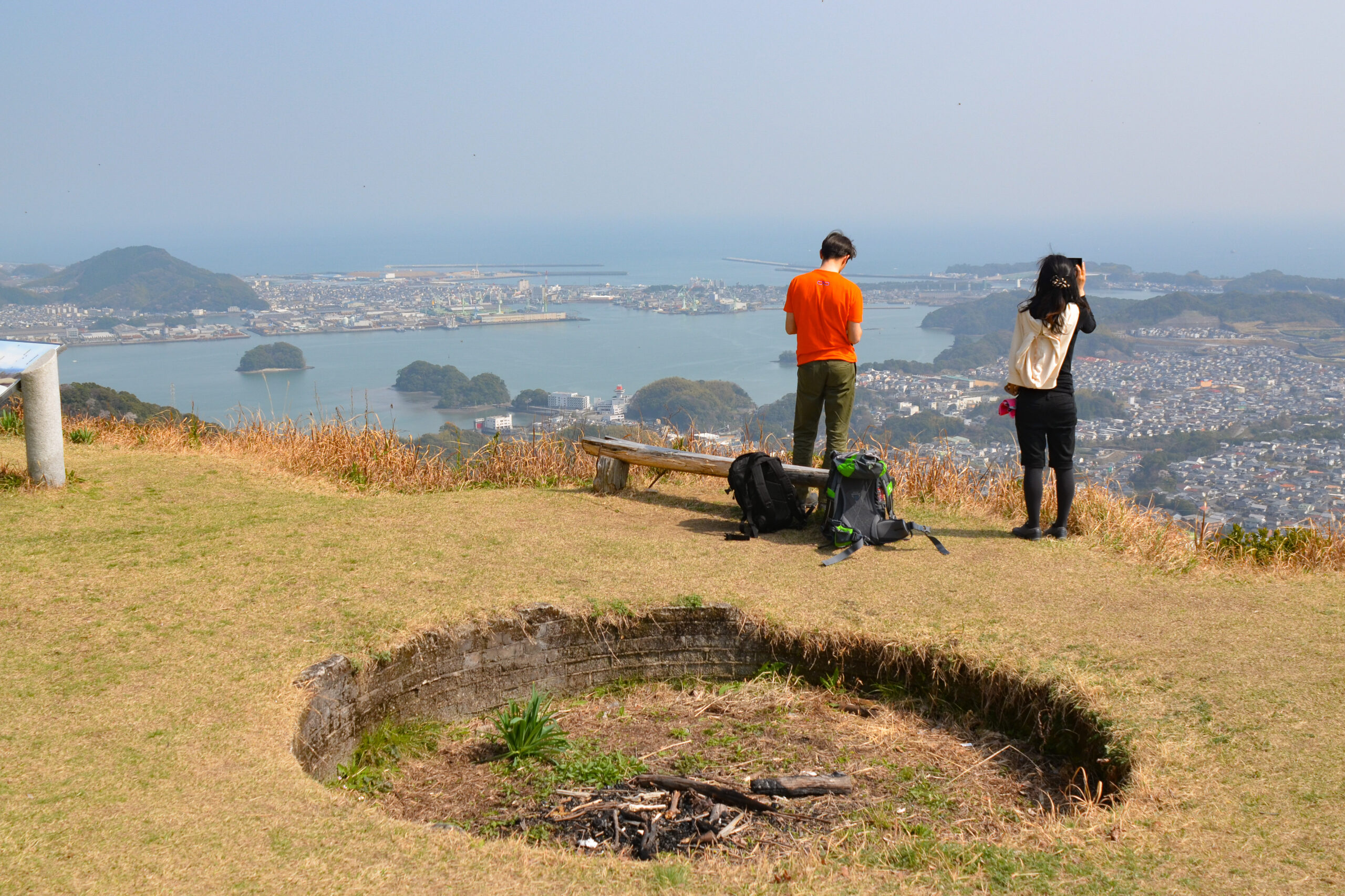
From here, the top was close. We arrived to find spectacular views and what appears to be a firepit at the top (rare in Japan). There are great views over the pacific ocean and city as well as to watch ships moving in and out of the bay. I really think this would make a great night hike / full moon hike (is that a thing?), or even just a hike for sunset. A had a friend who lives in the city who also apparently camped the night!
After a long time at summit we headed off. Retracing our steps following the recorded track. The great thing about this hike is that once you’re back down…. you’re only a few minutes away from plenty of food options in the city. Kaiten-zushi here we come!
The hike can also done as a longer traverse, or you can also visit the nearby Eboshiyama 烏帽子山 if you have time and want to cross off the “taller” peak. It is also a great option if you don’t have all day or a car to drive into the heart of the mountains.