
Mount Beecroft is an easy, rugged Scotland-esque hike that rewards you with solitude and spectacular views of Cradle Mountain and surrounds without the need for a park pass or booking.
Overview
Mt Beecroft (1,140m) is an 11km return day hike located close to Cradle Mountain but outside the National Park boundaries. The trail offers a mix of open sub-alpine grassland and rocky outcrops near the peak, rewarding you (on a clear day) with great views of surrounding peaks. Since it sits on crown land within the Vale of Belvoir area, it is a perfect option if you want to avoid shuttle and park fees or if you’ve already been to Cradle Mountain.
Access
Trailhead: Black Bluff / Cradle Mountain Lookout Carpark
Suggested Meeting Point: Woolworths Burnie
Travel time: By car: 1 hour 10 mins from Burnie, 2 hours from Launceston
Mt Beecroft Information
Hike time: 4 hours return (at a moderate pace due to wet track).
Season: Autumn (May)
Fitness: Grade 1 – Easy | Technical: Grade A – Easy
*See how I rate my walks
Safety Notes: The trail is clear and well formed. The track is very wet and the area exposed to wind and cold so weather (snow, cold), the remote location and gear (raincoat and extra socks) are the key safety considerations.
Download and the Mt Beecroft GPX file
App or map? While many rely on navigation apps I always recommend printing a copy of your hike maps using OpenTopo or similar and keeping it in a waterproof case. You should also consider an PLB or other emergency device in Australia.
Post Hike Report
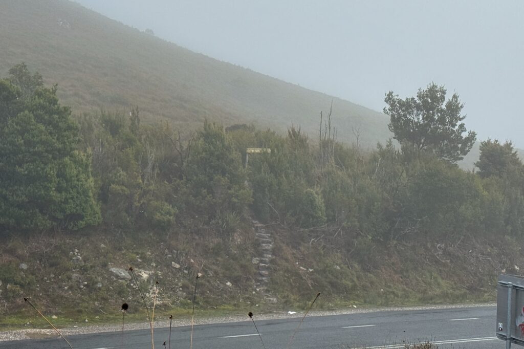
We started from the Black Bluff / Cradle Mountain Lookout carpark, located at around 900m elevation, at 11.00am. It was a little later than we had hoped, and the weather was already setting the mood with thick fog and temperatures hovering around 7 degrees. We packed our ponchos (and day packs, of course) and geared up for the inevitable rain.
The trail begins with a small set of stairs on the opposite side of the road from the lookout. From the outset, the tracks were wet and soggy. Most of the path had turned into a literal river, requiring us to hop between tufts of native grass to find any stable ground. The uphill bits were soggy, the flat bits were soggy, and the downhill bits were soggy. As we quickly discovered, the entire trail is wet except for small sections in the middle and the final summit push. Waterproof shoes and spare socks are strongly recommended, though we eventually just had to suck it up and accept the soaked feet.
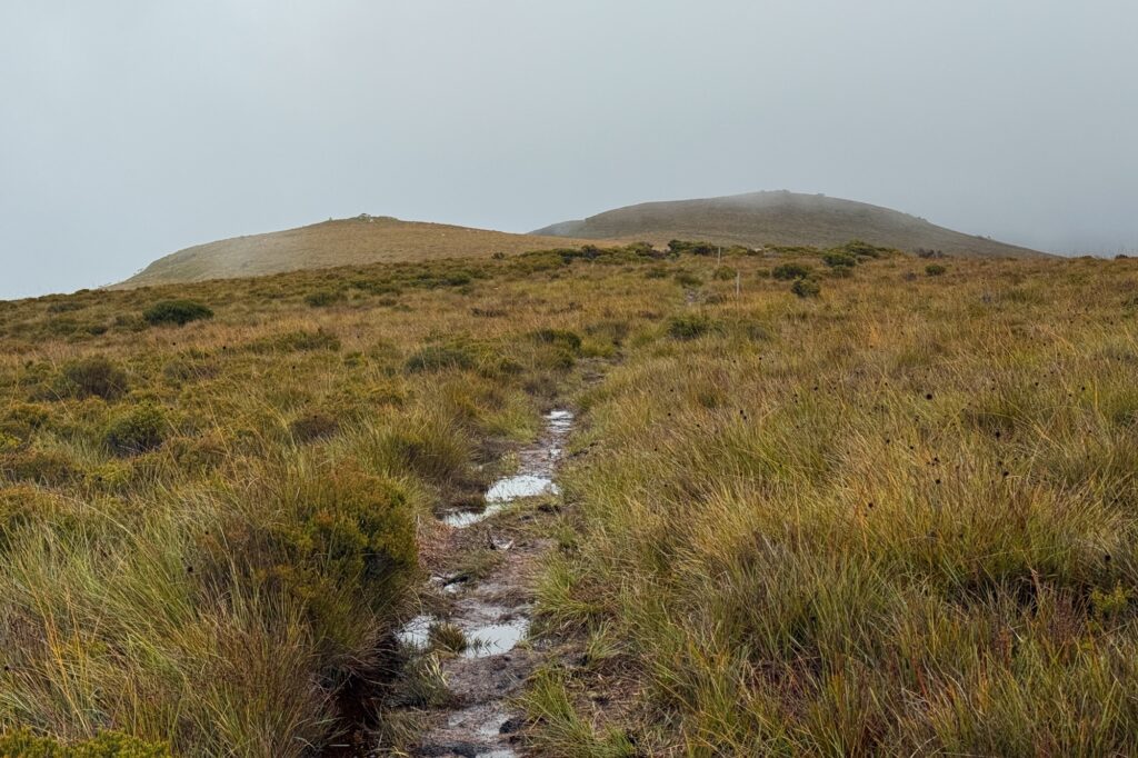
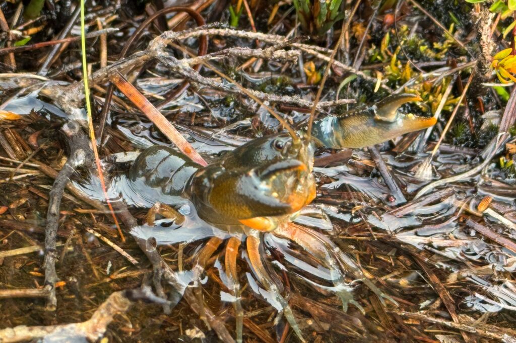
After a slight uphill to get us moving, the trail undulates and remains mostly flat for a large majority of the hike. It skirts around the side of Round Mountain on your right, providing views on your left over nearby ponds and, on a clear day, the massive silhouette of Cradle Mountain. For us, it was a total white-out most of the way, though we did spot a very high-altitude crayfish enjoying the damp conditions.
After passing around the hill, we entered expansive sub-alpine grassland. By this point, only 45 minutes in, we had fully accepted that our boots were saturated. This area is classic Tasmanian buttongrass plains. Some parts of the trail were up to 30cm deep in mud. We also started to realize we were going to encounter quite a few leeches.
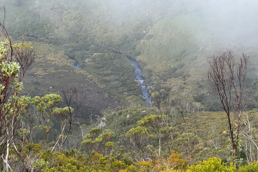
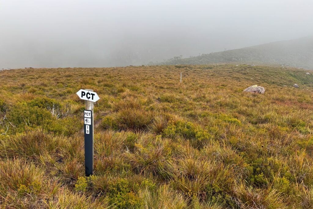
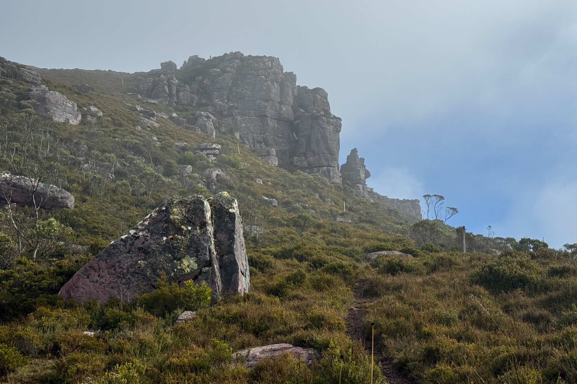
After crossing the bog, we headed up onto a temporarily dry ridge, which then drops down and follows a pretty little valley to the left before rising to a peak at about 1,000m. This is where Mt Beecroft finally comes into view. The trail follows a ridgeline until you reach a junction where the Penguin to Cradle Trail continues to the left. This is the only navigation point you really need to watch; make sure you take the right here to stay on track for the summit.
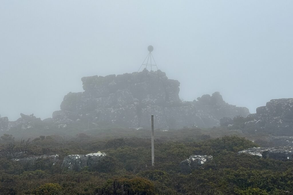
From here, the grassy landscape gives way to overgrown scrub as you head up the spur line beside a steep valley. A beautiful rocky outcrop comes into view ahead, which is probably more interesting than the summit itself. We could see the poles marking the trail as it headed up the very steep section beside a giant cliff. This final section is where most of the work is. It is a proper incline, but it is not dangerous and is easy enough if you take a few breaks.
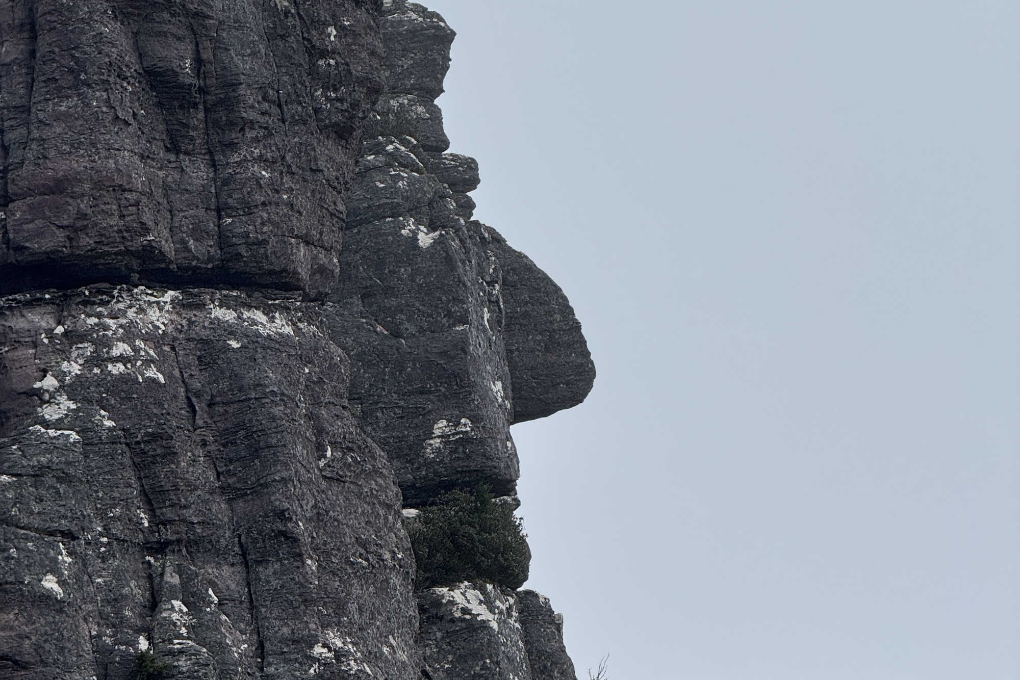
We stopped to admire one of the rock faces which my friend pointed out as looking like a Moai from Easter Island. Personally, I thought it looked more like Squidward. After a few hundred metres of steep climbing, we reached the flat top. With the wind and rain picking up, we set up for lunch halfway up the rocks below the summit trig to get some shelter. Unfortunately, there was no view at the top for us. After 20 minutes and with down jackets now on due to near-zero temperatures, we headed back down.
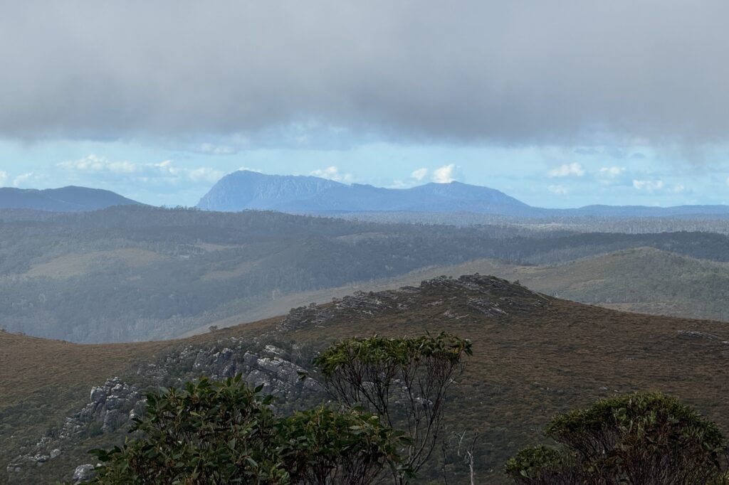
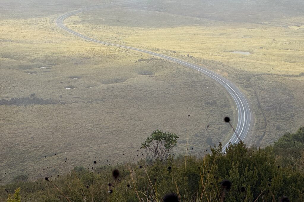
We were blessed to finally get some clear skies on the descent and were able to make out Mt Roland in the distance. The sunshine was short-lived, followed by 30 minutes of moderate sideways rain. With boots now heavy and fully saturated, we just plodded back toward the car. The sight of the final bend where we could see the car parked near the lookout was glorious.
We reached the end of the trail just on 3:00 pm and rushed into the car to get our boots off; we had been walking so fast my boots were actually steaming. After a quick leech check, we headed off. However, 30 minutes later, I noticed somehow three leeches had still managed to make it onto my legs!
Other photos of Mount Beecroft
Useful Resources
- Bushwalking Australia forum on St Valentines peak (before bridge built)
- Facebook post regarding the hike