

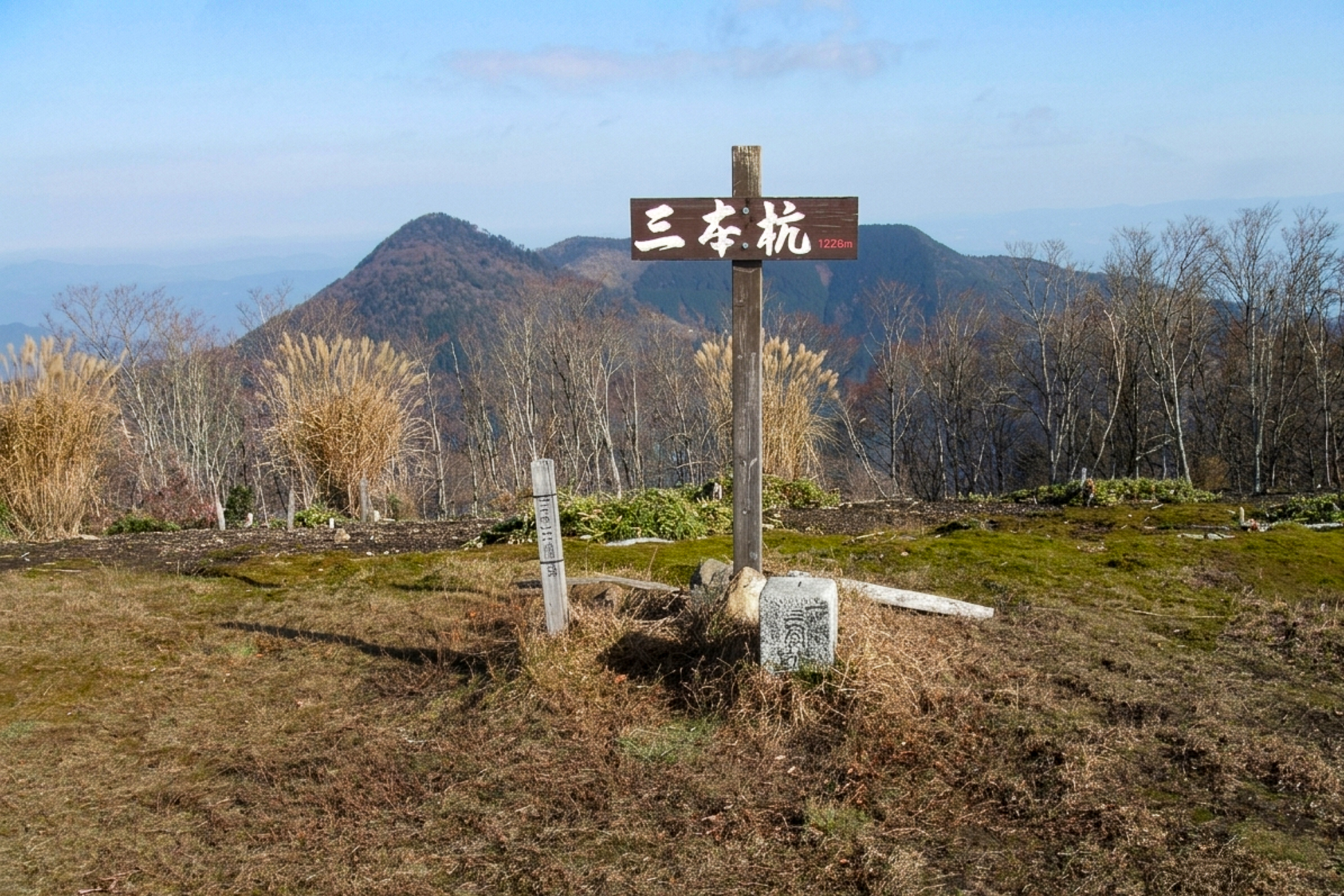
Mt Sanbongui 三本杭 (1,226m, also known as Nametokoyama 滑床山) and Mt Onigajoyama 鬼ヶ城山 (1,151m) are two prominent peaks in southern Ehime/Kochi offering sweeping views stretching across to the the Uwa Sea. Along with Nametoko Gorge it forms part of the Ashizuri-Uwakai National Park.
Starting from the trailhead at Shika-no-koru 鹿のコル along the forest road, a moderate 8.5km ridge loop connects both peaks via Mt Okubo (大久保山) and Mt Yatsuzura (八面山) through beech forest and regenerating miyako-zasa grasslands. For a longer, more adventurous approach can climb to Sanbongui via the scenic waterfalls and mossy stream-crossings of Nametoko Valley 滑床渓谷 before completing the ridge traverse.
⚠️ This is a planned hike. I haven’t walked this trail but am sharing my research in English to encourage people to get out there and explore Shikoku (and also so I can do the hike, too!). Please do your own planning and research. If you do end up hiking this mountain, I’d love to hear from you.
Access & Course Information
Option 1: Loop from Shikano Col area
Starting from the parking lot at Shikano Col (or Coru as its is read in Japanese) this 8.5 kilometer loop offers a gentler day hike that also includes Mt. Okubo (大久保山) and Mt. Yatsuzura (八面山). Traversing through varied beech forests and Miyako-zasa grasslands, if offers 360-degree views across Ehime and Kochi prefecture. Make sure to close the deer protection gates along the trail as you pass through.
Trailhead: Shikano Col/Cor Parking lot
Estimated hike time: 4.5 hours (8.5km with 679m of elevation gain)
Estimated fitness: Grade 2 – Moderate | Technical: Grade B – Moderate
*See how I rate my walks
Useful links: Yamap route information (In Japanese)
Option 2: Long route from the bottom (Oiwaiyama loop)
This option begins down in the Nametoko Valley (滑床渓谷) along a picturesque stream with smooth rock beds, mossy boulders, and scenic waterfalls including Setsurin Falls (雪輪の滝) and Okusenjo (奥千畳). Given the route’s nearly 10-kilometer length and slippery stream crossings (don’t cross in flood conditions), proper footwear and caution on wet surfaces are essential. Note that if you take this route, it does not include xxx which is also on the Shikoku 100 list so I’ll likely take Option 1.
Trailhead: Manneso Parking Lot
Estimated hike time: 6.5 hours (10km with 965m of elevation gain)
Estimated fitness: Grade 3 – Hard | Technical: Grade A – Easy
Useful links: Yamap trail report with picures (In Japanese)
*See how I rate my walks