

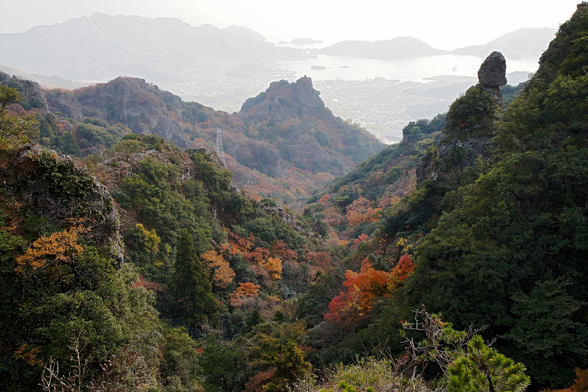
Kagawa Prefecture, located in Shikoku’s north-east, is home to 10 mountains listed on the Shikoku Hyakkumeizan (although there are 12 peaks on my list below as I am including a few lowcated just across the Tokushima border).
While many of Kagawa’s peaks are on the “smaller” side they make up for it for their beauty, spiritual connection and accessibility. I’ve set out the hikes below in sequential order that will allow me to tick them off as quickly as possible in a single visit. So long as I have decent weather I think it’s quite possible to achieve these in five days. Who knows… I might even have time to stop and eat some udon, too.
⚠️ These are planned hikes. I haven’t walked these yet myself but am sharing my research in English to encourage people to get out there and explore Shikoku (and also remind myself!). Please do your own planning and research. If you do hike these or find it useful, I’d love to hear from you.
Access & Course Information
The list below will be arranged in sections that makes them possible to do back-to-back, with driving directions and suggestions on places to stay in between each hike. It is a work in progress.
Section 1: City to sea
Hoshigajōyama 星ヶ城山 – 817m
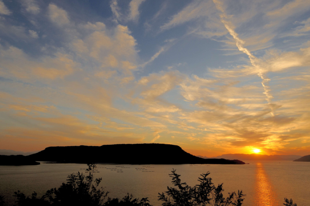
Standing at 817 metres, Hoshigajōyama is the highest peak on Shodoshima Island. The hike from the Kankakei Ropeway summit station to Hoshigajōyama covers about 2.3 kilometers through a shaded, tree-covered trail leading past historic castle ruins. This route is exceedingly popular in autumn, drawing large crowds. Access to the island, and then the hike itself seems the hardest part – due to time and cost. The bus service to the ropeway, for example, runs only a small part of the year. You can also drive to the peak instead of the ropeway. I’ve detailed the ropeway assisted route below however you can walk it from the bottom.
Trailhead: Kankakei Ropeway Top Station
Estimated hike time: 2 hours (3.8km) with 245m of elevation gain.
Estimated Fitness: Grade 1 – Easy Technical: Grade A – Easy
Useful links: Yamap hike report
Yashima 屋島 – 292m
Located near the heart of Takamatsu City, Yashima is a car accessible peak with a Shikoku Ohenro 88 temple on the top and a cool abandoned cable car at the bottom. I’ll detail the hike from the bottom below however due to how many mountains I have left to go to achieve my dream I may simply drive this one.
Trailhead: Yashima Nakamachi
Estimated hike time: 1.5 hours (4.2km) with 250m elevation gain.
Estimated Fitness: Grade 1 – Easy Technical: Grade A – Easy
Useful links: Yashima mountain info (Yamareco)
Section 2: The border peaks
Nyotaizan 女体山 – 774m
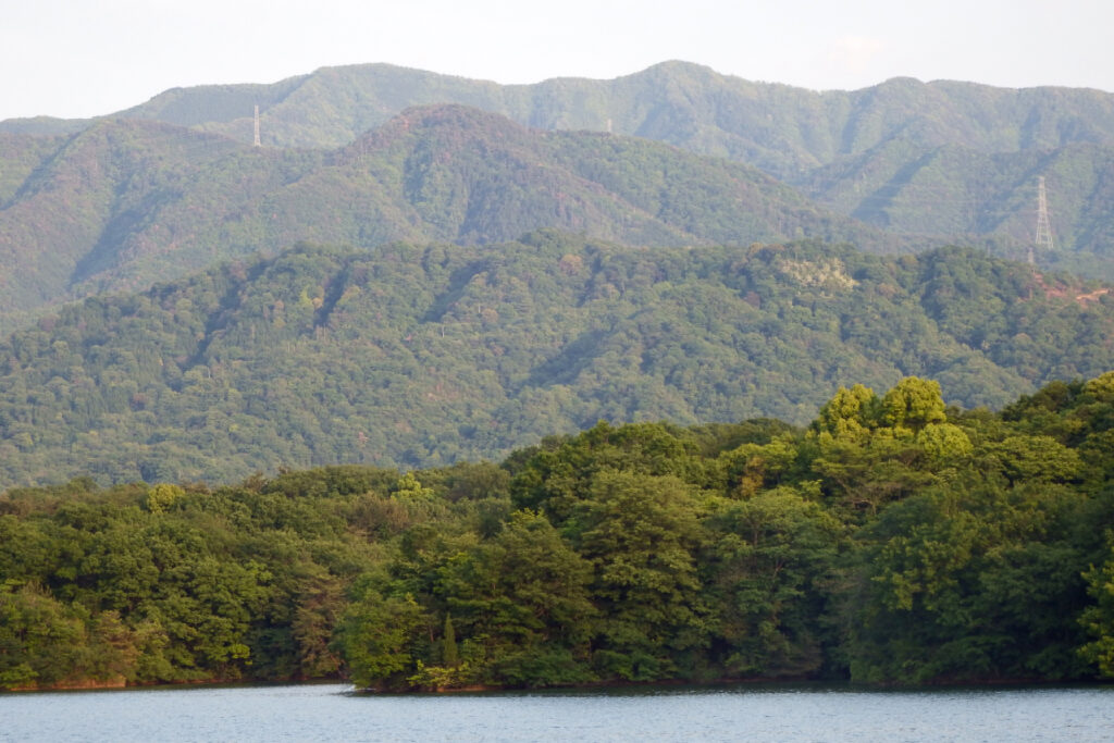
Nyotaizan, or “woman’s body mountain” is said to have been named because it looks like a woman sleeping when viewed from the Sanuki Plain. Once again, we have another peak that is road accessible, and forms part of the Shikoku Ohenro 88 temple route. There is a proper hiking trail to access this peak, called the Okubojitenbodai, which I’ll detail below. The hike is reportedly short and steep with some muddy sections, lots of steps and a short chain-assisted section near the top that might require moving on all fours.
Trailhead: Okubo Temple
Estimated hike time: 2 hours (2.1km) with 317m of elevation gain.
Estimated Fitness: Grade 2 – Moderate Technical: Grade B – Moderate
Useful links: Yamareco trail report
Ōtakiyama 大滝山 – 946m
Otakiyama is a 946m peak located on the Kagawa Tokushima border (Takamatsu City and Mima City) within the Sanuki Mountain Range. Traditionally this would be accessed via the ridgeline as part of the Shikoku Pilgramige, however today there is a road to the top for access to the temple.
Trailhead: Nishiterujinja Parking Lot
Estimated hike time: <30 minutes (allow an hour if you wish to explore)
Estimated Fitness: Grade 1 – Easy Technical: Grade A – Easy
Useful links: Yamap mountain info
Ryūōzan 竜王山 – 1,059m
Otakiyama is another 1059m peak located on the Kagawa Tokushima border within the Sanuki Mountain Range. A short trail of very interesting looking timber stairs leads to a heavily forested peak. Even the lookout tower doesn’t seem to poke very far above (if at all) the trees. The access road is probably suitable only for kei cars, take care.
Trailhead: Awaryuo Parking Lot
Estimated hike time: <30 minutes (allow an hour if you wish to explore)
Estimated Fitness: Grade 1 – Easy Technical: Grade A – Easy
Useful links: Yamap mountain info
Ōkawayama / Daisen (Tokushima) 大川山 – 1,043m
Okawayama, not to be confused with Okawamine which also appears on the Shikoku 100 list, is a peak on the Kagawa-Tokushima border which technically sits just inside Tokushima. The peak is conveniently located next to a camping ground, making it the perfect base for Section 2 of this trip. It may also be seen as “Daisen” on Google Maps or other places. Below I’ll detail the whopping 5 hour hike to this peak, but in reality it is a short walk from the campground which is accessible by car.
Trailhead: Nakadori Bus stop, in Nakato 中通
Estimated hike time: 5.5 hours (8.5km) with 895m of elevation gain
Estimated Fitness: Grade 3 – Hard Technical: Grade B – Moderate
Useful links: Yamap route info
Section 3: Volcanoes and temples
Ōsayama 大麻山 – 616m
Not to be confused with the peak of the same kanji in Tokushima nearby this is yet another Shikoku Pilgrimage related peak on Kagawa’s list. While it is possible to drive almost to the top on the northern side a lack of parking might make this difficult. The far more interesting route starts down below the Konpira temple – given it’s beauty it seems a shame to do this one the easy way so we’ll detail the “long route” below.
Trailhead: Konpirasansanpai Parking Lot こんぴらさん参拝駐車場
Estimated hike time: 3.5 hours (7km) with 658m of elevation gain
Estimated Fitness: Grade 1 – Easy Technical: Grade A – Easy
Useful links: Yamap course information
Iinoyama 飯野山 – 422m
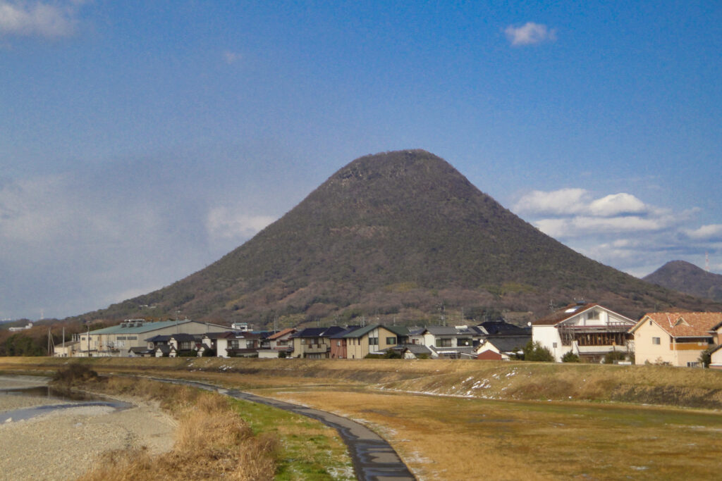
Mt Iino is probably one of Kagawa’s most iconic mountains, owing to its volcanic cone shape. Legend says Ojomo carefully piled up dirt to form the smooth, rice-ball shape of the mountain and there is a large hollow rock on the peak called “Ojomo’s Footprint” (Ojomo no ashiato). There are multiple trails up the mountain, the one detailed below zig zags a little bit more up the peak meaning the gradient is a little bit easier.
Trailhead: Yayoinohiroba Parking Lot
Estimated hike time: 2 hours (4.1km) with 400m of elevation gain
Estimated Fitness: Grade 2 – Moderate Technical: Grade A – Easy
Useful links: Yamap trail information
Section 4: Westside, MF
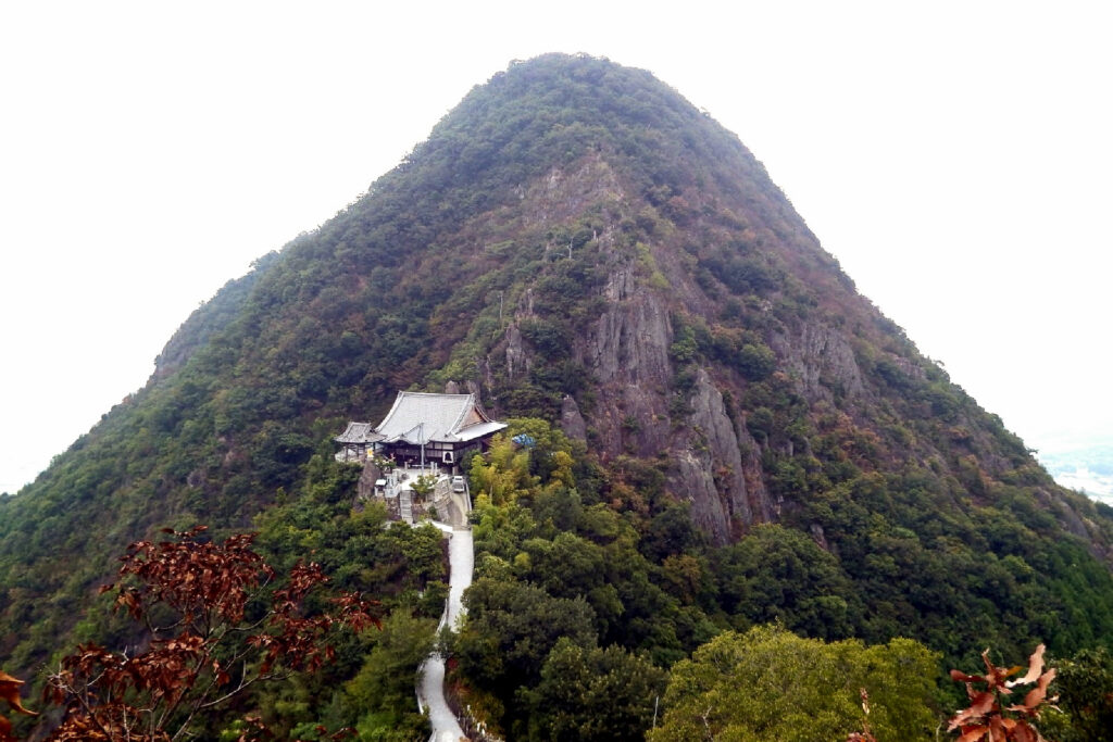
Gahaishizan 我拝師山 – 481m
Gahaishizan is a 481m mountain with an iconic view of the Shusshakaji Okunoin just below the peak making this one of the prettiest peaks in Kagawa. Located close to Oasayama the hike is short but steep with great views over the ocean.It does include a short section of chains on the route indicated below – avoiding these requires taking an entirely different route from the other side.
Trailhead: Shusshakaji Daiichi Parking Lot 出釈迦寺 第一駐車場
Estimated hike time: 2.5 hours (3.1km) with 424m of elevation gain
Estimated Fitness: Grade 2 – Moderate Technical: Grade D – Hard
Useful links: Yamap course info
Shiudeyama 紫雲出山 – 352m
Shiudeyama is known for its famous cherry blossom and Seto inland sea views and is today fully accessible by car. Functioning as a lookout it is possible to drive almost to the top. However if you prefer to take a stroll we’ve detailed the hike from the nearby Ohama fishing port below.
Trailhead: Ohama Fishing Port
Estimated hike time: 2.5 hours (5km) with 396m of elevation gain
Estimated Fitness: Grade 2 – Moderate Technical: Grade A – Easy
Useful links: Yamap trail information
Unpenjiyama 雲辺寺山 – 927m
Mt Unpenji, the final hike on this list, is accessible by hiking, car and even gondola. The peak hosts the highest-altitude temple on the 88-temple Shikoku Pilgrimage after which it is named. There are two main routes if you’d like to hike this. One that passes under the gondola on the east (detailed below) and another which starts further to the west. Both are detailed on the Yamap reference below.
Trailhead: Umpenji Ropeway Station 雲辺寺ロープウェイ
Estimated hike time: 4.5 hours (8.1km) with 790m of elevation gain
Estimated Fitness: Grade 3 – Hard Technical: Grade A – Easy
Useful links: Unpenji mountain information
Other peaks to do on this trip
While not in Kagawa, these nearby peaks could be added to your trip if you’re trying to complete the Shikoku 100 in as little time as possible.
Oasayama 大麻山 – 536m
Mt Oasa, located in Naruto City, Tokushima Prefecture, is the highest peak in Naruto and one of the 100 Famous Mountains of Shikoku. Affectionately known by locals as “Oasa-san,” the peak hosts the inner shrine (Okumiya) of Oasahiko Shrine, which sits right at the start of the trail. The most popular route is a well-maintained out-and-back trail starting from the shrine grounds, taking hikers past the sacred Manai Spring. This one must be walked.
Trailhead: Oasa Shrine parking
Estimated hike time: 3 hours (4.1km) with 513m of elevation gain
Estimated Fitness: Grade 2 – Moderate Technical: Grade A – Easy
Useful links: Trail report and pictures (in Japanese)