

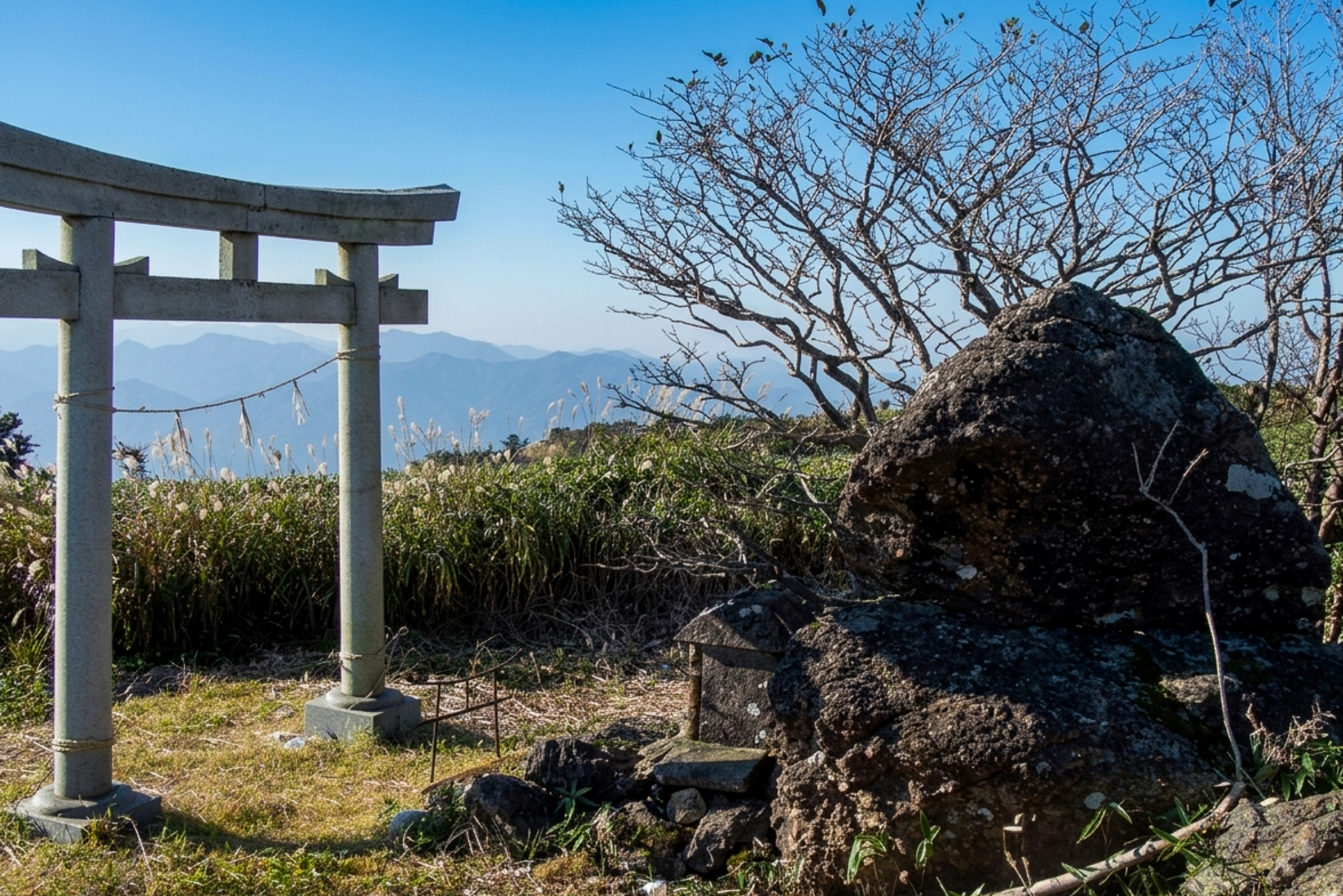
Mt Okujinga (奥神賀山) is a pretty, sasa-copvered 1,443m peak located on the Kami/Otoyo border in Kochi. Due to being just a short 30 minute walk from Toyonaga Pass, it makes a great candidate to pair up with nearby lesser-known peaks like Nakatoyama (中都山) or Daiboshiyama (大ボシ山) – although little online route information exists for these extensions. There is also a longer, much more challenging approach climbing up from the back (via Kamiga Shrine) for those seeking a full-day hike which I’ll detail below.
Note that simply accessing the primary trailhead via Toyonaga Pass is often the most challenging part of the journey; it requires navigating to the end of a long, unpaved dirt forest road that remains blocked or buried in snow long after winter has passed. Previously when I attenpted the drive it was closed for landslides and in poor condition. Okujingayama is on the Shikoku 100 Famous Mountains list I hope to complete one day.
⚠️ This is a planned hike. I haven’t walked this trail but am sharing my research in English to encourage people to get out there and explore Shikoku (and also so I can do the hike, too!). Please do your own planning and research. If you do end up hiking this mountain, I’d love to hear from you.
Access & Course Information
Option 1: Via Toyonaga Pass (Short Route)
Starting from Toyonaga Pass (豊永峠), this brief route reaches the summit of Mt Okujinga in just 20 to 30 minutes. Because it is so short, it serves as the perfect launchpad to extend your hike along the ridgeline. Be warned that the drive in along the long unpaved forest road is challenging, and I’d consider this a fairly “remote” area by Japanese standards with little to no mobile reception to be expected.
Trailhead: Toyonaga Pass (豊永峠)
Estimated hike time: <1 hour (1.4km with 73m of elevation gain) for Okujingayama only
Estimated fitness: Grade 1 – Easy | Technical: Grade A – Easy
*See how I rate my walks
Useful links: Yamap course map (In Japanese)
Option 2: From Kamiga Shrine (Challenging Route from the Back)
For those looking for a proper physical test or wanting to avoid the long, snow-prone dirt road drive up to Toyonaga Pass, this out-and-back traverse ascends from the Kamiga Trailhead. The route climbs up past Kamiga Shrine (神賀神社) and Mt Kamiga (神賀山), then follows the ridgeline over Nakatoyama (中都山) before reaching Okujinga Shrine and the peak of Mt Okujinga.
Trailhead: Kamiga Shrine
Estimated hike time: 6.5 hours (12.1km with 939m of elevation gain)
Estimated fitness: Grade 3 – Hard | Technical: Grade B – Moderate
Useful links: Yamap trail report with picures (In Japanese)
*See how I rate my walks