

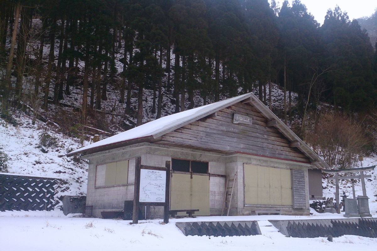
If you want to experience a drive through old Japan this is for you. This remote and off-the-beaten track hike to Oku Kuishiyama (奥工石山, 1516m) or sometimes known as Tajikawa Kuishiyama (立川工石山) starts and finishes in Otoyo-cho at the Kuishiyama mountain hut (工石山山荘). Accessing to the mountain hut is by car however it requires driving on dirt/gravel roads for 10km once you pass Tajikawa (立川).
Trail Information
Estimated hike time: 3 hrs return (from cabin)
Date/Season of Hike: Late February – Winter
Difficulty: Fitness (Grade 1: Easy) Technical (Grade 2: Moderate)
There is some rock scrambling near the top and slightly dangerous cliff faces however most of the hike goes along an easy, well marked track. The main challenge of this hike comes from the fact that since it is in winter, you will need crampons in order to walk through the snow. We used four-peg microspikes and found that near the top we were slipping a little due to the snow being deeper than 20cm in place.
Access and Parking
Trailhead: Kuishiyama Cabin – Access by car only (see the post hike report for more information about our challenges getting to the start point).
Suggested Meeting Point: Otoyo Convenience Store or trailhead
During winter the road may be covered in snow and after rain it may be quite muddy. If you do not wish to drive on the dirt road you can park further back along the trail and take the long way up which adds about 10km to the walk.
Staying at the cabin
The Kuishiyama cabin is free but hikers are recommended to make a donation to help with it’s maintenance. The cabin will probably be empty however there may be other hikers that you will have to share the facilities with. The fireplace is inside the building but there is no chimney. Traditional Japanese style or design flaw (or both). If you light a fire and there is smoke you’ll need to open the doors.
Download and print the trail map
App or map? While many rely on navigation apps these days I strongly recommend printing a copy of your hike maps using one of the free topographic map services.
Post Hike Report
Ascent: We left Otoyo convenience store around 10am and headed towards Tajikawa along the main road. After 40 minutes we turned off onto the road which passes Tajikawa Post office here and Tajikawa Bansho where you can get pizza on weekends. It took about 40 minutes from the post office to reach the cabin and after 20 minutes the paved road stops. From here the road was muddy and icy due in some places due to the wintery conditions and the road’s use as a logging access trail.
We passed a Japanese driver in a fairly new white plate that didn’t any issue being there. That being said, if you have a large white plate/wagon you may have difficulty in some sections as the surface is uneven. Drive as far as you feel comfortable and consider walking the rest.
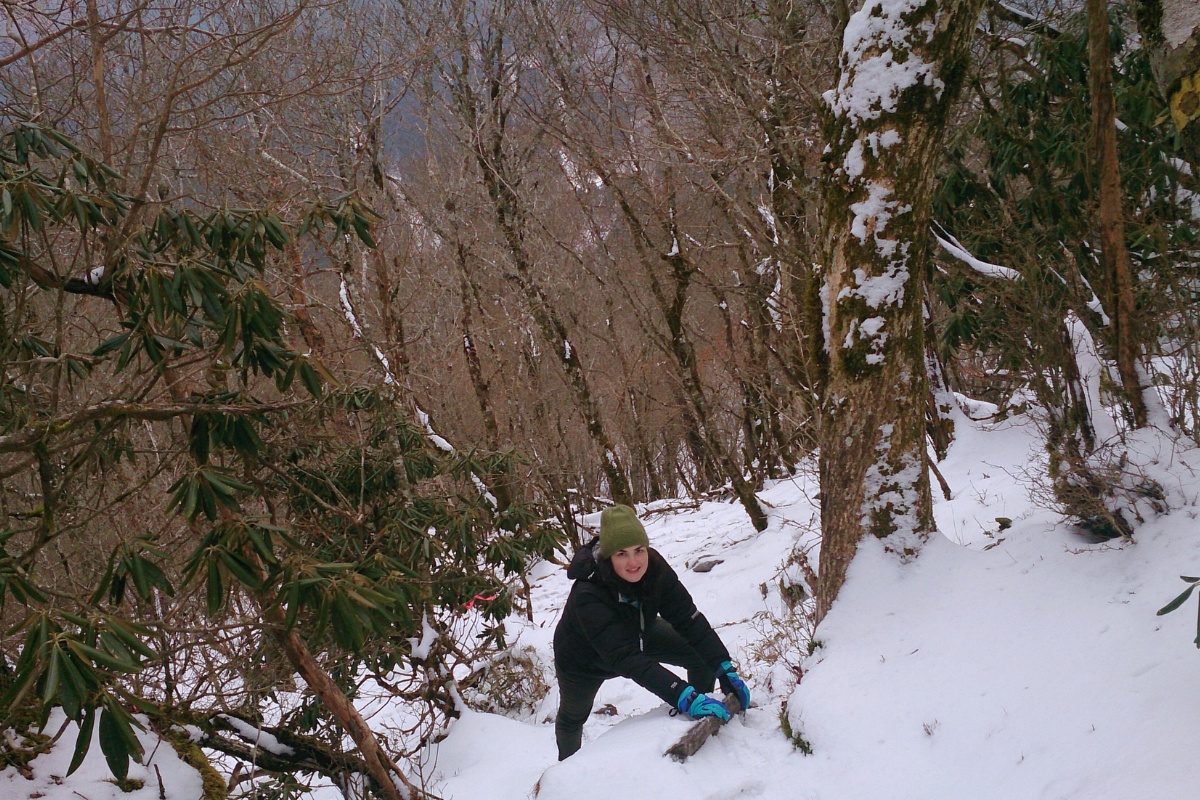
After reaching the cabin, which was above the snow line, we unloaded our overnight packs and left them in the cabin. We decided to only hike with our day packs – we took microspikes, warm clothes, and food for the top. We started hiking shortly before 12 lunch. The plan was to hike to the top of the mountain and return before dark. The path starts just behind the hut and slowly starts winding up through the evergreen forest. This side of the hill hadn’t been exposed to the sun and was covered by trees so a lot of snow was still laying around. I’ve found this is quite common on Shikoku. You can’s see the snow because the evergreen canopy, but in many areas above 1000m in winter there will be snow on the ground which can be quite deep. After about 40 minutes of hiking we reached the main spur which continues up to the top. Here, the snow was exposed to the sun and the snow had melted a lot.
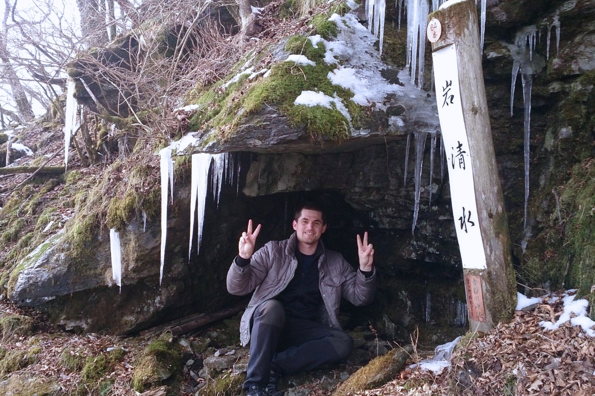
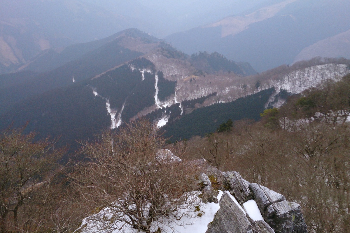
We continued on and from here the trail got steeper, rockier and was snowy. We put on our crampons for the first time to help grip in the snow and on the rocks. There are a few sections where you could slip and fall a few metres so be careful. In some sections there are ropes to help you out but those are pretty old looking so I wouldn’t trust them too much. We passed a natural spring, one of the sources of the Yoshino River, and saw some beautiful ice formations on the rock. As you near the top you’ll reach a rocky outcrop which has a sign, a small shrine and a nice view to the cabin you started from. We ate lunch here despite the fact it wasn’t the peak of Oku-Kuishiyama. As we ate it started snowing heavily which was really amazing because most of the year in Otoyo we only get cold rain as the snow melts.
The peak is actually another short 10 minute hike up hill. It’s clear when get near because it’s definitely the highest point around. The peak itself is actually not very exciting which is why I think you often see only pictures of the ‘sub peak’ with the shrine (we also didn’t take any pictures of the actual peak, because it really did suck).
Descent: Going back down was a little more tricky because of the snow. We needed out crampons in a few sections to stop ourselves slipping off the track. We returned to the cabin about 4.30 and set up for the night. The cabin was really nice (firewood, cooking grill, tatami mats, tables all there) however the firepit inside did NOT have any chimney and the cabin had no ventilation. We started a fire but had to put it out soon after because the smoke built up (we tried opening the big doors but that kind of defeats the purpose of warming the place up). Unfortunately this meant we were quite cold that night! Also, we smelt like bacon for days afterwards. TL;DR The cabin was nice but I have no damn idea why they didn’t add a chimney to the damn thing.
Photos of Oku-Kuishiyama
Packing and Preparation
Useful Resources
- Tajikawa Bansho recommended stop
- About Kuishiyama – Otoyo Tourism (Japanese)
- Hike description (Japanese)