

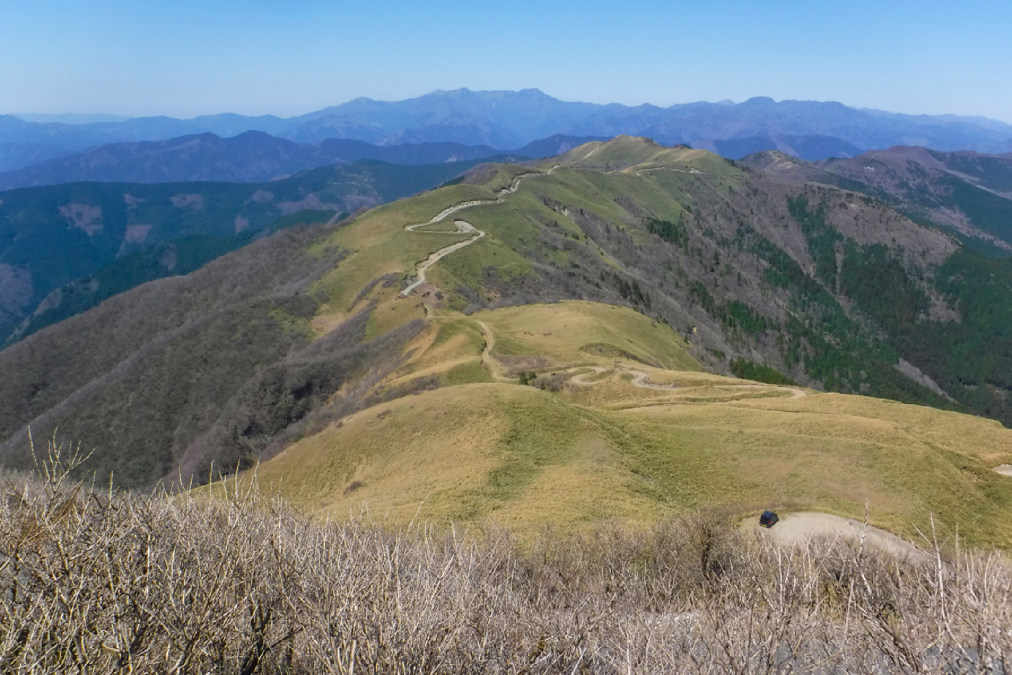
Nakatsuyama 中津山 also often seen as Nakatsumyōjin 中津明神山 (or just Myōjin) is a 1,541m peak on the Ehime/Kochi border which offers a short but steep 4km hike through tranquil forest before reaching the 360 degree sasa-covered peak.
Starting from the Agawa Sky Park the peak is actually accessible by car via narrow paved road (similar to one of my favourite places Mt Kajigamori). Some people choose to walk the forest trail, others walk the slightly longer (but less steep) road while some simply drive or ride to the top. There’s also a slightly less steep route from the back accessible by forest road I’ll detail below as a second option.
⚠️ This is a planned hike. I haven’t walked this trail but am sharing my research in English to encourage people to get out there and explore Shikoku (and also so I can do the hike, too!). Please do your own planning and research. If you do end up hiking this mountain, I’d love to hear from you.
Access & Course Information
Option 1: Forest trail from Agawa Sky Park
Starting from Agawa Skypark in Niyodogawa, this steep, relentless trail passes Oyamazumi Shrine and climbs directly through dense cedar forest without switchbacks. Although the summit can reached by car using adjacent access road, hikers agree that the panoramic views make the demanding physical effort worthwhile. As this trail crosses the road multiple times you can “opt out” of the steep bit at any time. You could also go up via the trail and back via the road.
Trailhead: Agawa Skypark
Estimated hike time: 4.5 hours (4km with 740m of elevation gain)
Estimated fitness: Grade 3 – Hard | Technical: Grade A – Easy
*See how I rate my walks
Useful links: Yamap forest trail route (In Japanese)
Option 2: From the back (Ehime side)
This 4km back option starts at the end of a forest road in Kumakogen, Ehime. Reports indicate that you may need to hike 2km to get to the trailhead marked below as the paved road turns to dirt or is inaccessible. As such I wouldn’t advise this unless you have 4WD and own your own (cheap) kei car. The trail itself looks fairly overgrown, with some rope assited sections, so keep that in mind as a safety consideration.
Trailhead: Unmarked forest road
Estimated hike time: 3 hours (4.5km with 558m of elevation gain)
Estimated fitness: Grade 1 – Moderate | Technical: Grade A – Easy
Useful links: Yamap trail report with picures (In Japanese)
*See how I rate my walks