
This hike to Yakedake’s North Peak (焼岳北峰) is a 7km return trek with 811m of elevation gain in Nagano. Starting at an elevation of 1,600m near Nakanoyu, it tops out at 2444m. While the South Peak is technically higher, the North Peak is the destination for hikers due to the volcanic activity.
As the only active volcano in the Northern Japan Alps, and sitting right next to the famous Kamikochi gorge, it’s a popular spot that can get busy. Highly recommend this if you have a day spare near Kamikochi, but give the mountain respect, hike within your level and check the weather.
Access
Trailhead: Yakedake Nakanoyu Trailhead (新中の湯登山口)
Suggested Meeting Point: 7-ELEVEN Matsumoto Station Store セブン-イレブン 松本駅前店
Travel time: By car: 1hr 30m from Matsumoto / 1 hour from Takayama. Always allow extra time for mountain driving in Japan.
Yakedake North (焼岳北峰) Trail Information
Hike time: 5.5 hours (be sure to start as early as possible)
Season of report: Autumn (October)
Fitness: Grade 3 – Hard | Technical: Grade A – Easy
See how I rate my walks
Safety Notes: This is an active volcano. Pay attention to the smell of sulfur and any official volcanic warnings. Even in autumn, the weather at 2,400m can turn quickly – check the forecast and don’t attempt it in poor conditions unless you are geared for winter.
Download and print the trail map
App or map? While many rely on navigation apps these days I strongly recommend printing a copy of your hike maps using one of the free topographic map services.
Post-Hike Report
Traveling with family, we spent the night before in Matsumoto and finished the trip at a ryokan in the nearby Hirayu Onsen area. We wanted a hike that wasn’t too isolated but offered spectacular views and some altitude to show those who were visiting us. This one fits the bill perfectly!
We set off from Matsumoto early, starting with a convenience store stop for coffee and snacks. This is something Japan excels at – no country is as well set up for pre- and post-hike supply and recovery.

The fall leaves were “on fire” when we reached the trailhead. At 1,600m, the start of the trail is already higher than the peaks of many hikes in Australia. The trail sets off at a steady pace and is clear and easy to follow. While cherry blossoms can be hard to time, the great thing about autumn leaves is that if you hike 1,000m of elevation, you’re bound to catch them somewhere.
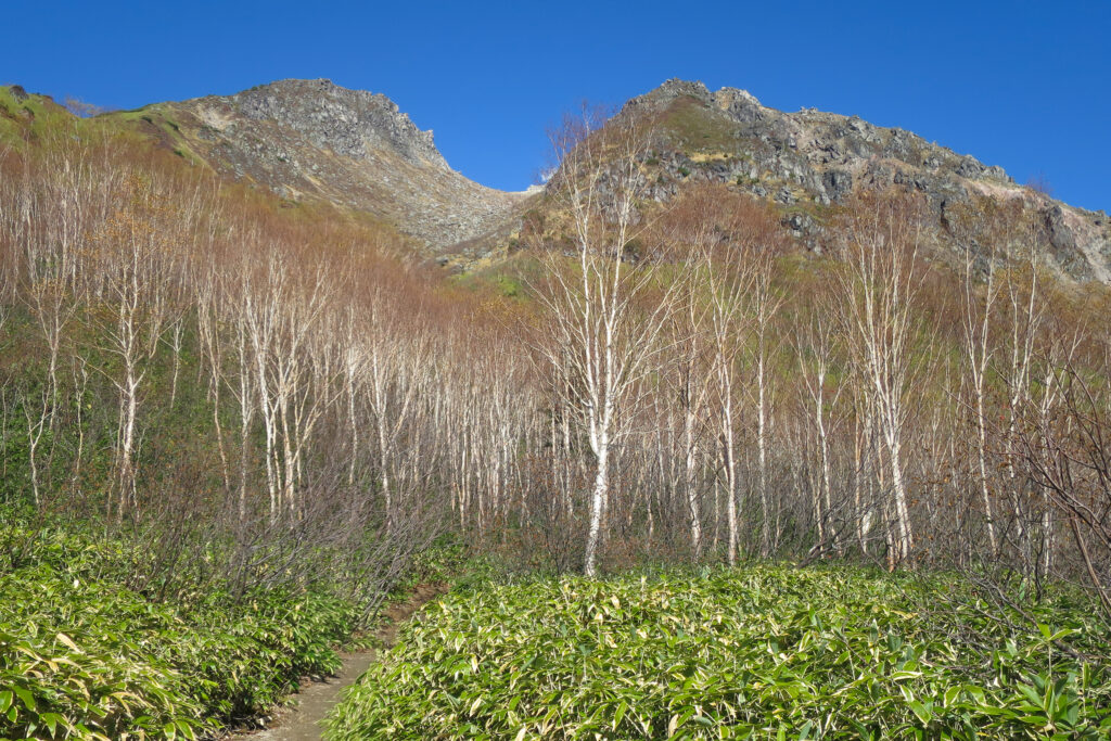
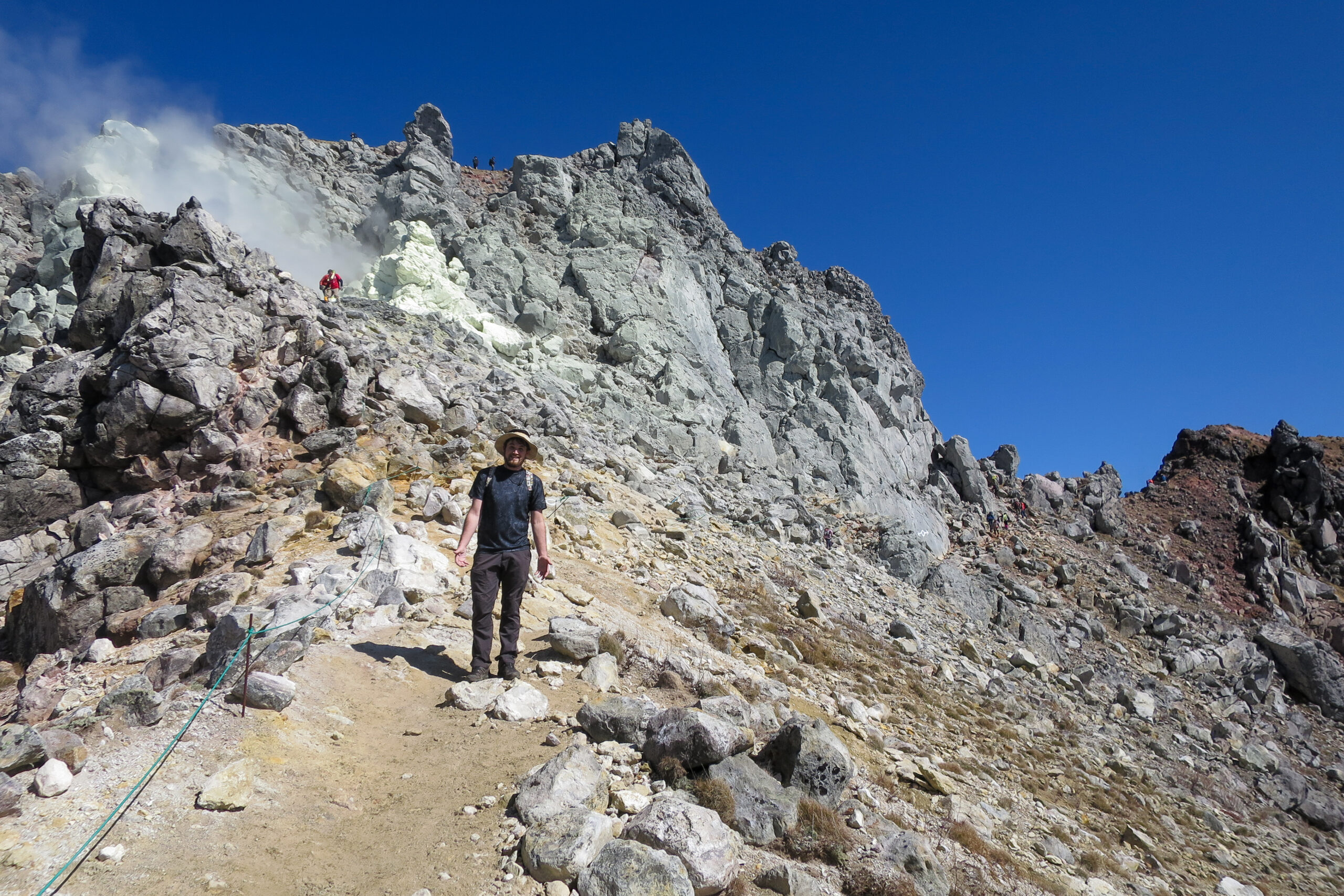
The trail zig-zags through the forest before reaching the treeline where the summit comes into view. As we progressed, the trees disappeared entirely. We had perfect weather, but I can imagine how brutal this ridge would be in winter. The smell of sulfur grew as we got closer to the top, leaving a few in our group feeling a bit light-headed.
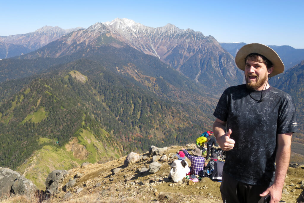
The summit was pretty busy, especially compared to the empty peaks of Shikoku we are used to. The views of the surrounding peaks and valleys were amazing, but with the sulfur in the air and the crowd at the top, we didn’t stay long. Watch your footing on the way down, but otherwise, the hike is fairly straightforward.
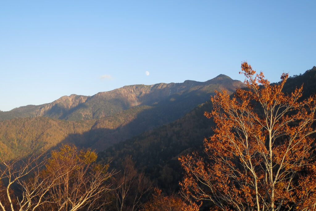
Halfway down we were greeted by a spectacular moonrise above the fiery red leaves. The air was crisp and the onsen was waiting. We headed down to the Hirayu-no-yu Onsen area where we’d booked a ryokan. A highlight was trotting the streets in our timber geta shoes and yukata. We don’t usually stay at places like this as we prefer to camp, but it’s a memory I’ll treasure.
Highly recommend this if you have a day spare near Kamikochi, but give the mountain respect and check the weather before you go.
Packing and Preparation
Useful Resources
- Trail information (Japanese) – Not a return hike
- Hirayu Onsen Information
- JMA Volcano Alerts (Japanese)