

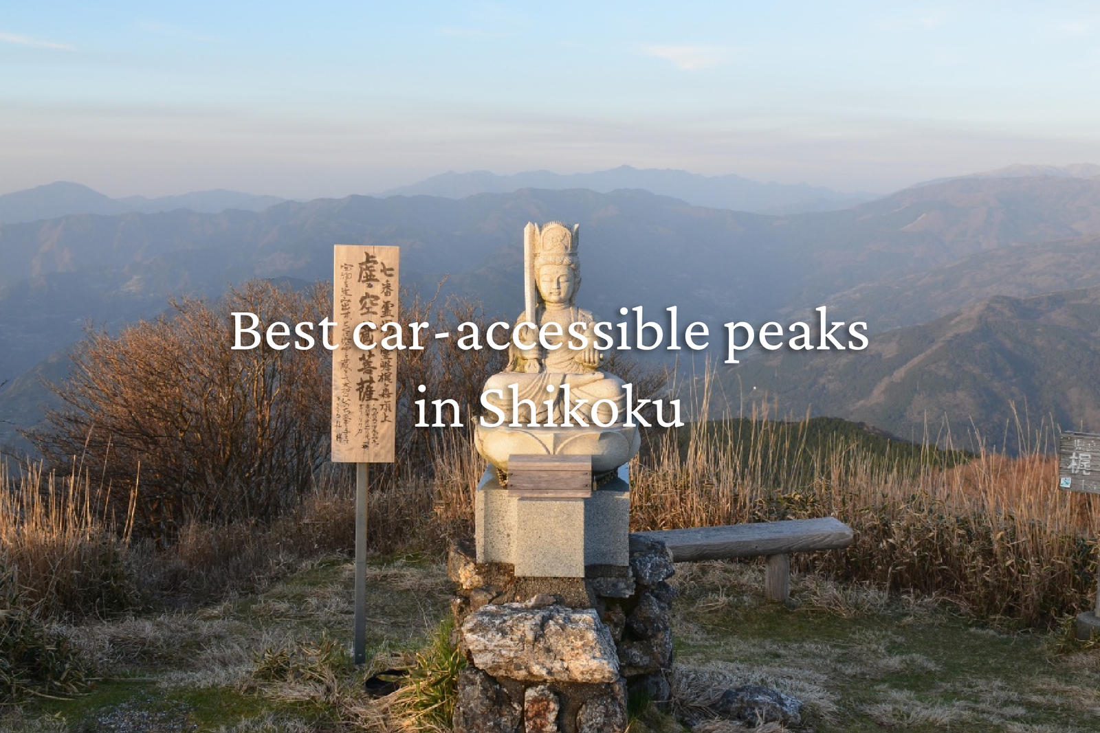
One of the things I recall most fondly about Shikoku is its abundance of road-accessible peaks. Whether you want to catch a sunset, camp for the night, escape the summer heat, or simply experience the thrill of driving a single-lane paved road up to 1,800 meters, I highly recommend adding at least one of these car-accessible mountain visit to your Shikoku itinerary!
⚠️ While I’ve visited most of these places personally, there are a few that I have not been to yet. These peaks are best accessed by kei car and you should allow double the time Google Maps predicts. Shikoku’s narrow mountain roads can be dangerous year-round, especially when it snows, so I don’t recommend visiting in winter.
So without further ado – here is my top 10 car-accessible summits in Shikoku. Please note that reaching some of these summits requires a short walk or hike, ranging from a casual stroll to a brief but strenuous climb. If you’re looking for an effortless trip, stick to the options that suit you.
10. Mt. Tsurugi 剣山 (1,955m), Tokushima
Shikoku’s second-highest peak, Mt. Tsurugi, is undoubtedly one of the island’s most iconic summits. Whilst its high altitude and iconic views make it a must-do, I’ve put it at #10 as the summit isn’t technically car-accessible… but by using the chairlift you have a reasonably steep 30 to 40-minute walk to the top.
- Access: Drive up Route 438 through the Iya Valley to the large parking area at Minokoshi (1,400m). From there, take the single-chair lift up to Nishigurodan Station (1,750m),
- Best time to visit: Summer is a great time to visit to escape the heat
- Links: Mt Tsurugi chair lift and info | Mt Tsurugi hike

Mt. Tsurugi in Tokushima Prefecture is significantly easier to climb than Mt. Ishizuchi in Ehime Prefecture. A lift is available, and the trail is relatively gentle, making it suitable for beginners (low difficulty). Mt. Ishizuchi, on the other hand, has steep sections requiring the use of chains and is more suitable for intermediate climbers. The name originates from a legend that Emperor Antoku's sword was buried on the mountaintop.
(Comparison of Mt. Tsurugi and Mt. Ishizuchi: Ease of Climbing and Difficulty)
⦿ Mt. Tsurugi (Elevation 1,955m): 2nd highest mountain in Western Japan
⦿ Difficulty: Suitable for beginners (one of the easiest mountains to climb among Japan's 100 Famous Mountains)
⦿ Features: A tourist lift is available from the trailhead to the middle of the mountain (Nishijima Station), and from there the trail is a well-maintained, gentle slope. The area near the summit is treeless, offering a 360-degree panoramic view of grasslands.
⦿Mt. Ishizuchi (elevation 1,982m): The highest peak in Western Japan.
⦿Difficulty: Intermediate.
⦿Characteristics: As befits the highest peak in Shikoku, it features steep rocky areas and nearly vertical "chain sections," requiring physical strength and careful technique. (There are detours, but many sections are treacherous.)
Origin of the name
⦿Origin: Although the name sounds rugged, the mountain actually has a gentle appearance. According to legend, the name originates from the fact that the "sacred sword" of Emperor Antoku, who was brought to Japan as a fugitive from the Taira clan, was buried on the summit and made into a sacred object.
⦿Alternate name: Also called Tarogyu. Known as a sister peak or counterpart to "Jirogyu," which lies to the southwest.






9. Kirosan Observatory Park 亀老山展望公園 (307m), Ehime
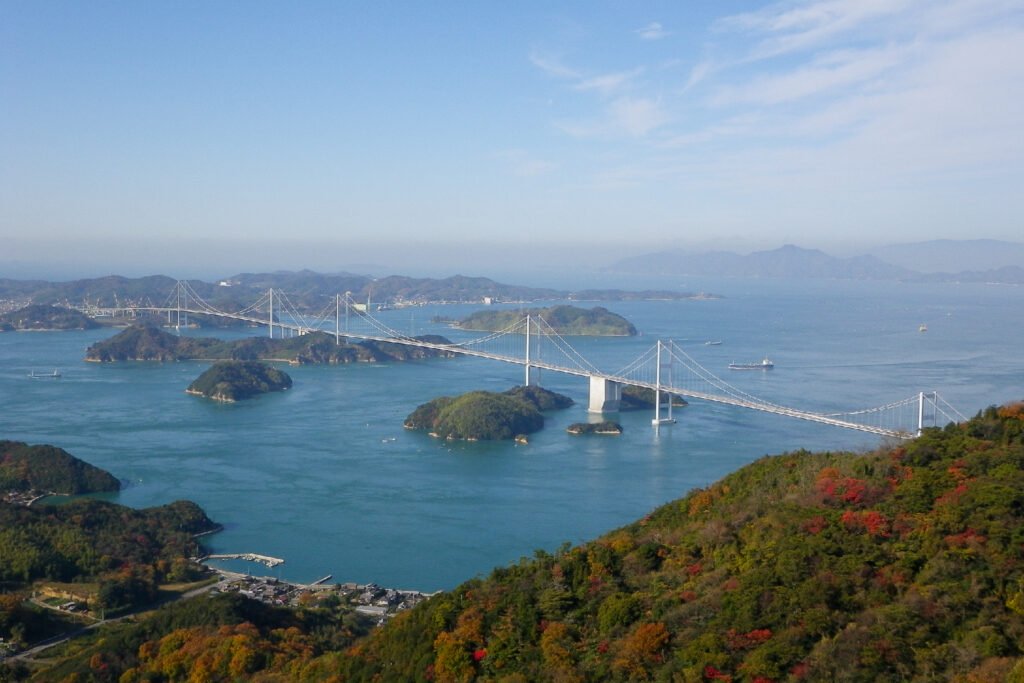
Located on one of Shikoku’s most popular routes, the Shimanami Kaido, the modern lookout atop Kirosan provides fantastic views over the Seto Inland seawith sunset panorama over the Kurushima Kaikyo Bridge
- Access: Drive all the way to the top with a short 3-minute walk to the observatory complex.
- Best time to visit: Any time during observatory opening hours
- Links: Visit Ehime – Kirosan

There are only toilets and a parking lot; there aren't even any vending machines, but it's definitely worth a visit.







People do bike and walk up, I do not recommend unless you are advanced.
There is a cute shop at the top and the observatory stairs and lookout has great architecture.
Highly recommend to get a good view!
8. Yutoristo Park ゆとりストパークおおとよ (750m), Kochi
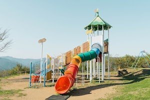
Located above the township of Otoyo this highland park features a camping ground, playground, flower garden and local produce store. It is famous for the “cloud sea” that’s visible during the colder months – and is one of my personal favourites.
- Access: Drive straight onto the park plateau; < 5 minutes from the car park onto the grassy ridge viewing terraces.
- Best time to visit: Winter (early morning to catch the cloud sea)
- Links: Visit Kochi – Yutoristo Park

It's quite chilly in the mornings.

I went because I heard there was a motorcycle shrine there...

The view was amazing!

Just the shower facilities would be a bit far that need to drive over.



++ amazing view of the moutains all around
++ great amenities, with every single pitch having its own sink
+ playground nearby, included in the price of the campground
+ pricing is reasonable
- Pretty far from anything (~30 min)

Awesome views
Loved it
7. Suihamine 翠波峰 (892m), Ehime
Perched above Shikokuchuo city, Suihamine is a scenic plateau peak best known for its vibrant flower fields and dual-sided vistas. Driving to the summit area gives you front-row seats from the industrial coastline of the Seto Inland Sea to the forested mountain ranges of central Shikoku.
- Access: Drive to the Suiha Kogen central lot; follow a 10-to-15-minute paved path and boardwalk up to the West Peak Observatory.
- Best time to visit: Spring (April) to catch the blooming yellow flowers and annual festival. Early autumn to catch the early-blooming cosmos
- Links: Shikoku Tourism – Suiha Plateau
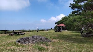


Suihoho Peak is located at a point where hawks migrating westward from Awaji Island across the Naruto Strait and along the Yoshino River in Tokushima Prefecture meet those coming from Kagawa Prefecture via Okayama Prefecture and the Shiwaku Islands. The observation point at the summit offers an unobstructed 360-degree view, making it an excellent location for photographing migratory birds. During the peak season in late September, nearly 2,000 hawks can be observed.
If you're lucky, you might witness a spectacular sight known as a "hawk column," where hawks with their wings spread wide catch updrafts and soar into the sky in a circle.
Hawk migration can be observed at Suihoho Peak and Gujo Observatory from early September to mid-October, with the peak time being from around 10:00 AM to 1:00 PM.



In the Houou Tunnel, you need to make good use of the passing areas, and the curves and slopes up to Suiha Plateau are quite steep, so this course is probably more suitable for intermediate riders ^ - ^

While Higashimine is nearby, this peak offers better views and is therefore more recommended.
6. Shiozukamine 塩塚峰 (1,043m), Ehime/Tokushima
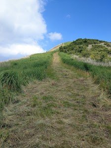
On a clear day this smooth, grassy dome offers 360-degree views over rolling fields pampas grass toward the sea. The surrounding forests (on the way up) are renowned for their autumn colors.
- Access: Park at the upper Shiozukamine lookout a 20-minute grassy trail walk will take you up to marker at the peak.
- Best time to visit: Autumn (make sure you check for snow in the forecast)
- Links: Shikoku Tourism – Shiozukamine

The road from Shingu IC is narrow, and there are limited places where you can pass oncoming vehicles. Also, in some places the gutters on the side of the road were difficult to see due to fallen leaves.


The view is amazing!
Weekdays in September are recommended.

5. Kajigamori 梶ヶ森 (1,399m), Kochi
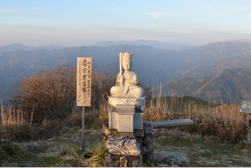
Featuring expansive views across central Shikoku – on a rare, clear day you can see the ocean on either side of Shikoku from this peak. There is a campground and lodge where you can stay, as well as an observatory. Make sure you plan plenty of time to get up and down. You can drive all the way to the radio towers at the top or stop at the lodge and hike up.
- Access: You can drive all the way to the radio towers at the top or stop at the observatory/lodge and hike up in 30 minutes
- Best time to visit: Summer (or early autumn) to escape the Shikoku heat
- Links: Otoyo Town Tourism – Kajigamori | Mt Kajigamori hike

「土佐の名水40選」に選ばれているだけあって、水はとても澄んでいて冷たく、自然の豊かさを全身で感じられる場所です。周囲には苔むした岩や清流が広がり、水の音を聞いているだけで心が落ち着きます。
この霊水を持ち帰り、いつも飲んでいるコーヒーを淹れてみたところ、同じ豆とは思えないほどまろやかな味わいになり驚きました。家族や職場の人にも飲んでもらいましたが、「美味しい!」と好評でした。
若き日の弘法大師(空海)が修行したと伝えられる御影堂も近くにあり、歴史や自然を一緒に感じられるのも魅力です。
地域の大切な水源でもあるので、案内板のルールを守り、これからも大切に残していきたい場所だと感じました。コーヒー好きはもちろん、自然や名水巡りが好きな方にもおすすめです。 ☕💧


標高は1,399.6mながら、なんと山頂まで車でアクセス可能!
見上げるような電波塔が印象的で、人工物と自然が不思議と調和しています。
展望は抜群で、360度のパノラマ!
山頂から伸びる木道風の草原トレイルも心地よく、歩くだけで癒やされます。
アクセスは道がやや細いものの、舗装路で普通車でも問題なし。
駐車スペースも山頂付近にあり、登山が苦手な人でも手軽に“天空の眺望”を味わえる穴場的スポット。

行きましたが涼しくて最高です。見晴らしも良く暫しボーとしてました。2年前に来た時と比べる道も多少補修されてました。山小屋がきれいにリフォームされていたので今度は泊まってみたい。



頂上は標高1,300mくらいで、晴れの日は良い景色が眺められます。展望スペースが少しだけあります。トイレはありません。
4. Godan Highlands 天狗高原 (1,485m), Ehime/Kochi
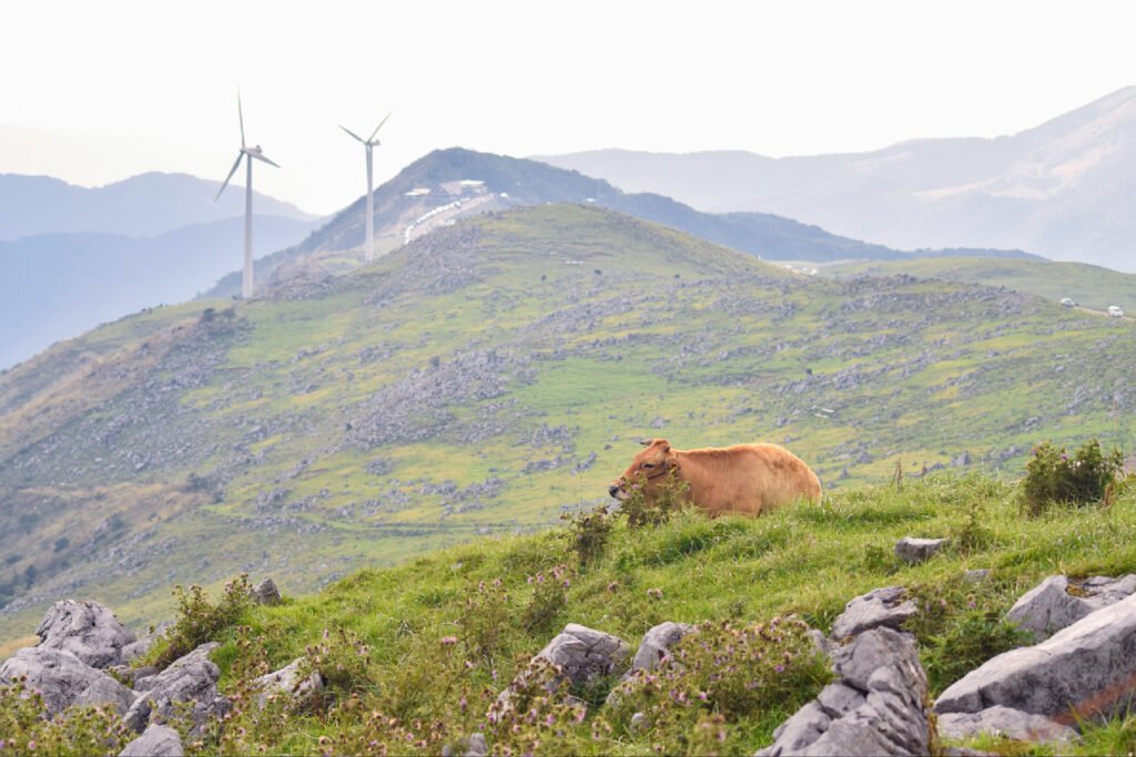
Part of the dramatic Shikoku Karst State Park along the high ridge plateau the white limestone rockes scattered around the green alpine pastures give off a distinct “Swiss-Alps” atmosphere. You can also get icecream!
- Access: Drive all the way to the top; you can follow the well-maintained karst walking trail for 15 to 20 minutes along the ridge or do a hike like this.
- Best time to visit: Summer (or early autumn) to escape the Shikoku heat
- Links: Visit Kochi – Shikoku Karst | Godan Highlands three peaks hike




2. Iyo-Fuji 伊予富士 (1,756m), Ehime/Kochi
Accessed via the iconic UFO Line forest road, which reaches close to 2000m in elevation, this peak is named due to its shape reminiscent of the famous Mt Fuji. The spectactular sasa covered ridgeline provides views over large parts of Shikoku including its highest peak, Mt Ishizuchi. You might be wondering where #3 is? I’ve included this peak alongside Kamegamori up next in equal 2nd place.
- Access: Park in the nearby designated pullover area and take the short but steep trail to the peak in around 30 minutes.
- Best time to visit: Summer (to escape the Shikoku heat), or early autumn. UFO line gates are closed in winter.
- Links: Ehime Tourism – Iyo-Fuji | Iyo-Fuji hike
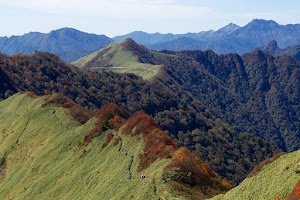


I started my climb from the south entrance of the old Kanpuzan Tunnel. There are toilets and a teahouse. Hikers are instructed to park their cars according to the signs.
From here, a steep climb of about an hour leads to Kuwase Pass. This is the fork in the road, with routes to Kanpuzan and Mount Iyo-Fuji. I began walking towards Mount Iyo-Fuji, and my excitement grew as the mountain's distinctive shape came into view.
The view of Mount Iyo-Fuji from the foreground is particularly magnificent; I was satisfied even without reaching the summit. From here, another steep climb leads to the summit.
The view from the summit was also wonderful, but the sight of the road directly below was a slight disappointment. There are also trailheads that ascend directly from that road, and a route that starts from Higashi-Kuromori-yama.


It is a small decision that allows one to temporarily shake off the gravity of everyday life and entrust oneself to the logic of the mountain.
Once you reach Kuwase Pass and stand on the ridge, the paths narrow, but your mind strangely broadens.
The footprints dividing the bamboo grass fields continue silently forward, as if to say, "Don't get lost."
Looking back, the ridge you've walked stretches out before you, and facing forward, the steep, sky-high climb of Iyo Fuji quietly awaits you.
But the mountain doesn't feel rushed, and it's grateful that it respects your breathing.
Standing at the summit, the wind blows through from a higher level.
Iyo Fuji is majestic, but never arrogant.
It simply offers views proportional to the distance you walk.
It's as if it's saying, "That's enough."
In the distance, above the overlapping mountains, the light of the Pacific Ocean shone faintly.
Iyo Fuji doesn't make you feel a sense of accomplishment, but rather quietly affirms the time you've spent walking.
Perhaps that's why I often found myself looking back on my way down the mountain.
It's this kind of mountain that slowly but surely has an impact on you, not so much the fact of reaching the summit as the process of getting there.

The name Iyo-Fuji comes from the fact that its shape resembles Mount Fuji when viewed from the west. Although it is a peak in the Ishizuchi mountain range, its gentle slopes led to it being called "Iyo's Mount Fuji."
Its main characteristics are as follows:
⦿ Elegant shape: While Iyo-Fuji is not an isolated peak, it has a well-proportioned shape compared to the surrounding mountains.
⦿ Sacred mountain: Because it was once not a mountain easily accessible from human settlements, some believe it was likened to Mount Fuji as a high and sacred mountain.
⦿ Similar shape to Mount Fuji: This mountain, with an elevation of 1756m, has a beautiful appearance when viewed from the west, reminiscent of Mount Fuji, a symbol of Japan, hence its name.
⦿ Example of a "Local Fuji": Throughout Japan, there are many mountains called "Local Fujis" that resemble Mount Fuji, and Iyo-Fuji is one of them.

The climb was postponed three times due to weather, but I finally made it! 😉
Caution ⚠️
From the Iyo Fuji trailhead:
This is the shortest route, but you immediately have to cross a waterfall! 😳
If you're not wearing proper shoes, you'll end up climbing with wet shoes. There are large stones and rocks in places. It's extremely slippery.
There are ropes provided in some places, but they are old and worn, so please be careful.
Well, it's not a problem for experienced climbers. Also, there are places where the bamboo grass is about waist-high, so your pants 👖 will get wet depending on the season and time of day.
I'm a beginner 🔰, so I took my time and it took me about an hour to climb.
The temperature was around 18℃, but it was hot because there was no wind 🥵
The summit has a bit of space, so it's perfect for a light snack 😉 (There were a lot of gnats? on this day...is it always like this?)
The autumn leaves 🍁 were starting to change color, and we enjoyed the colorful scenery. The bamboo grass glistening with morning dew was also beautiful. It didn't show up in the video though 🙄
Since it was a calm day, I was able to fly a small drone and take some videos 🤩
Mt. Ishizuchi is usually very crowded, so I think it's a good mountain for people who don't like crowds 😉

2. Kamegamori 瓶ヶ森 (1,897m), Ehime/Kochi
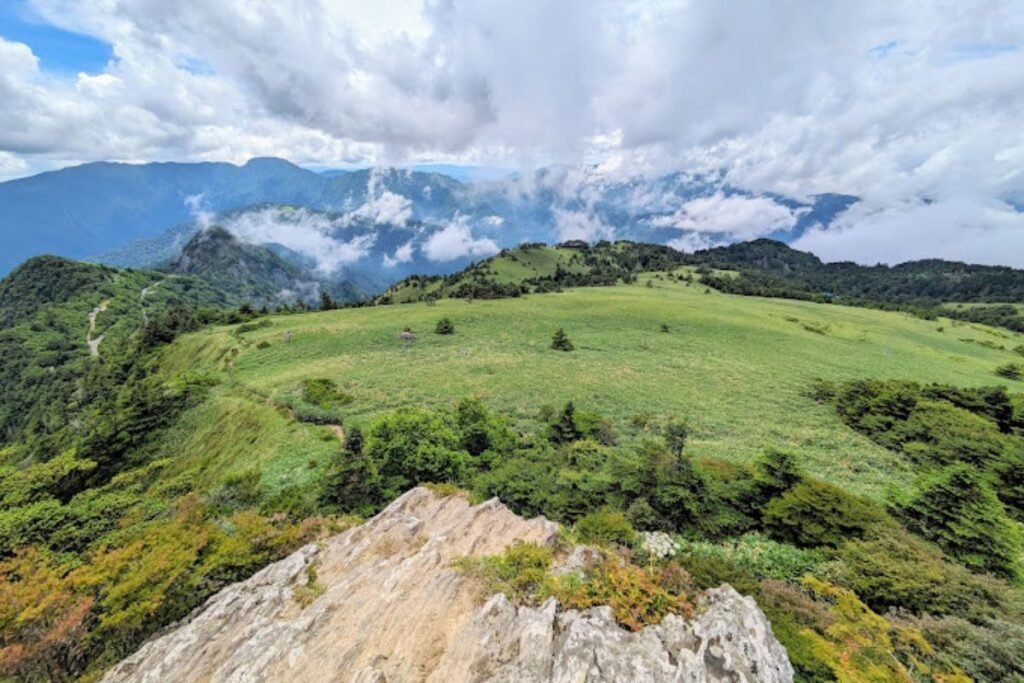
Just off the UFO Line not far from Iyo-fuji mentioned above this peak offers the same iconic Shikoku views a little bit less effort (and better parking) than the trail to Iyo-Fuji. For that reason Kamegamori is my reccomendation if you only have time for one mountain on the UFO line.
- Access: Park at the Kamegamori parking area on the UFO Line; a steep but rewarding 25-minute walk along a clear path brings you onto the summit.
- Best time to visit: As above.
- Links: Japan Travel – Mt. Kamegamori | Mt Kamegamori hike
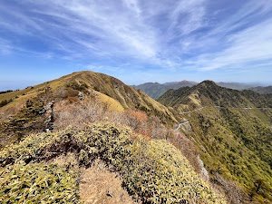

Be careful, though, as the roads are narrow, there are a lot of motorcycles, and it's difficult to pass oncoming traffic in many places.

It was just as amazing as I remembered.
If you're looking for a mountain hike, this is a great option for beginners; there are toilets, and the trails are easy to walk. 😊

Mt. Onnayama can be reached in about 20-30 minutes from Mt. Otokoyama.
From the summit of Mt. Onnayama, you get a magnificent 360-degree panoramic view ✨ You can even see the Shimanami Kaido 👀
However, since there's nothing to block the wind at the summit, it's often quite strong, so I recommend bringing a windbreaker or something similar to wear during breaks 🙂
The path back to the parking lot, circling around Himi Nisenkokuhara, is well-maintained and has a consistent slope throughout, making it the perfect trail for a tiring descent.
It takes a little over two hours if you take your time ⏰
It's a recommended course for beginners 🔰👍


It's a recommended spot for beginner hikers.
Despite its high altitude of 1897m, you can actually drive almost all the way to the summit! Enjoy a relaxing hike while scenic drive to the parking lot at Mt. Kamegamori.
After walking along the well-maintained trail for about an hour, you'll reach the summit in no time. A breathtakingly beautiful view of the Shikoku mountains awaits you. You'll be captivated by the wind blowing through the bamboo grass and the mystical atmosphere of the bleached-bone forest.
After the hike, we enjoyed local cuisine at the nearby "Sanso Shirasa" mountain lodge. Lunch and soft-serve ice cream were incredibly refreshing after our tiring hike.
It's a recommended healing spot where families, couples, and friends can enjoy nature.
Please try hiking there on a sunny day!

Less people and easy way so some family with small kids climbed there
It was nice views
It was easy for me( beginner) so when I done have power much it’s the best
1. Mt. Shiude / Shiudeyama 紫雲出山 (352m), Kagawa
Arguably the most popular and well-known lookout in Shikoku. Located on the Shoin Peninsula it provides world-famous views during cherry blossom season with views over the islands of the Seto Inland Sea.
- Access: Drive straight to the top with a gentle 5-10 minute walk to the primary lookout
- Best time to visit: During cherry blossom season, but arrive early if you want to beat the crowds
- Links: Mitoyo Tourism – Mt. Shiude | Hike from the bottom (in case you are feeling like the walk)
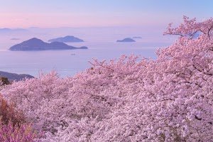


You can even clearly see the tip of the Shonai Peninsula ☺️
You can see the Seto Ohashi Bridge, of course, as well as Mt. Konpira, Mt. Iiyama (Sanuki Fuji), Mt. Ishizuchi, and even Imabari.
The hydrangeas are beautiful right now.






The cafe has large glass windows so you can relax with a coffee while enjoying the landscape—it’s like a live postcard. I had an iced latte, which was delicious and perfectly chilled after my Bike ride.