


Tasmania is famous for its beautiful mountains, but if you’re like me and are usually just visiting for a few days, spending $49 for multiple 24 hour passes or $98.35 for an annual pass you’re never going to use seems wasteful… especially if you’ve already spent thousands on flights, car and accom just to get there.
To help you save your hard-earned money (at least until Parks Tasmania introduce a weekly pass) here’s my list of 7 peaks in northern Tasmania that offer big views without big fees.
⚠️ I haven’t walked all of these peaks yet myself but am sharing my the list encourage people to get out there and explore Tasmania (and also remind myself to book my next trip!). Please do your own planning and research. If you do hike these or find it useful, I’d love to hear from you.
Top 7 hikes in Northern Tasmania outside of the National Parks
Mt Arthur – 1,188m
Being just 30 minutes or so from Launceston Mt Arthur is a local workout spot offering towering tree ferns and sub-alpine scrub with vast views the city and Tamar Valley. You may have noticed this one as you fly in. There are two options for this hike but I’ve selected the longer one as it seems a little more 2WD friendly. There are limited parking spaces at the trailhead, and the walk is steep and slippery at the top.
Trailhead: Mountain Road before locked gate
Estimated hike time: 4-5 hours (8.5km) with 648m of elevation gain
Estimated Fitness: Grade 2 – Moderate Technical: Grade B – Moderate
Useful links: Hike report | Facebook discussion


At the summit, Mount Arthur offers sweeping views over all of the Tamar Valley and north-eastern Tasmania. You can even see the Western Tiers, Central Highlands, Northern Midlands, and Mount Barrow!
Don't forget to sign into the visitor's book that's provided. Highly recommended adventure to try out. 👍


Mt Beecroft – 1,139m
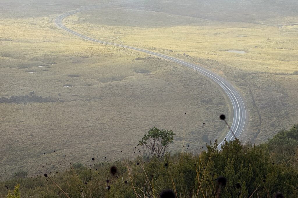
Located just outside the Cradle Mountain National Park Mt Beecroft provides a rugged, unrefined Scotland-esque wilderness walk. The track navigates wet, boggy sub-alpine grassland and classic Tasmanian buttongrass plains before climbing onto a rocky crest with sweeping views toward Cradle Mountain and Barn Bluff. Be prepared for muddy boots!
Trailhead: Black Bluff / Cradle Mountain Lookout Carpark
Estimated hike time: 4 hours (11km) with 436m of elevation gain
Estimated Fitness: Grade 2 – Moderate Technical: Grade A – Easy
Useful links: Mt Beecroft hike report
Mt Victoria – 1,213m
Located in the north-east about 1 hr 40 from Launcestion, Mt Victoria is a short but challenging hike through rainforest and ancient myrtle beech that climbs (via a bit of rock scrambling) onto a high ridge with dramatic dolerite columns known as the “Organ Pipes.”
Trailhead: Trailhead on Mt Albert Road
Estimated hike time: 3-4 hours (5km) with 400m of elevation gain
Estimated Fitness: Grade 2 – Moderate Technical: Grade C – Hard
Useful links: Yamap trail info


Ben Nevis – 1,368m
Not to be confused with its Scottish namesake, Tassie’s Ben Nevis is located around an hour and a half from Launceston near Ben Lomond Alpine Resort and is located within a conservation area. Rising sharply above the surrounding forest, this hike leads to an expansive high-altitude dolerite plateau that features alpine tarns and views all the way to the coast (when it is clear).
Trailhead: Schulhofs Road Trailhead
Estimated hike time: 3 to 4 hours (4.5km) with 420m elevation gain.
Estimated Fitness: Grade 2 – Moderate Technical: Grade B – Moderate
Useful links: Post-hike report
Mt Claude – 1,034m
Part of the impressive Mount Roland Regional Reserve range near Sheffield, Mt Claude is less well known than its neighbors Mt Roland and Mt Van Dyke. I’ve included Mt Claude as it’s length is shorter and much more accessible as a day hike than the other peaks however all three are actually accessible without a parks pass if you have more time on your hands.

Trailhead: Olivers Road trailhead
Estimated hike time: 3-4 hours (6.5km) with 370m of elevation gain
Estimated Fitness: Grade 2 – Moderate Technical: Grade B – Moderate
Useful links: Parks Tasmania tourist information


St Valentines Peak aka Natone – 1,107m
Standing prominently above the surrounding plantations and tea tree scrub south-southwest of Burnie, St Valentines Peak offers panoramic 360-degree views stretching across to Cradle Mountain and the North-West coast. The trail climbs steadily through wet eucalyptus forest before breaking out into open alpine vegetation and a steep scramble up the dolerite summit ridge.
Trailhead: St Valentines Peak Track car park
Estimated hike time: 4-5 hours (8km) with 605m elevation gain.
Estimated Fitness: Grade 2 – Moderate Technical: Grade C – Hard
Useful links: My post hike report


Mt Cameron – 551m
Located in the far northeast corner within the Mt Cameron Regional Reserve, this peak rises out of coastal scrub and granite country. The hike crosses unique granite slabs and labyrinthine rock formations that are reminiscent of Wilsons Prom and Mt Oberon in Victoria (once connected by land). I wonder if they’re geographically related?
Trailhead: Parking near boom gate (pin is approximate)
Estimated hike time: 3 hours (7.2km) with 480m of elevation gain
Estimated Fitness: Grade 2 – Moderate Technical: Grade C – Hard
Useful links: Post hike report by Safarihiker


Cons: No public amenities (e.g. no toilets), Can get steep and is rather vegetated in certain areas of the track. Track not entirely clear.